Posts on this site may contain affiliate links. This means that whenever you buy or book something through those links, we may earn a small commission – without any extra cost to you at all! You can read more about our Terms of Use / Disclosure here.
Home to five amazing national parks, all lined up wonderfully along scenic roads in the southern part of the state, Utah is one of the world’s best adventure travel destinations.
In this post, I’d like to keep the number of words to a minimum. I think the landscapes of Utah’s national parks speak for themselves.
As you might know, I visited all five national parks in Utah last April as a part of a six-week cross-country road trip. Below, you’ll find a crapload of my favorite Utah national parks photos.
I’m pretty sure you’ll like seeing them, but I also know that these landscapes are much more impressive in real life.
So, if the scenery shown in the following Utah national parks photos leaves you in awe, you shouldn’t hesitate to actually visit Utah.
Get Inspired With These Utah National Parks Photos
From west to east, the national parks in Utah are Zion, Bryce Canyon, Capitol Reef, Canyonlands and Arches. All of them are glorious. From deep river gorges and slot canyons to towering sandstone domes, red rock pillars and natural arches, these parks on the magnificent Colorado Plateau have them all.
Established: 1919 Area: 229 square miles (593 km²) Annual visitors: 4,300,000 What to see: Emerald Pools, Court of the Patriarchs, Weeping Rock, Angels Landing, Observation Point, Virgin River, The Narrows What to do: Hiking, camping, bird watching, cycling, rock climbing Website: https://www.nps.gov/zion/index.htm
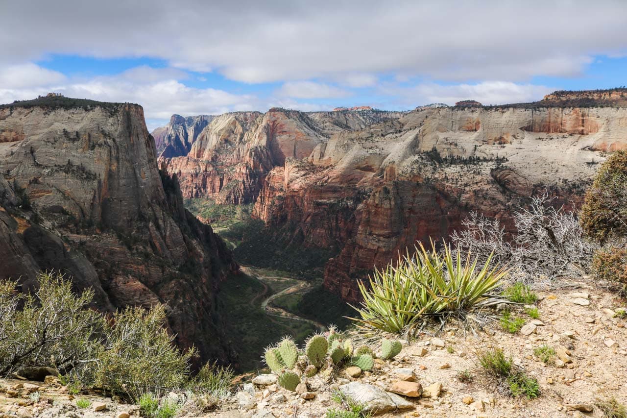
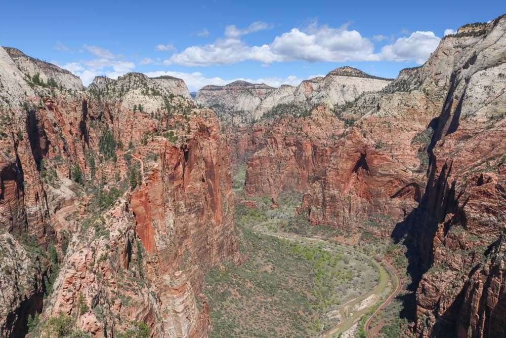
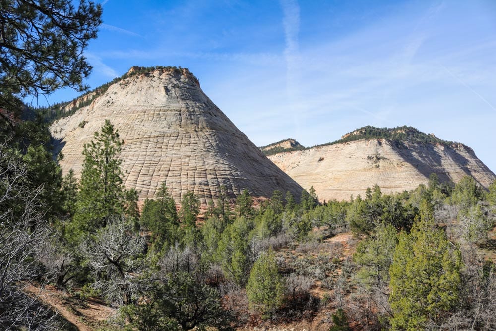
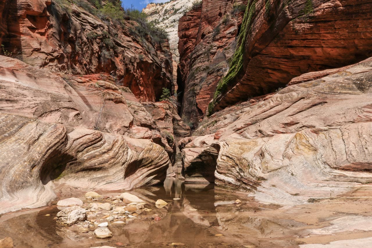
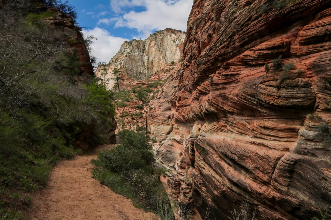
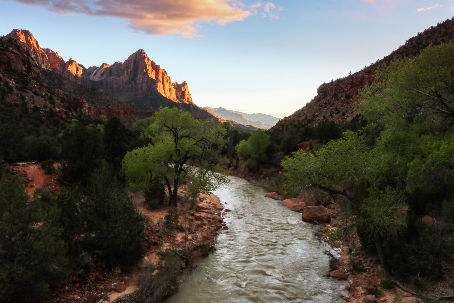
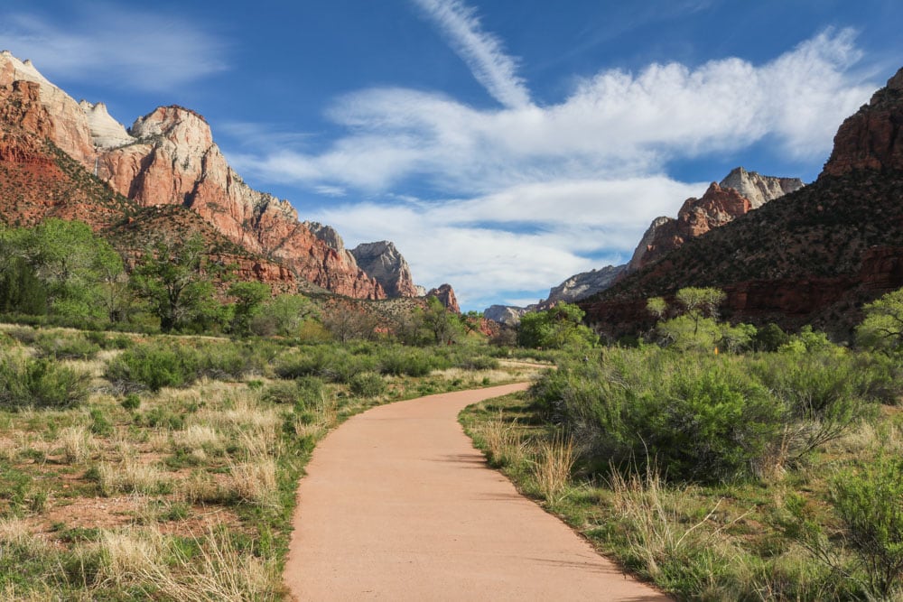
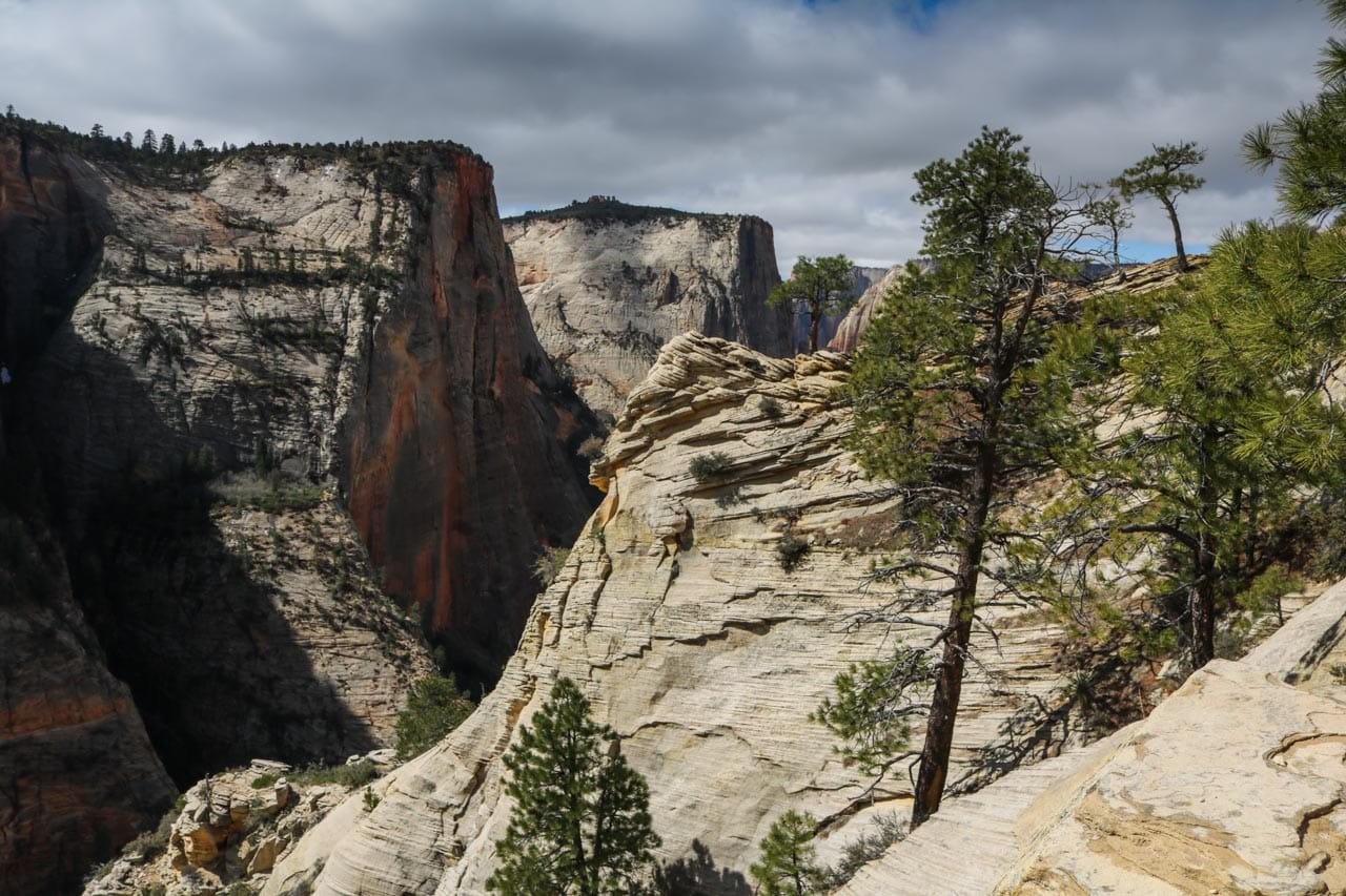
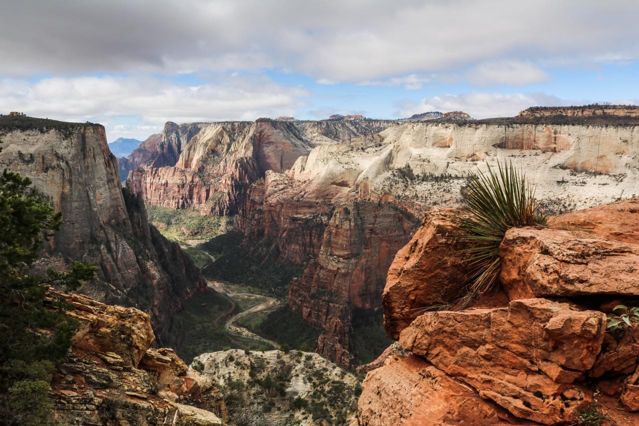
The Observation Point Trail provides some of the best views of Zion Canyon.Angels Landing is both the most popular and most dangerous hike in Zion National Park. This is what it looks like from the top; the trail is visible in the left.Interesting rock formations, like Checkerboard Mesa, abound in Zion National Park.Echo Canyon on the Observation Point Trail is one of the most stunning slot canyons in the park.Many trails run past, along, and even through striking geological features, such as this rock wall.The Virgin River backed by The Watchman at dusk is a classic view in this spectacular park.The best viewpoints in the entire national park is appropriately-named Observation Point.Running along the Virgin River, the Pa’rus Trail accommodates bikes, wheelchairs and strollers.Younger, white rock makes up the upper layer of Zion Canyon.This is another jaw-dropping view of Zion Canyon, again from the amazing Observation Point Trail.
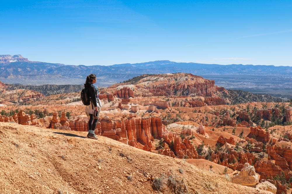
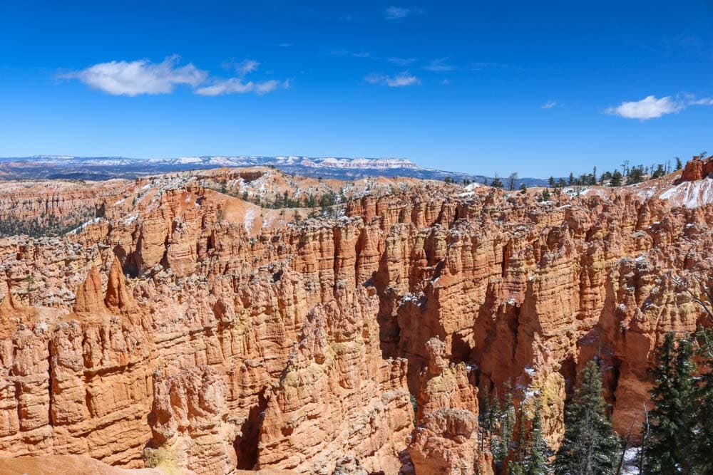
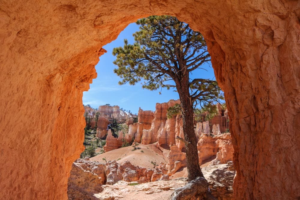
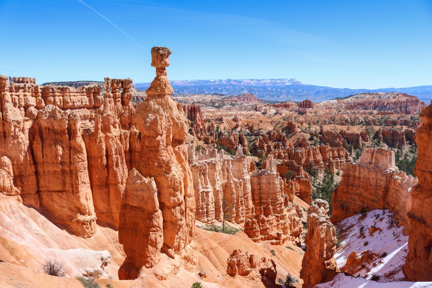
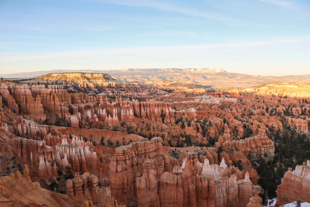
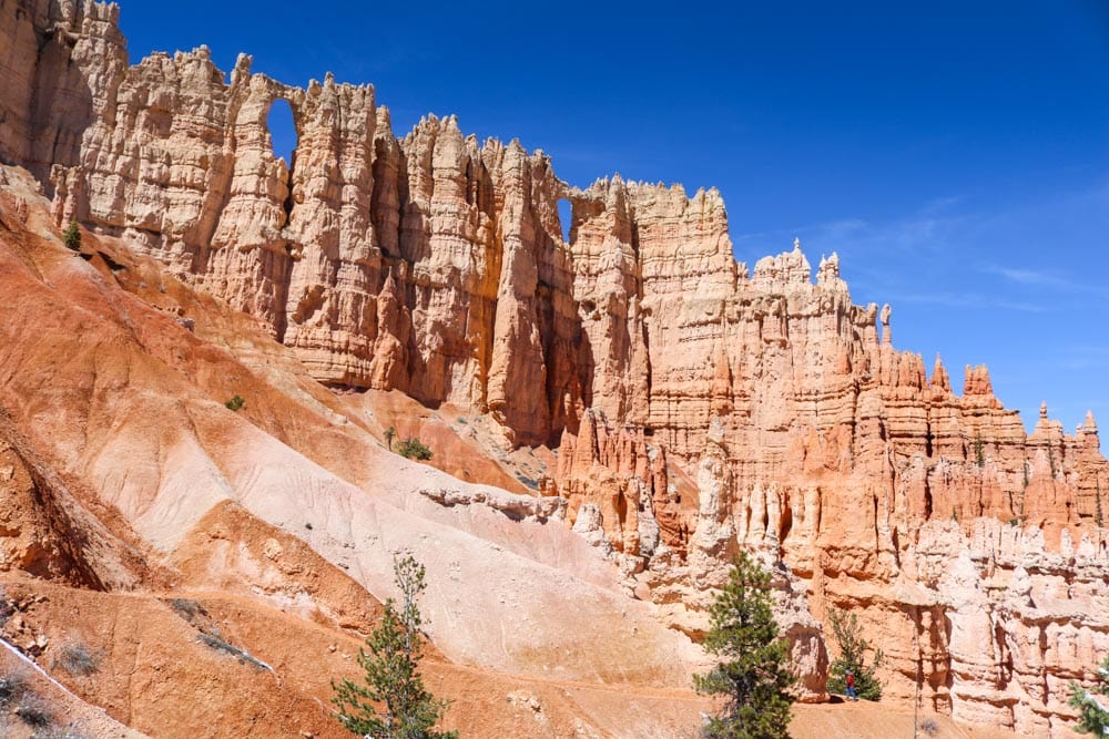
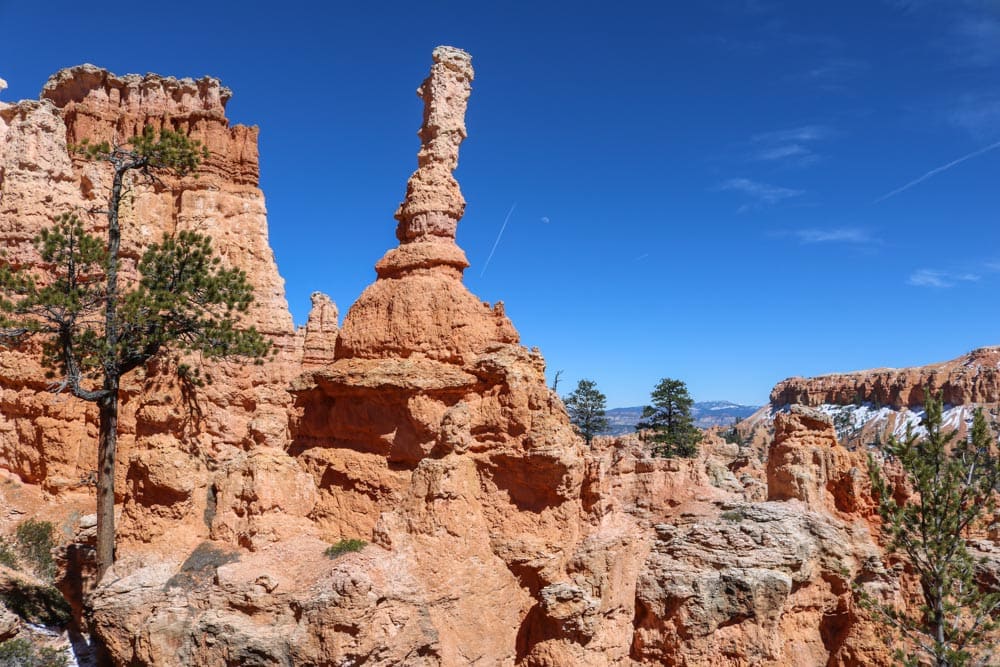
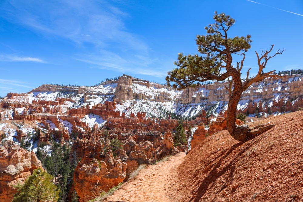
Established: 1928 Area: 56 square miles (145 km²) Annual visitors: 2,350,000 What to see: Bryce Canyon Scenic Drive, Wall Street, Thor’s Hammer, Silent City, and Sunset, Sunrise and Inspiration Points What to do: Horseback riding, hiking, sunrise watching, stargazing Website:https://www.nps.gov/brca/index.htm
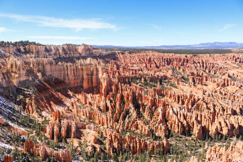
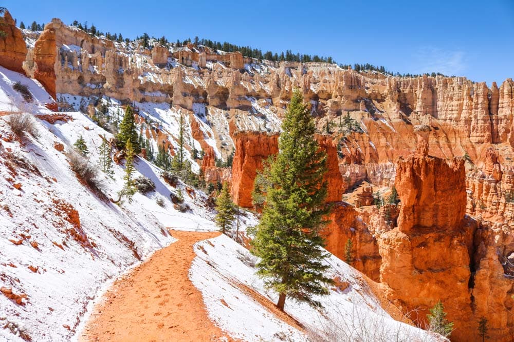
Bryce Amphitheater is the centerpiece and star attraction of this small, but spectacular, national park in southern Utah.The Peekapoo Trail runs into the heart of Bryce Amphitheater, part of dense network of hiking trails.A hiker takes in the view from one of several overlooks on the wonderful and super-easy Rim Trail.Bryce Canyon is the upper step of the “Grand Staircase”, a huge region of canyons, cliffs, plateaus, and rock formations that descends toward and into the Grand Canyon.When hiking in Bryce Canyon National Park, you’ll occasionally pass through extraordinary rock windows.Thor’s Hammer, on the left, is one of Bryce Canyon’s most famous hoodoos.Sunrise Point, pictured here, is one of the four main viewpoints on the rim of Bryce Amphitheater.The evolution process of hoodoos consists of three major steps. First is the formation of fins, followed by the creation of rock windows like those pictured here. The third step is the collapse of the upper bridge, leaving behind a set of rock spires, “hoodoos”.This particular hoodoo caught my eye because of its interesting angle.Due to the park’s elevation between 8,000 and 9,000 feet, Bryce Canyon receives fresh snow well into spring.
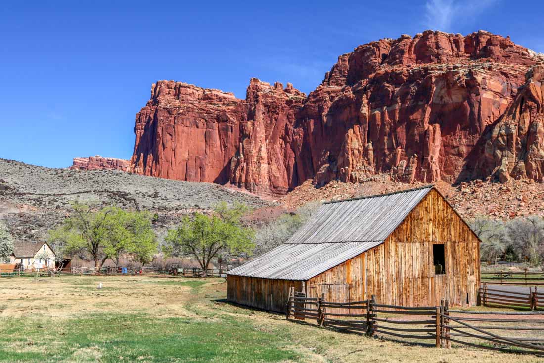
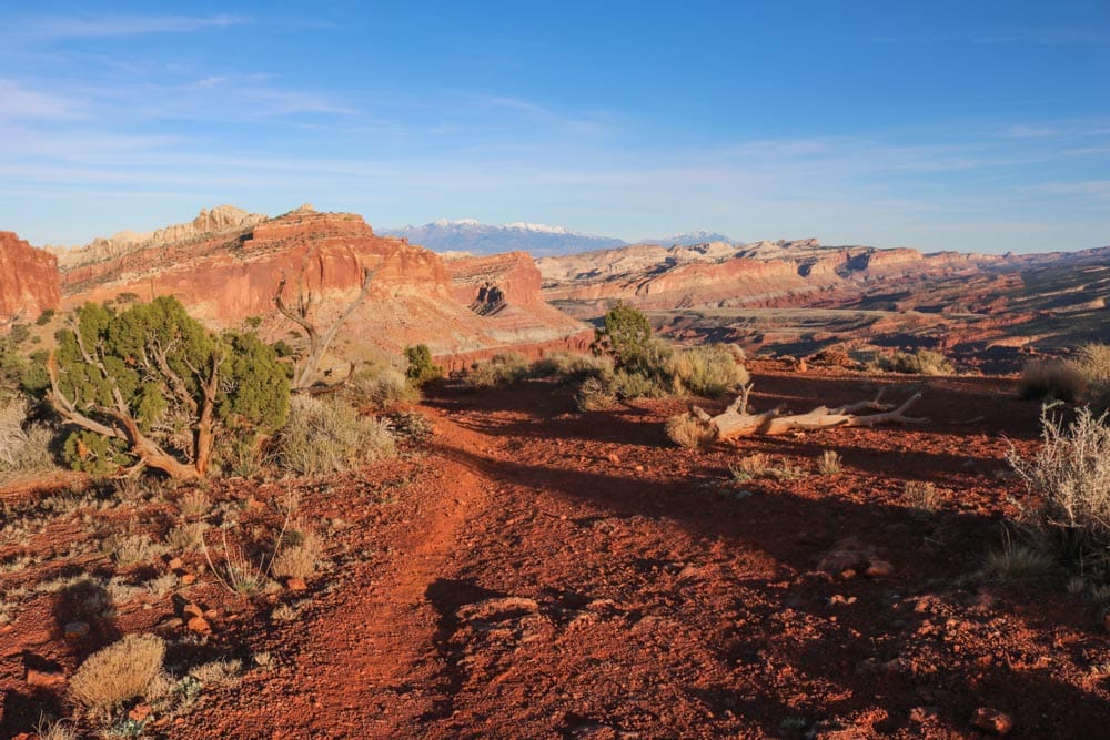
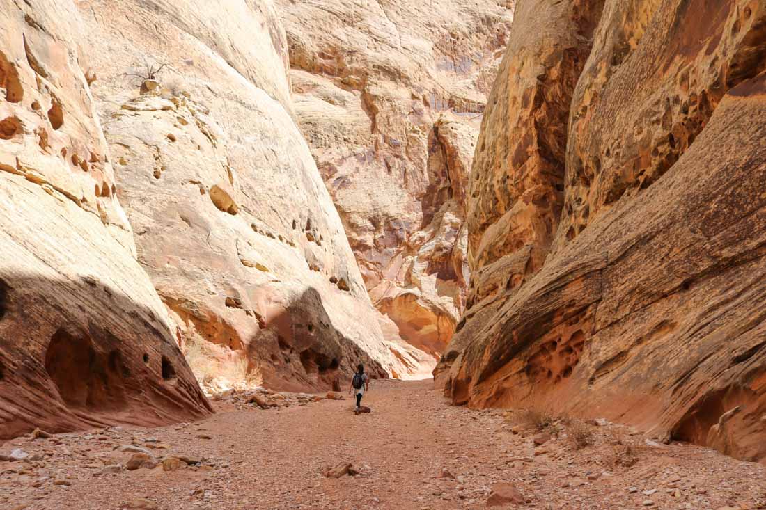
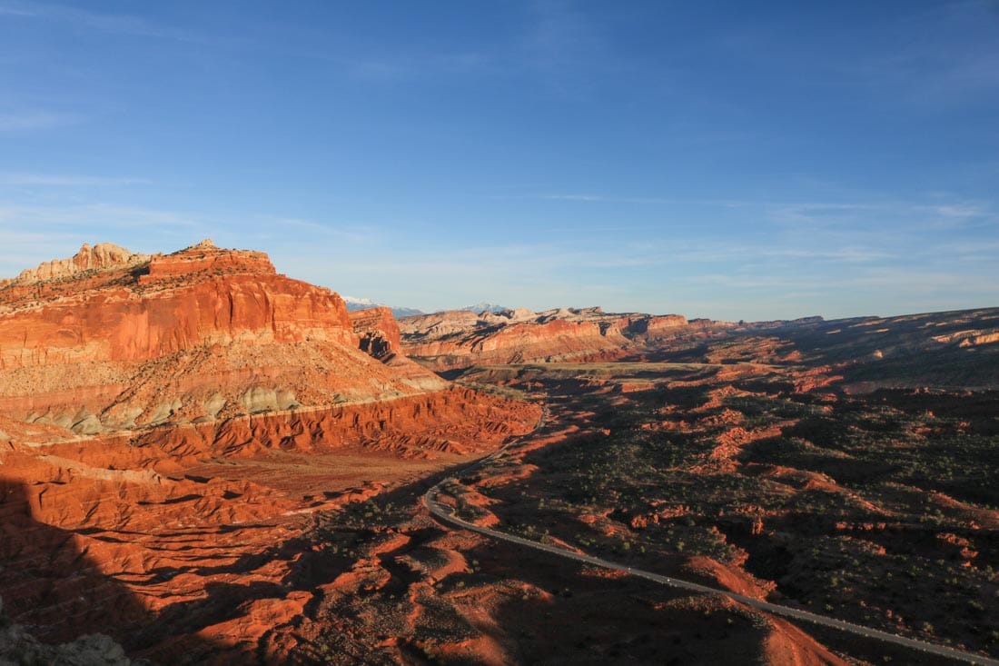
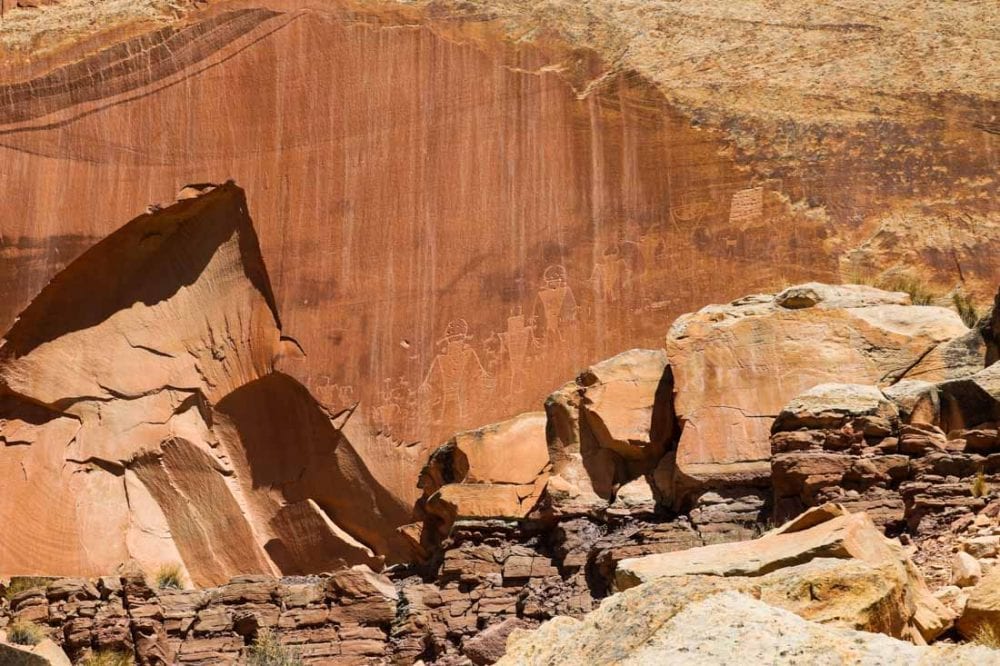
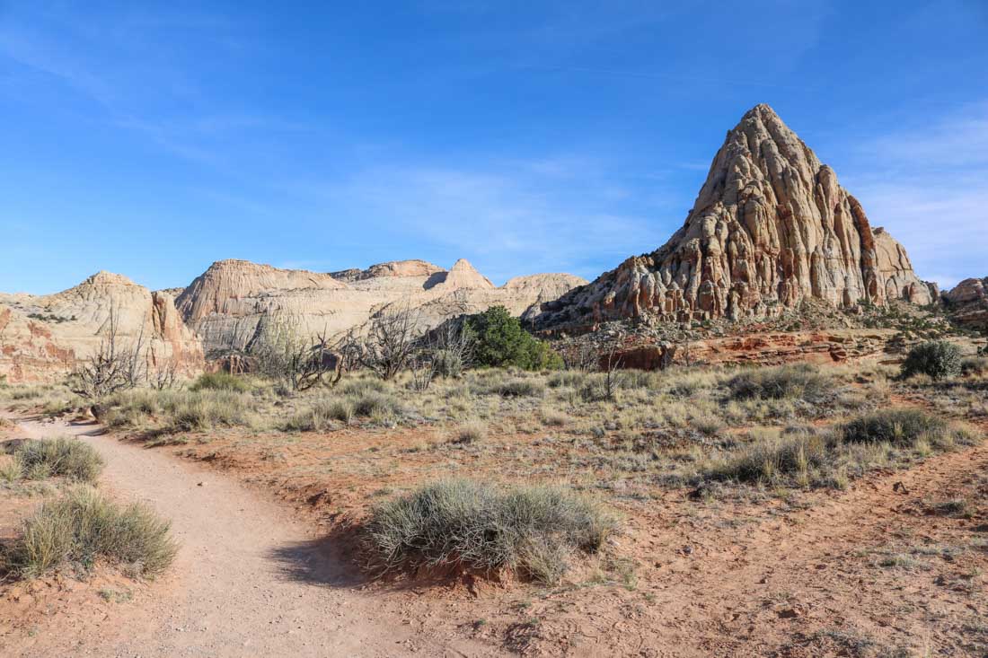
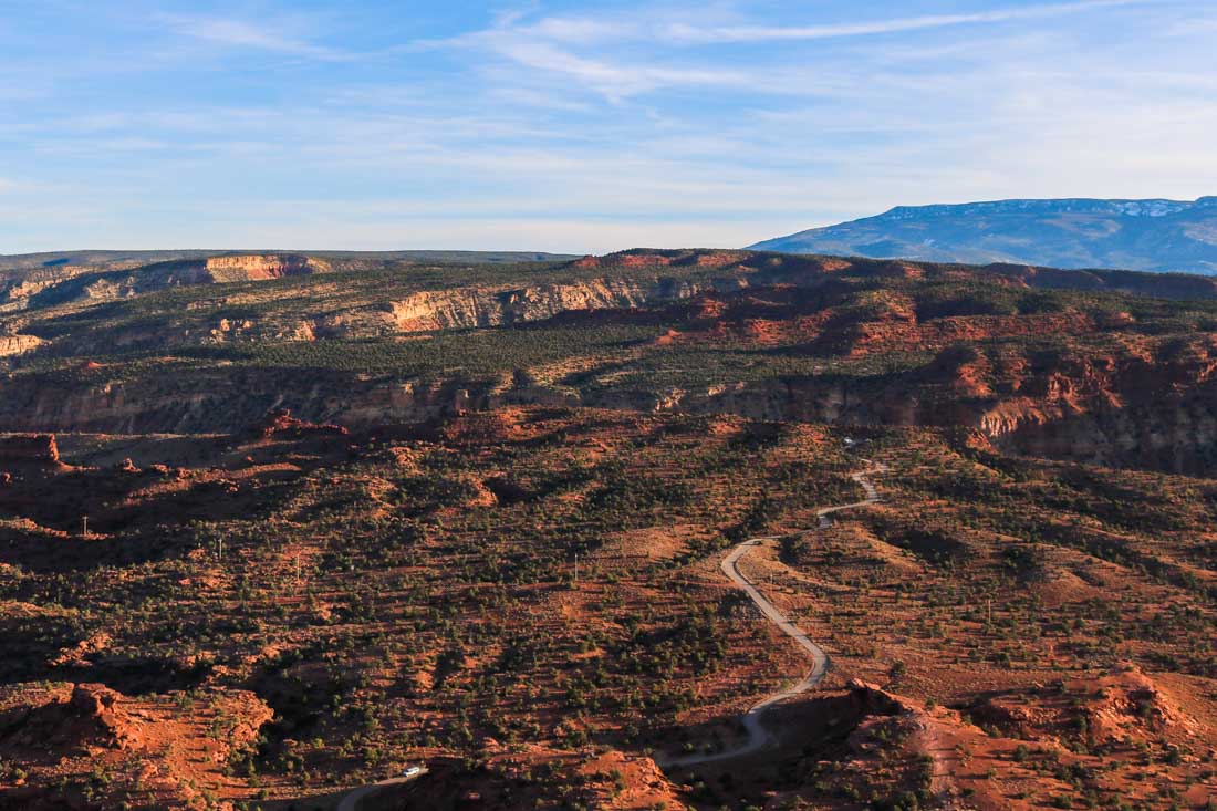
Established: 1971 Area: 378 square miles (979 km²) Annual visitors: 1,050,000 What to see: Orchards in Fruita, Chimney Rock, Cathedral Valley, Grand Wash, Hickman Bridge, Capitol Dome, Golden Throne, petroglyphs What to do: Hiking, 4-wheel driving, fruit picking, learning about Native American culture Website:https://www.nps.gov/care/index.htm
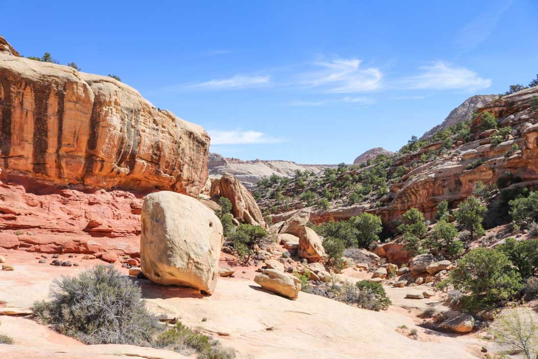
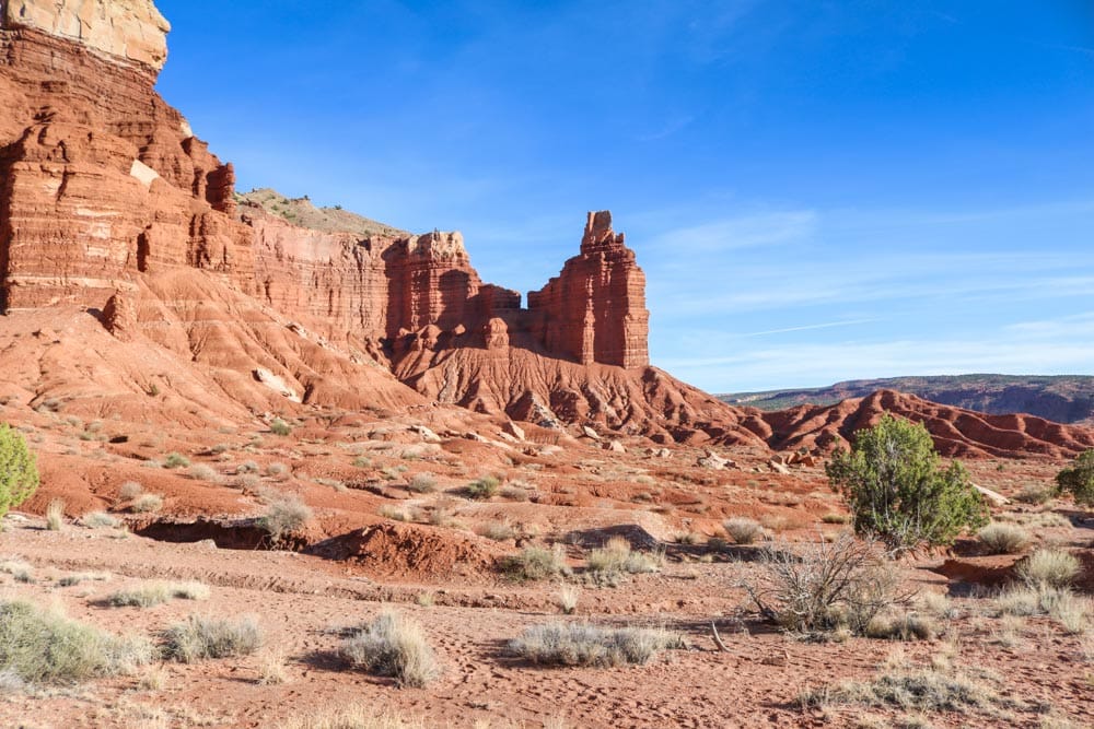
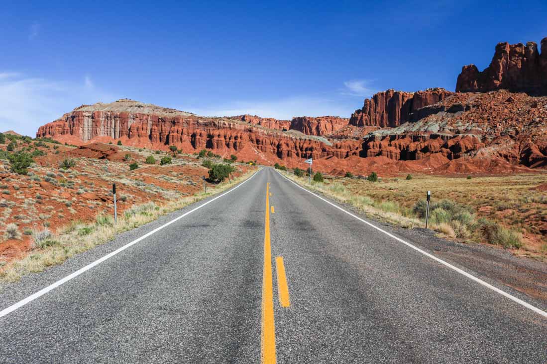
Majestic, towering red cliffs rise up behind the iconic Gifford Homestead Barn in Fruita.White boulders and red rocks combine to form the incredible desert landscapes of Capitol Reef National Park.Late-afternoon sun rays cast a shadow behind Chimney Rock, one of Capitol Reef’s greatest rock formations.Scenic Route 24, a public highway, cuts through the heart of Capitol Reef National Park.The sun sets on the beautiful Chimney Rock Trail, painting the desert landscape in the warmest of colors.Hiking the magnificent Grand Wash Trail, you’ll find yourself surrounded by imposing cliffs on both sides.Dusk falls over Route 24. The famed Waterpocket Fold is visible in the distance.Native American petroglyphs, a top attraction in the park, remind visitors that this area was inhabited long before Europeans arrived and it became a national park.Striking white sandstone formation dominate parts of the Capitol Reef National Park landscapes.Long shadows extend across the undulating desert as nightfall approaches.
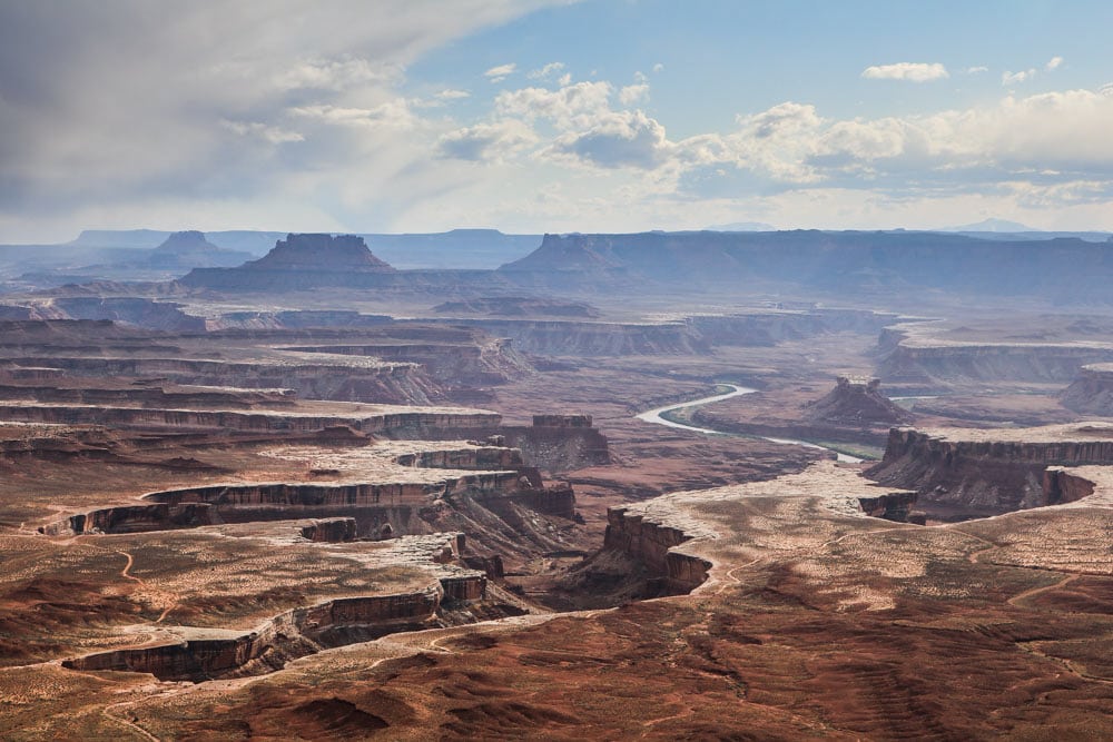
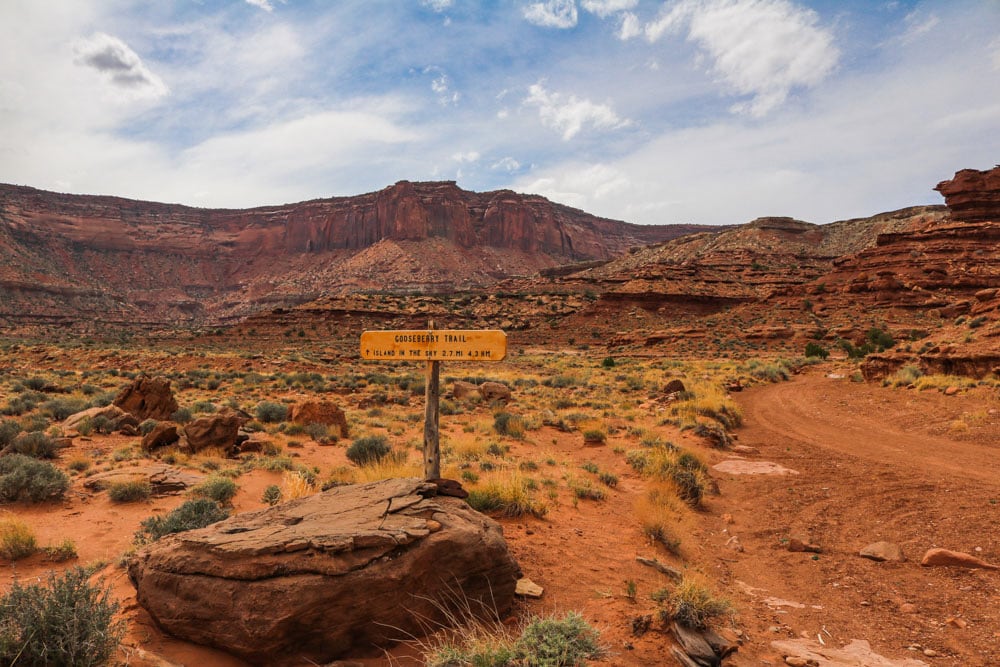
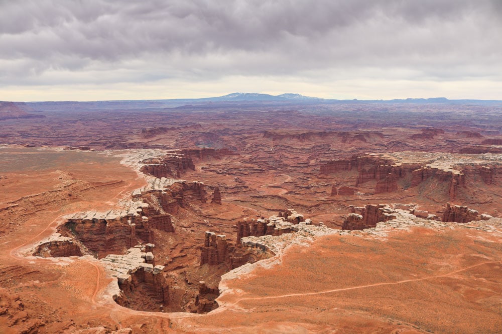
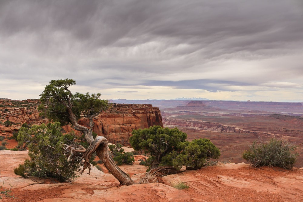
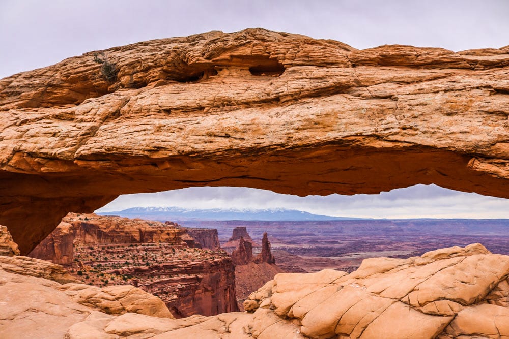
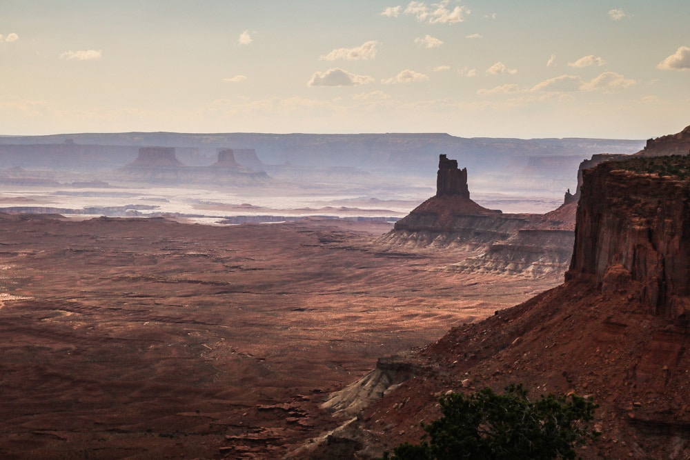
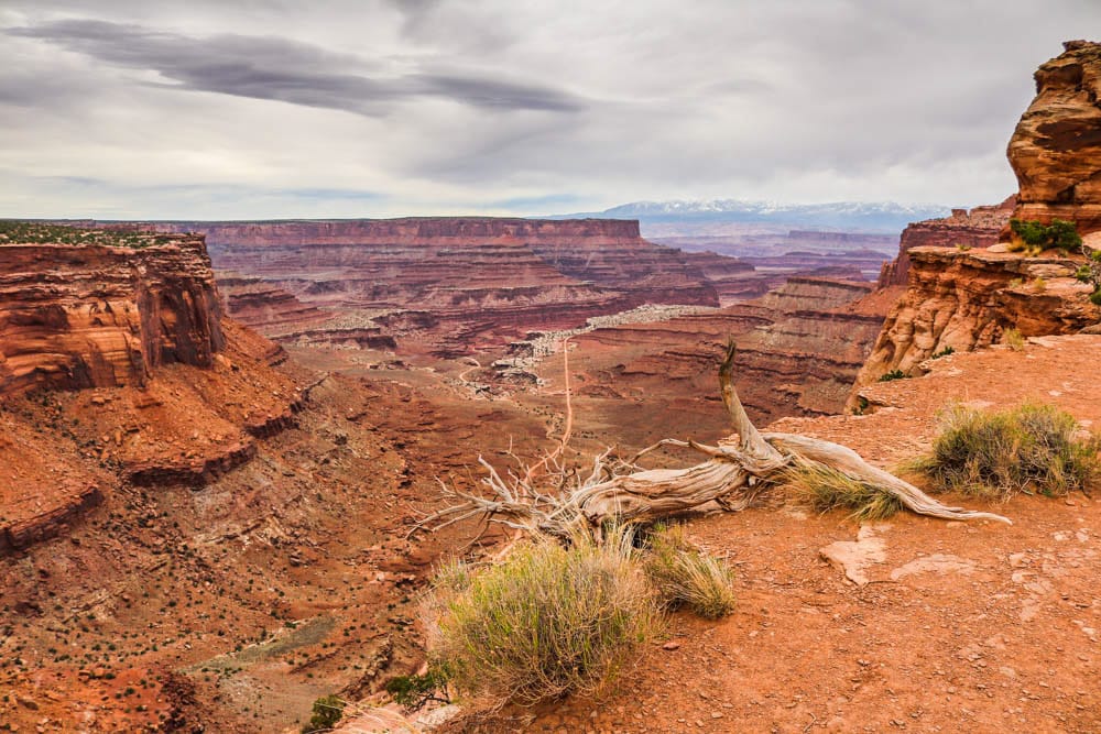
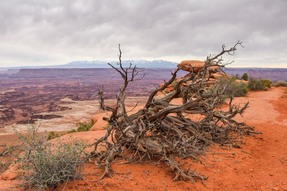
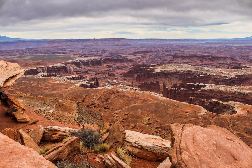
Established: 1964 Area: 527 square miles (1,365 km²) Annual visitors: 775,000 What to see: Mesa Arch, Grand View Point, Horseshoe Canyon What to do: Mountain biking, hiking, (4-wheel) driving, stargazing Website:https://www.nps.gov/cany/index.htm
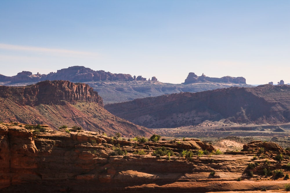
The Green River Overlook is breathtaking, offering a view deep into the heart of the park’s rugged interior wilderness.Among the steepest and most exposed trails in Canyonlands National Park, the Gooseberry Trail offers hikers a challenging hiking experience.The landscapes of Canyonlands National Park consists of multiple levels of ravines, canyons and gorges.Ominous-looking clouds roll into the Island in the Sky District, indicating a spring lightning storm.Perfectly framing the canyon below, Mesa Arch is arguably the best-known attraction in Canyonlands National Park.As the skies slowly clear in the Island of the Sky District after a rainstorm, mist and shadows create a dramatic landscape.Home to many miles of dirt roads and tracks, Canyonlands National Park is one of the top mountain biking destinations in the world.The sheer vastness of Canyonlands is astonishing. Hike along one of the rims to fully appreciate the enormity and depth of these canyons.The abundance of scorched trees on mesa tops and along canyon rims provide proof that lightning strikes are not uncommon here.Canyon after canyon, after canyon… Canyonlands National Park’s name surely is appropriate.
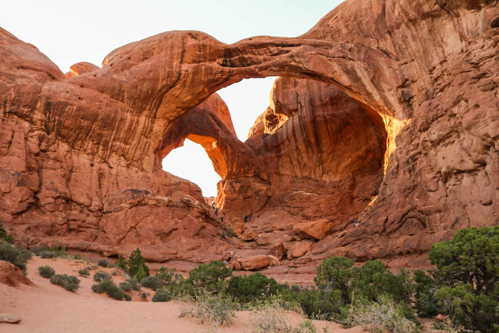
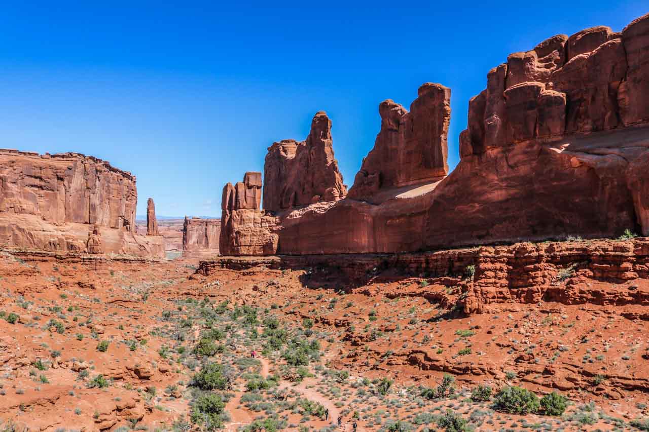
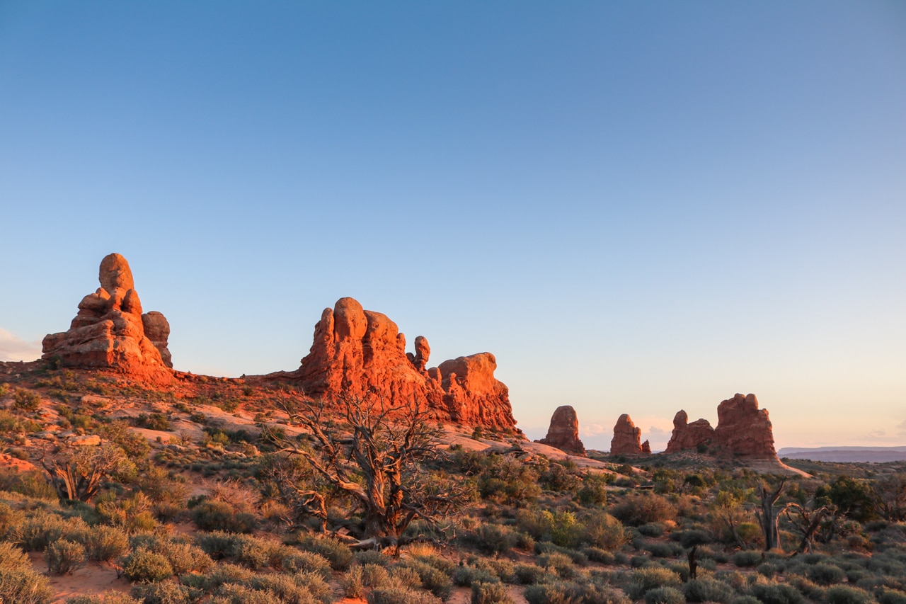
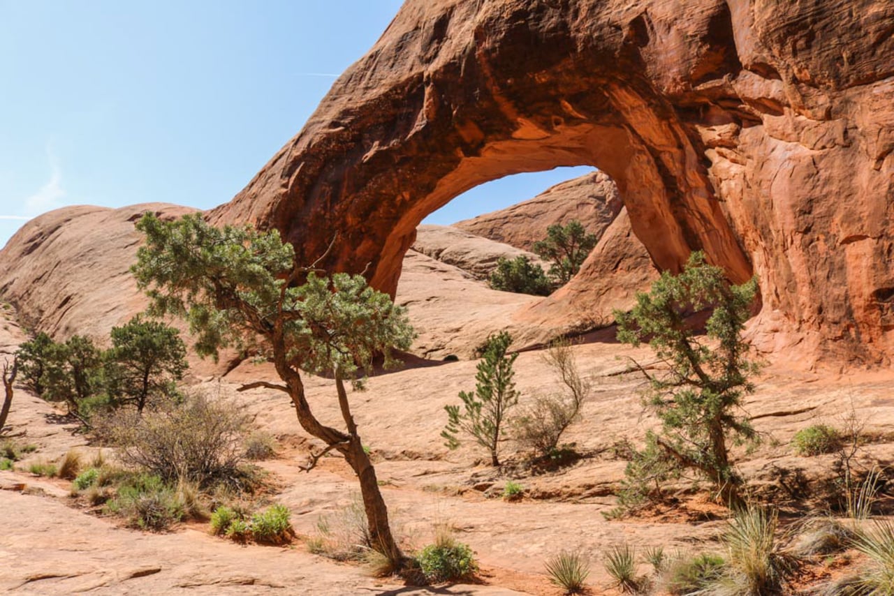
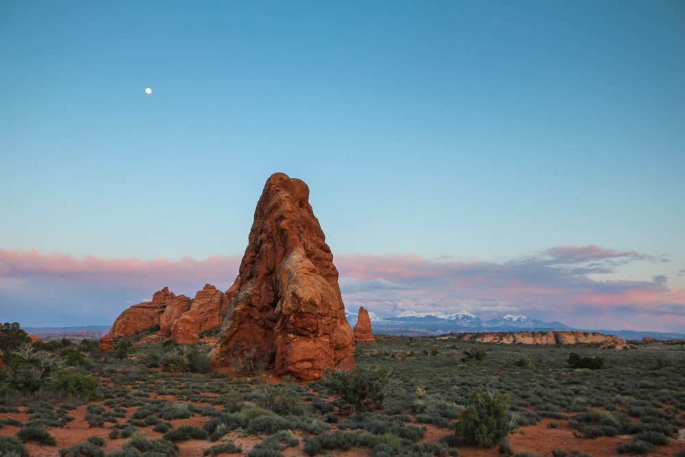
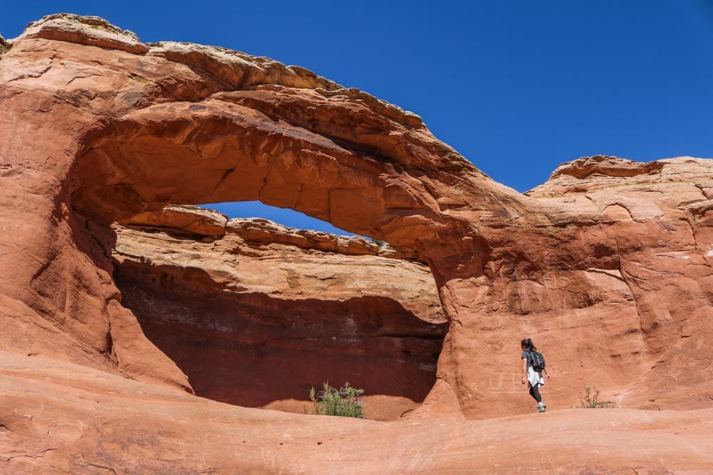
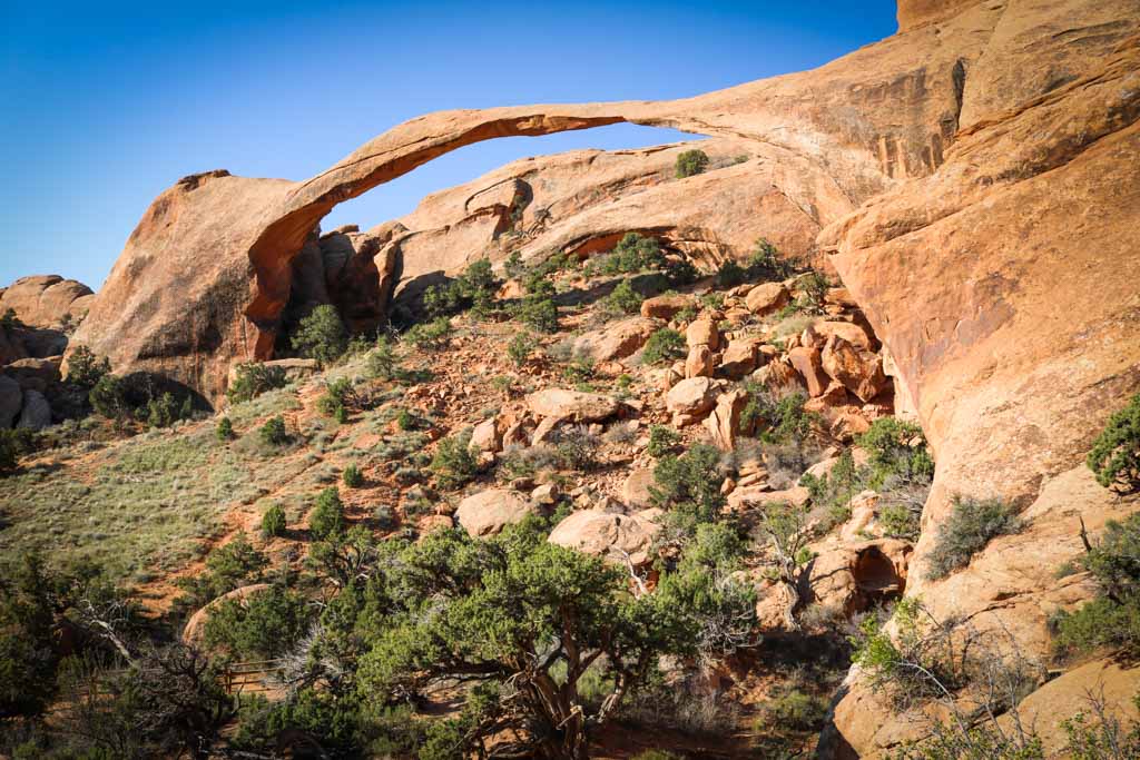
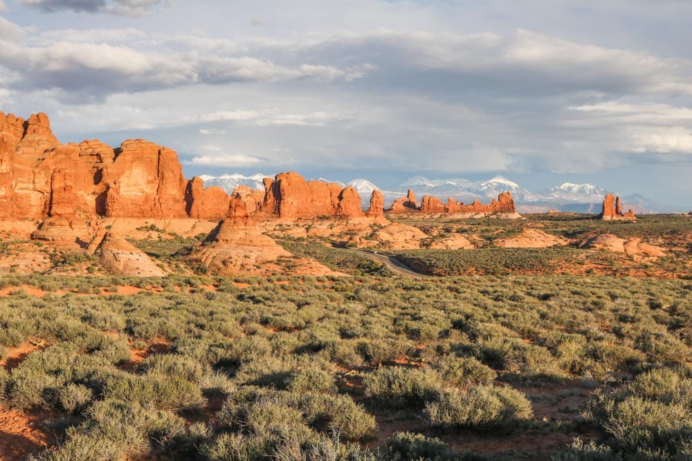
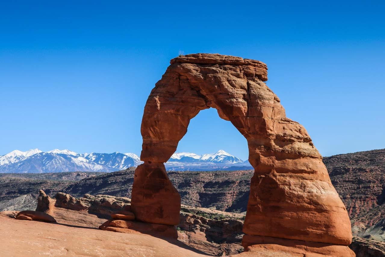
Tiny hikers put into perspective the massive size of Double Arch, one of the park most popular locations.Huge rock fins, pillars and cliffs line Park Avenue, home to one of my favorite trails in Arches National Park.The busy Windows Area is an amazing place to enjoy the sunset in Arches National Park.Private Arch is one of the many arches you can see on the awesome, primitive Devils Garden Trail.A full moon rises behind a rock formation in Arches National Park.Tapestry Arch is a gigantic rock arch, as is shown clearly by this hiker walking towards it.In addition to 2,000 arches, the greatest density on Earth, Arches National Park boasts wild desert scenery and other geological features.You can see Landscape Arch, the longest natural rock arch in the world, via a short and flat hiking trail.The snow-capped La Sal Mountains provide the perfect backdrop to the red-colored rocks in the Garden of Eden.Arguably America’s most famous rock arch, Delicate Arch is surprisingly large and is the final destination on a great desert hike.
What makes this particular collection of U.S. national parks so exceptional—there are more clusters of parks in other states, such as California, Washington and Alaska—is that they’re all super-easily accessible. When driving on the highways of southern Utah, one park literally follows the other.
It’s amazing how convenient this is. In seven to ten days’ time, you can see much of what each park has to offer. This includes doing a few epic hikes, desert camping and enjoying star-studded night skies.
If these Utah national parks photos sparked your interest in visiting the national parks in Utah, you should definitely check out the following more specific blog posts:
Beautiful photos, certainly made me want to go there! Thanks for sharing!
Bram Reusen
Sunday 18th of June 2017
Thanks Helene! You should definitely get out there if you have the chance. It's amazing down there.
We use cookies to give you the most relevant experience by remembering your preferences and repeat visits. By clicking “Accept”, you consent to the use of ALL cookies. You can change your cookie preferences by clicking on "Settings". Click on "Read More" for more details about our privacy policy.
This website uses cookies to improve your experience while you navigate through the website. Out of these, the cookies that are categorized as necessary are stored on your browser as they are essential for the working of basic functionalities of the website. We also use third-party cookies that help us analyze and understand how you use this website. These cookies will be stored in your browser only with your consent. You also have the option to opt-out of these cookies. But opting out of some of these cookies may affect your browsing experience.
Necessary cookies are absolutely essential for the website to function properly. This category only includes cookies that ensures basic functionalities and security features of the website. These cookies do not store any personal information.
Any cookies that may not be particularly necessary for the website to function and is used specifically to collect user personal data via analytics, ads, other embedded contents are termed as non-necessary cookies. It is mandatory to procure user consent prior to running these cookies on your website.


Helene
Sunday 18th of June 2017
Beautiful photos, certainly made me want to go there! Thanks for sharing!
Bram Reusen
Sunday 18th of June 2017
Thanks Helene! You should definitely get out there if you have the chance. It's amazing down there.