Last Saturday, before we went to Stowe to celebrate our first wedding anniversary, Caroline and I spent the day in the Green Mountains. In addition to yummy maple syrup, covered bridges and gorgeous farmlands, the Green Mountains are one of Vermont’s main attractions. Hiking Camel’s Hump was something I’d wanted to do for quite some time and because it was up to me to plan the weekend, that’s exactly what we did.
Camel’s Hump is the third-highest mountain in the state, after Mount Mansfield and Killington Peak. The first Europeans to spot the mountain were most likely those on the Lake Champlain expedition led by Samuel de Champlain in 1609. De Champlain referred to the mountain as ‘The Resting Lion’. However, since then, it has had various different names, including Camel’s Rump. It got its present-day name in 1830. Unofficially, there still are no less than twelve names for the mountain, such as Catamountain and Tah-wak-be-dee-ee-so wadso.
View of Mount Mansfield from Camel’s Hump’s summit
Because, at 4,083 feet (1,244 meters), it’s not the tallest of mountains, its most notable feature is not its size, but its shape. The peak is, in fact, shaped like a hump of a camel, with two humps, the southern one being the highest. Camel’s Hump stands relatively isolated from surrounding mountains, making it very prominent and easily recognizable. The mountain is visible from many miles away.
Hiking Camel’s Hump
We arrived at the head of Burrows Trail, the most popular trail to the summit, around 10.30am. The trailhead lies at the end of Camel’s Hump Road, about 3.5 miles (5.63 kilometers) east of the town of Huntington. There’s no fee to park, but it’s strongly suggested to get there in time as the parking lot fills up fast, especially on the weekends.
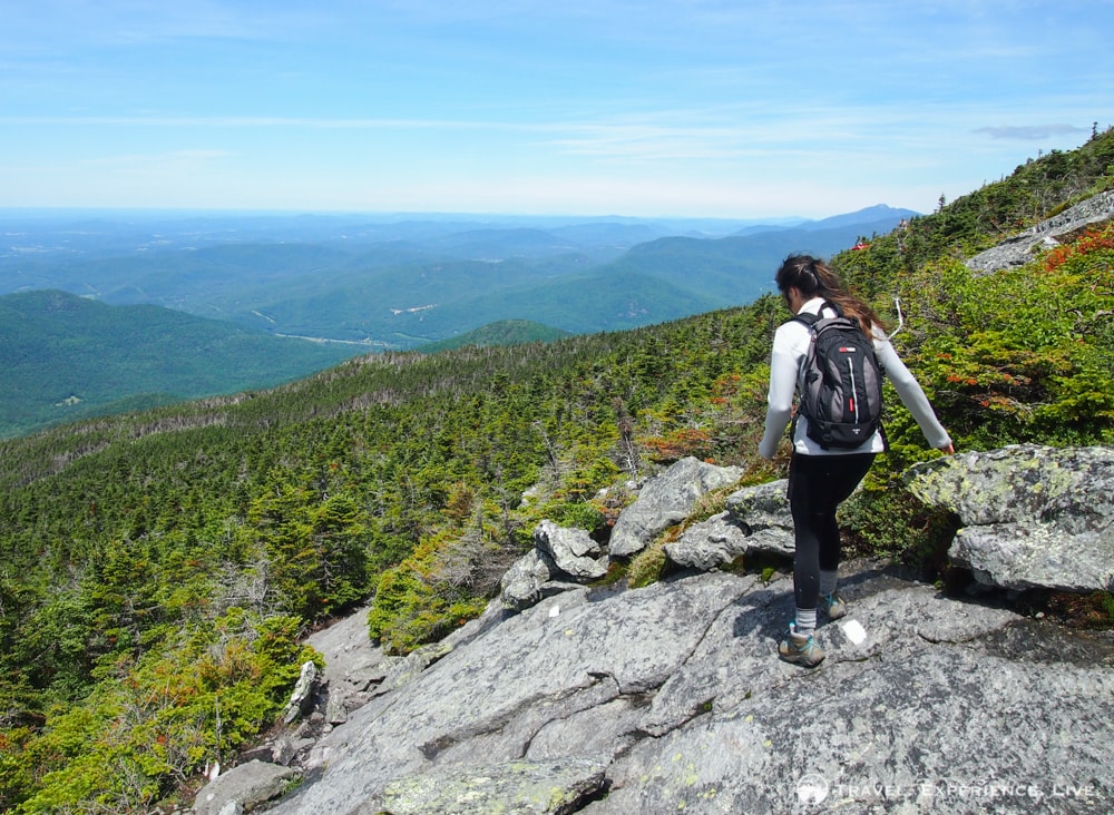
Caroline skips her way down the mountainside
The Burrows Trail runs through the heart of Camel’s Hump State Park and is easy for the first mile (1.6 kilometers). It leads across pleasantly bubbling mountain streams and through deciduous woods before starting to climb to higher altitudes. The next 1.1 miles (1.77 kilometers) gets gradually steeper. Although it’s not a technical ascent by any means, it is quite tiring and few breaks to catch a breath are needed to get to the summit. The Burrows Trail is the shortest and most popular trail to the summit, but there are no views along the way whatsoever, which really is too bad.
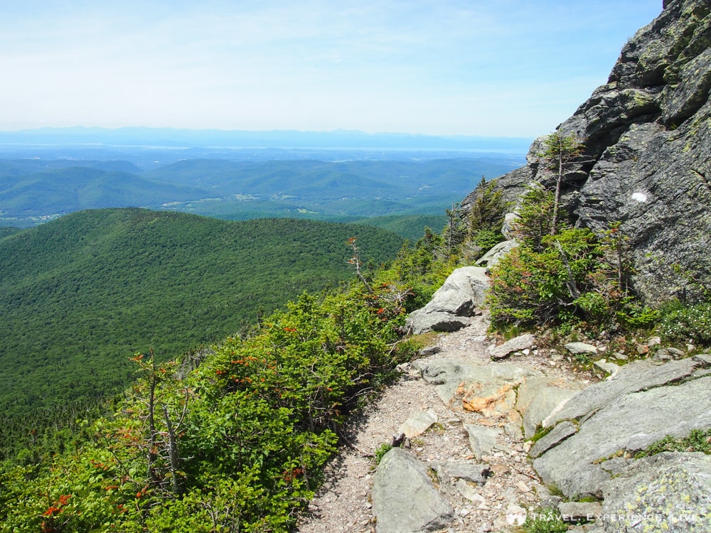
The Long Trail runs up and over Camel’s Hump and offers spectacular views
The Burrows Trail ends at the intersection with the Long Trail after 2.1 miles (3.38 kilometers). From there, it’s another steep 0.3 miles (0.48 kilometers) south along the Long Trail, which is one of the best short long-distance hikes in the US, to the actual summit of Camel’s Hump.
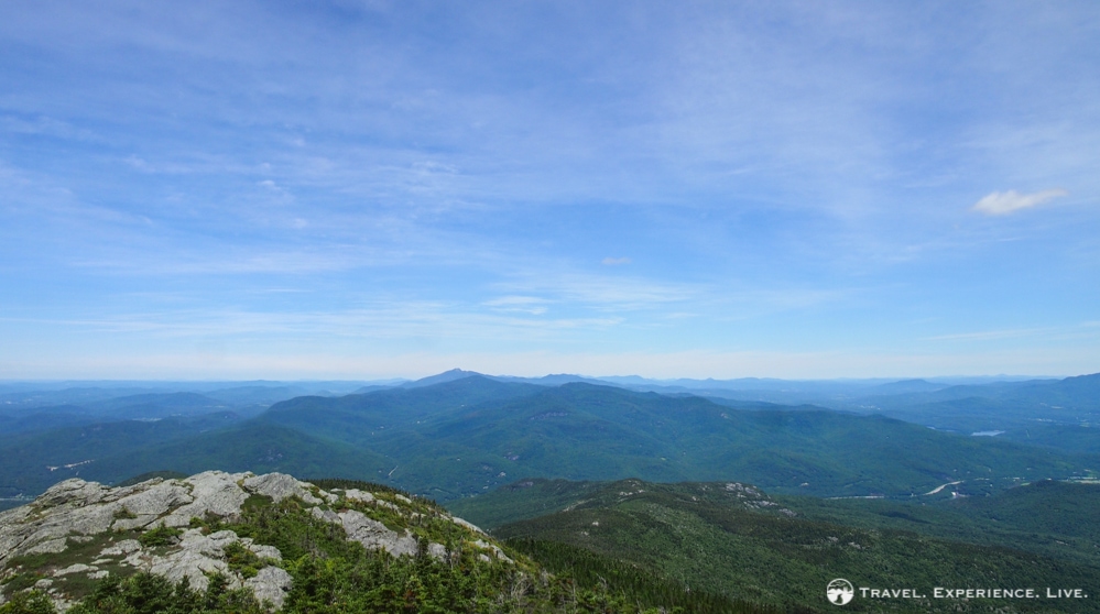
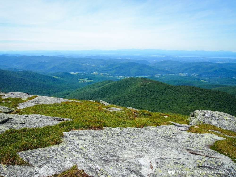
Mount Mansfield seen from Camel’s Hump
Camel’s Hump’s summit is home to fragile alpine vegetation and hikers are reminded not to leave the trail and stay within the marked areas. The summit offers great panoramic views in all directions. Views include Mount Mansfield to the north, Lake Champlain and the Adirondacks to the west, and many valleys and lesser mountain ranges to the east, possibly even as far as Mount Moosilauke in New Hampshire—that’s what I thought, but it’s hard to tell.
Distant view of Lake Champlain
More hiking in Vermont: Mount Ascutney
Despite the views being, objectively speaking, excellent, I felt like I’d seen it all before. Surprisingly, although I definitely enjoyed them, the views from the summit didn’t blow me away. To me, it almost seemed as if the view of Camel’s Hump from another mountain could be better than the actual views from the mountain itself.
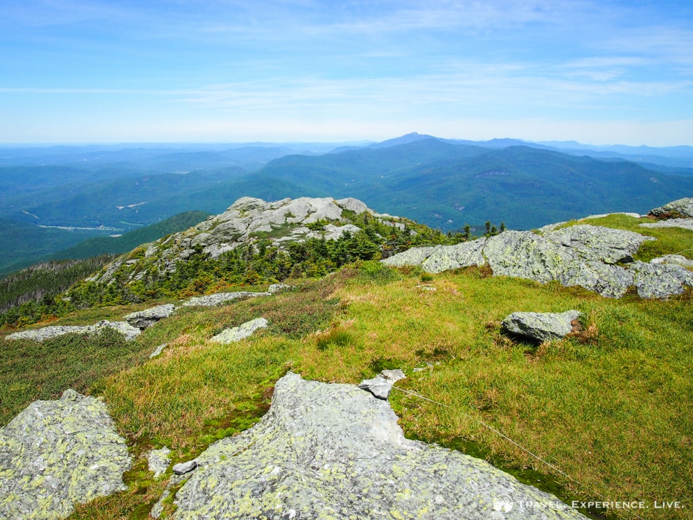
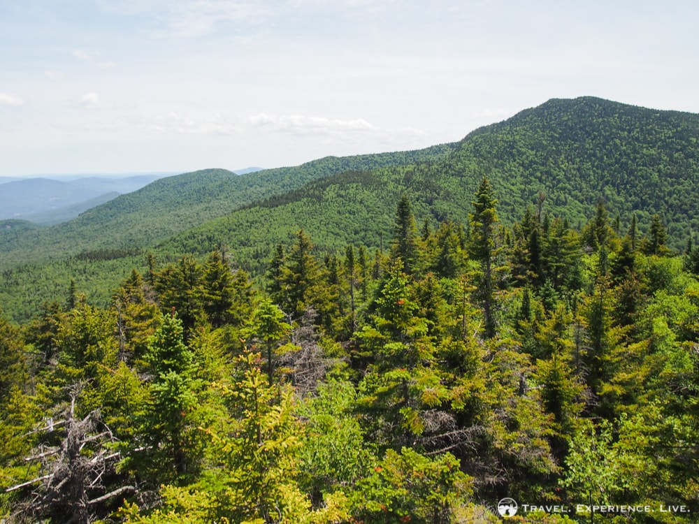
Green Mountains as far as the eye can see
We had lunch at the summit, which is small and was rather crowded, and headed back down south on the Long Trail. The views on the way down are, I think, more spectacular than those at the top. The first section is quite technical and very steep and involves boulder climbing and even some rock hopping. The trail runs right underneath the summit—a summit that has an almost vertical cliff on its southern side—and is squeezed between a sheer rock wall on the left and a magnificent view of a valley and mountain ranges beyond on the right.
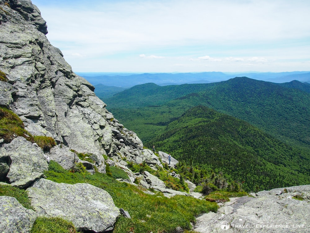
View from the Long Trail on the way down
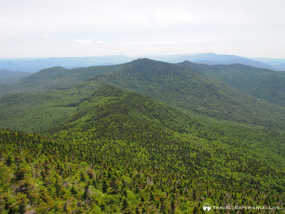
The Long Trail then flattens out a bit, but continues to offer great views of the mountains to the south of Camel’s Hump—Mount Ethan Allen and Mount Ira Allen, for example. (I now want to climb Mount Ethan Allen as well because the views of Camel’s Hump from its summit must be incredible.) After 1.7 miles (2.74 kilometers), the Long Trails connects with the Forest City Trail somewhere at the saddle between Camel’s Hump and Mount Ethan Allen.
Mount Ethan Allen seen from the south side of Camel’s Hump
The 1.7-mile (2.74-kilometer) Forest City Trail runs down to the parking lot through dense woods and along a few streams, waterfalls and tiny rivers. This last section of the loop is extremely fast—we did it in 25 minutes.
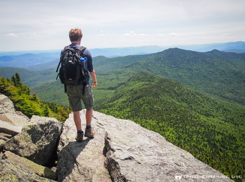
Bram enjoys the fantastic mountain views
Trail Info
Ascent
Burrows Trail: 2.1 miles (3.38 kilometers)
Long Trail: 0.3 miles (0.48 kilometers)
Hiking time: 1 hour and 30 minutes
Descent
Long Trail: 1.7 miles (2.74 kilometers)
Forest City Trail: 1.7 miles (2.74 kilometers)
Hiking time: 1 hour and 45 minutes
Total
Burrows Trail-Long Trail-Forest City Trail Loop: 5.8 miles (9.33 kilometers)
Hiking time: 3 hours and 15 minutes
Outing time: 4 hours
You can find more information on Camel’s Hump State Park, including a trail map (which is also available for free at the Burrows Trail trailhead), on the Vermont State Parks website.