The first weekend of fall was spectacular here in New England. Temperatures rose to an incredible 80°F (27°C) and there wasn’t a single cloud in the sky.
Fall foliage was peaking (and still is) and New Hampshire’s White Mountains were pretty much overrun with so-called leaf-peepers. We, of course, were there as well.
It would’ve been a shame to pass up weather like that.
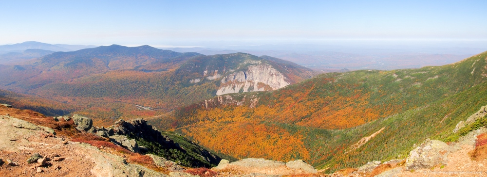
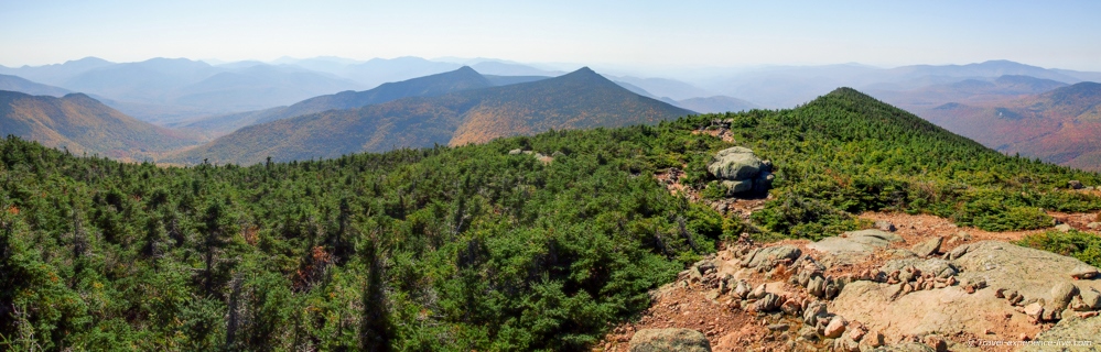
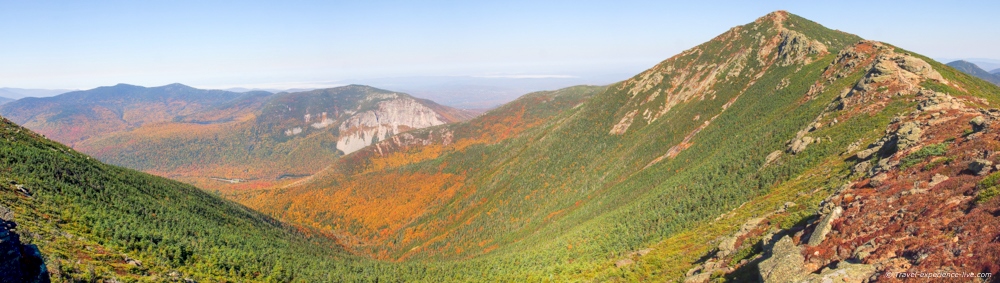
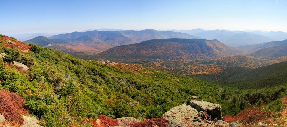
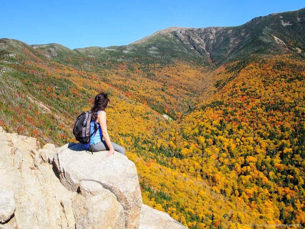
Amazing panoramic views from the Franconia Ridge
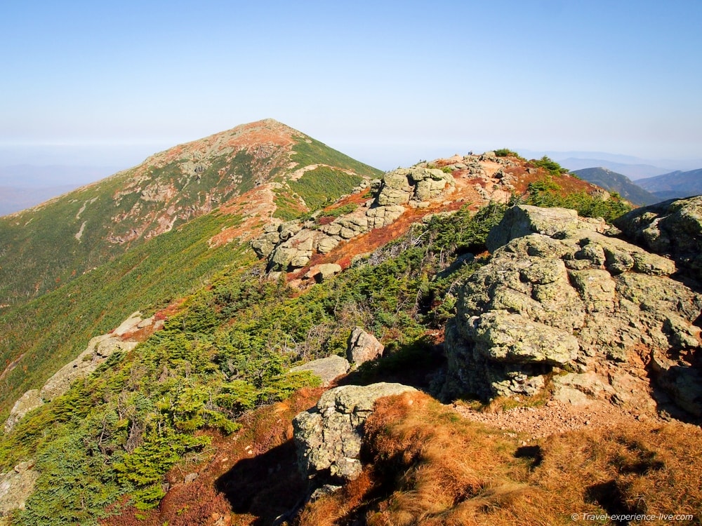
Mount Lafayette via the Franconia Ridge Loop Trail
We hiked the Franconia Ridge Loop Trail, one of the more popular summit loops in the White Mountains. It is a magnificent loop hike that must be among the best hikes in all of New Hampshire.
The loop is located in Franconia Notch State Park and includes the summits of three 4,000-footers – the White Mountains, by the way, are home to 48 peaks above 4,000 feet (1,219 meters).
These summits are:
- Little Haystack (4,780 feet/1,457 meters)
- Mount Lincoln (5,089 feet/1,551 meters)
- Mount Lafayette (5,240 feet/1,597 meters)
The Franconia Ridge can be reached via a variety of trails, but the most direct trails to Mount Lincoln and Lafayette begin at Lafayette Place in Franconia Notch. This is where we started.
The Franconia Ridge Loop consists of three sections and four trails. We hiked in a counterclockwise direction, because this way the sun would be behind us when we were at the Franconia Ridge, which is good photographywise.
Let’s break the loop up into those three sections, shall we?
Falling Waters Trail
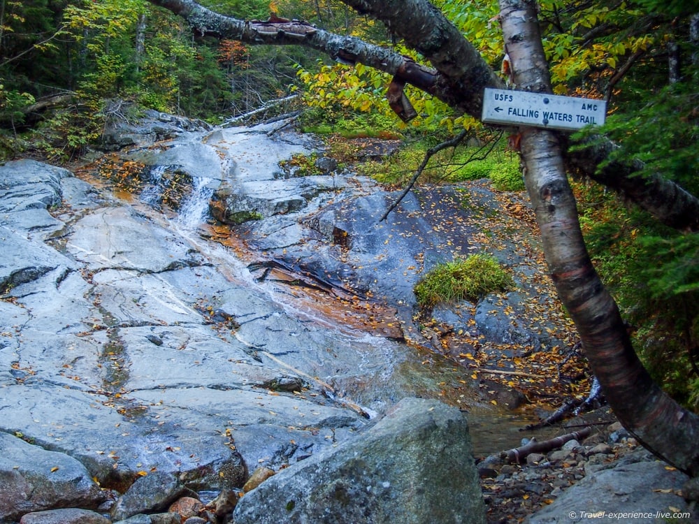
Falling Waters Trail
The loop starts at the Lafayette Place trailhead. After about 0.2 miles (0.3 km) the trail splits up; the Old Bridle Path continues straight, while the Falling Water Trails bends to the right.
We followed the latter across Walker Brook and along Dry Brook. The trail then climbed steadily along Dry Brook, crossing the brook regularly, and ran past a series of beautiful waterfalls.
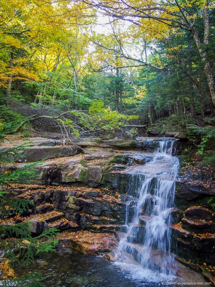
Beautiful waterfall along the Falling Waters Trail
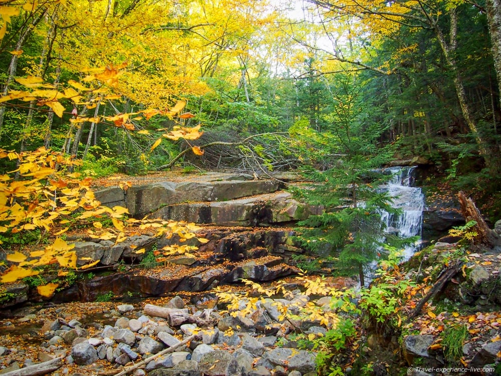
Fall foliage and waterfalls
After about 1.6 miles (2.6 km) the trail got steeper and included several switchbacks. The last straight stretch to the summit of Little Haystack was very steep and even involved some rock scrambling – it is officially classified as a class 1 trail, but it think it’s fair to say that it’s more than that.
We had to take breaks several times to catch our breaths. It was a warm morning and my t-shirt was already soaking wet.
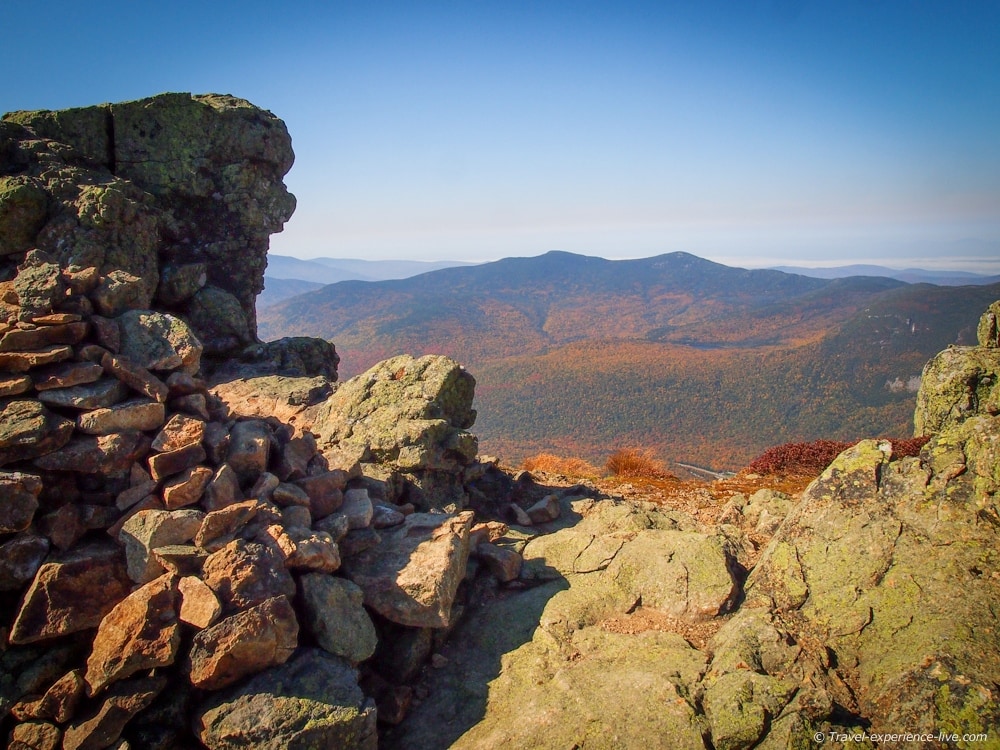
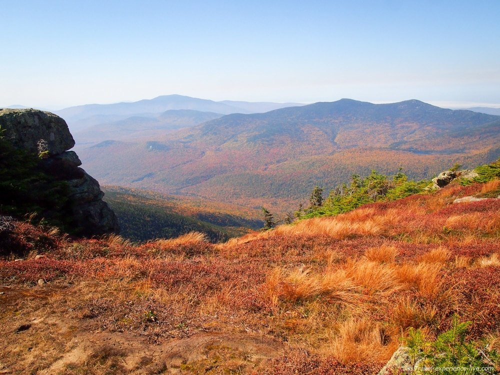
Panorama from the summit of Little Haystack
The Falling Waters Trail ends at the summit of Little Haystack after a steady 3.2-mile (5.1-km) climb.
That first section of the Franconia Ridge Loop took us an hour and fifty minutes. We turned left onto the Franconia Ridge Trail and enjoyed our first panoramic views of the morning.
Franconia Notch and the Kinsman Range, seen from Little Haystack
And again, from another angle
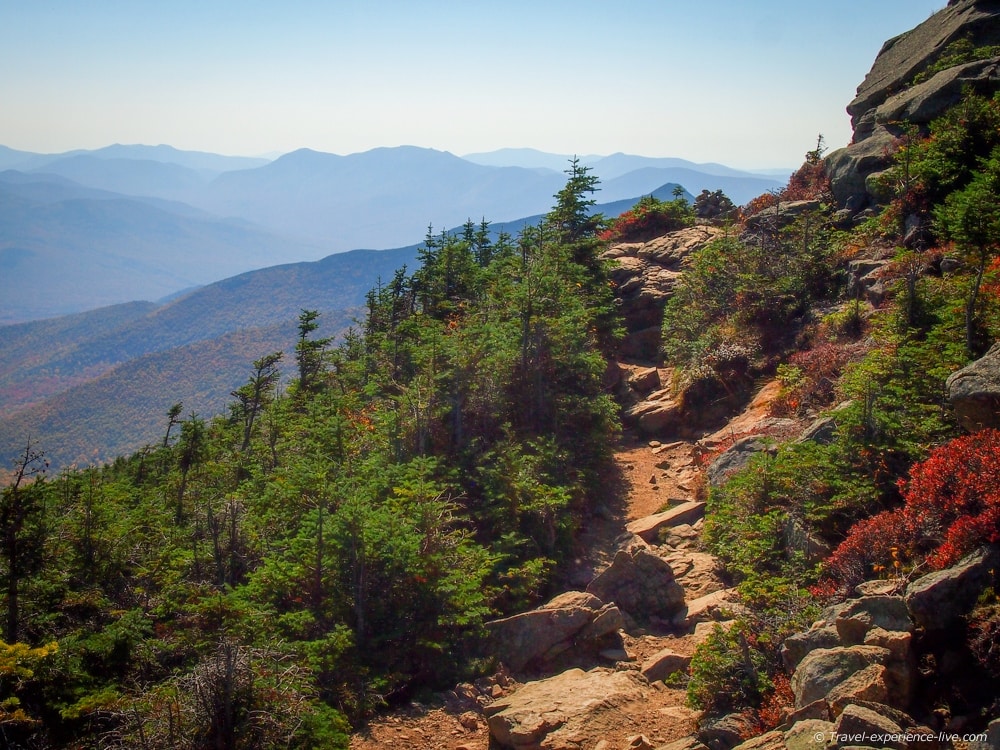
Franconia Ridge Trail
Following the Franconia Ridge for many miles, this trail is actually a section of the Appalachian Trail.
We followed it for 1.7 miles (2.7 km), from the summit of Little Haystack, across Mount Lincoln and to Mount Lafayette, the highest peak in the White Mountains outside of the Presidential Range and our goal for the day. This section, while technically not that long, took us an hour and twenty-five minutes.
I blame it on the views. And on the fact that we were hungry and had to eat.
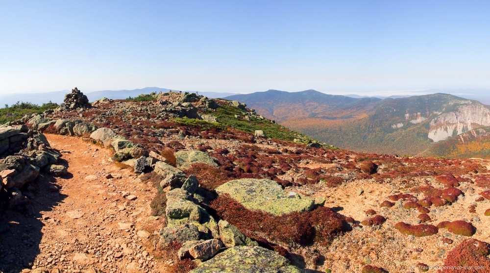
Franconia Ridge Trail from Little Haystack to Mount Lincoln

Caroline posing for a photo
View of Franconia Notch below and Mount Lincoln to the right
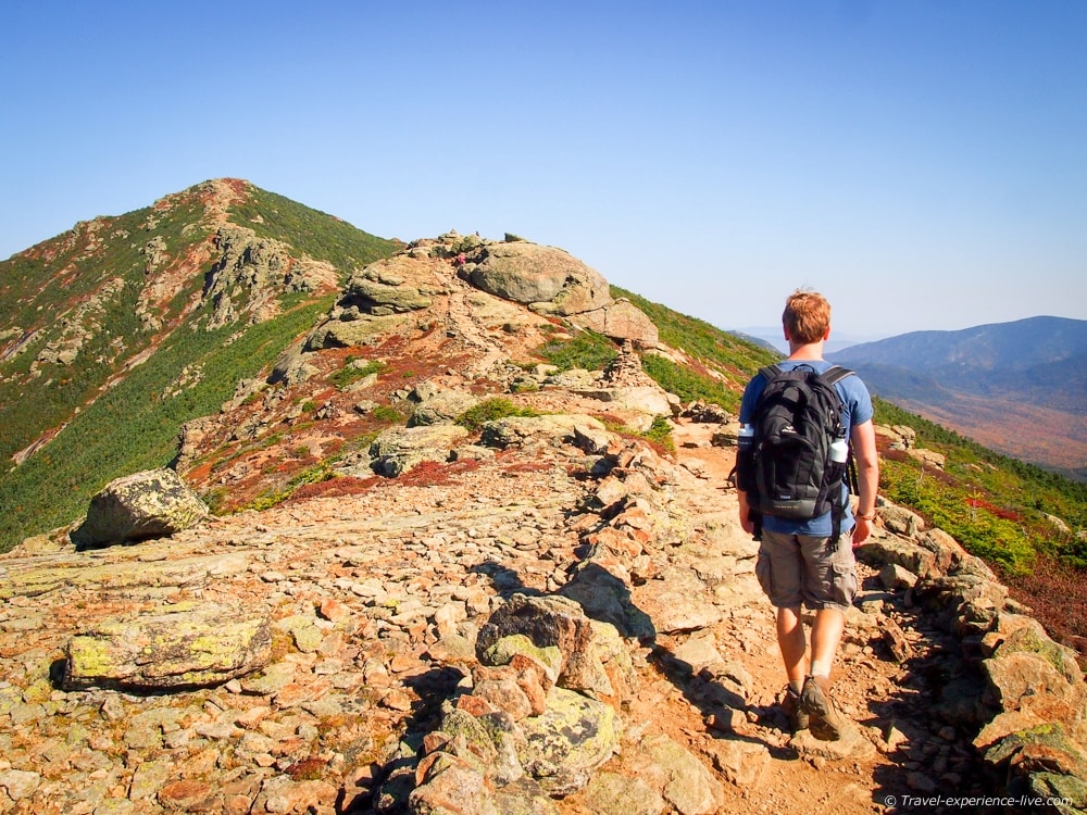
Bram walking towards Mount Lincoln
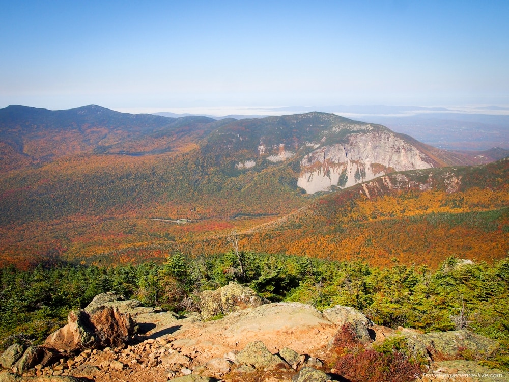
The ridge trail offers downright breathtaking views of Mount Moosilauke, Franconia Notch, Cannon Mountain and the Kinsman Range to the left, and the Presidential Range and the Pemigewasset Wilderness to the right.
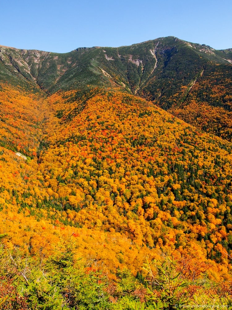
Gorgeous fall foliage in the Pemigewasset Wilderness
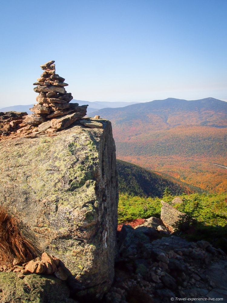
Little cairn and a backdrop of orange leaves
Gorgeous panoramic view of the Presidential Range and the Pemigewasset Wilderness
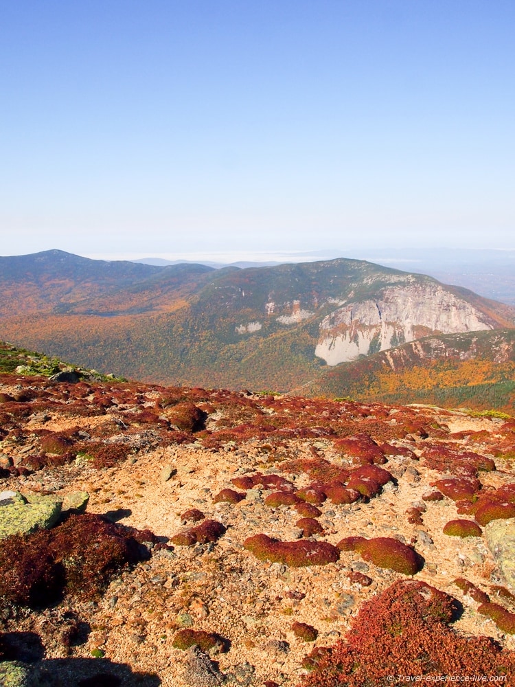
Stunning views near Mount Lincoln’s summit
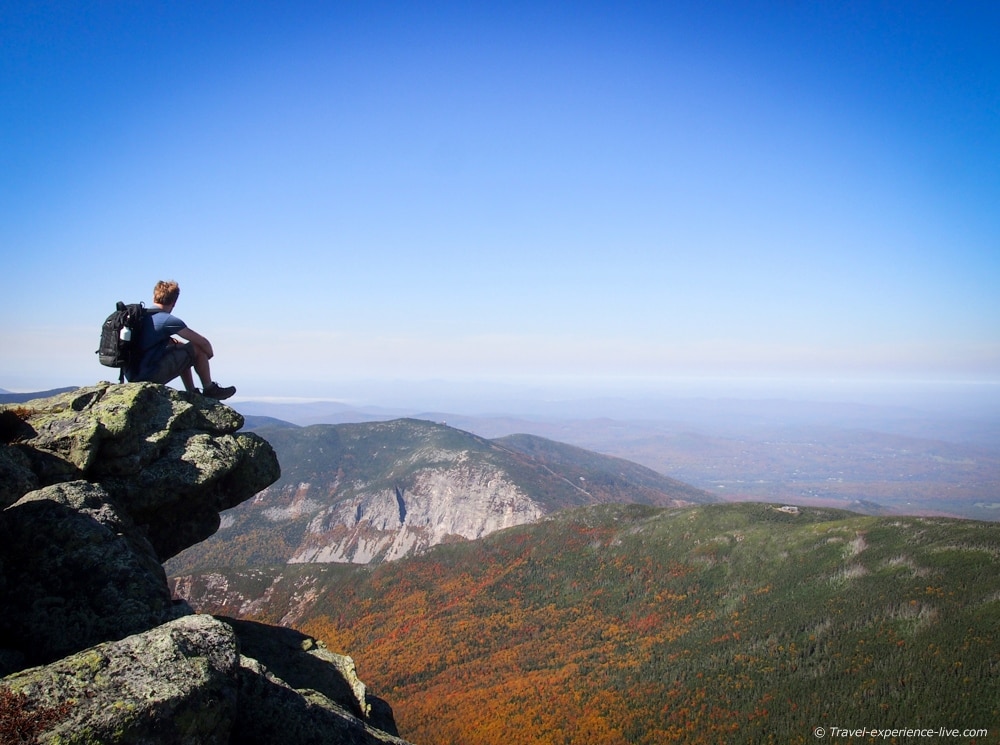
Time for a scenic break
We continued down and up along the knife edge ridge to Mount Lincoln, where we ate our lunch, and eventually to the summit of Mount Lafayette, where we ate another snack before heading back down.
My personal favorite peak was Mount Lincoln, which, I think, has the best panoramic views. The surrounding mountainsides were covered in yellow and orange forests, while the trees in the valleys further afield were a deep red.
I had never seen anything like it before. It was glorious.
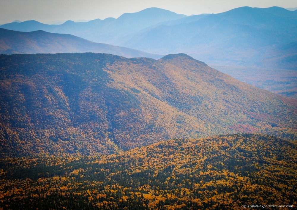
Looking east to the Presidential Range
Looking west to the Kinsman Range and Franconia Notch
Looking north to Mount Lafayette
At the summit of Mount Lafayette we banged a left again and headed down on the Greenleaf Trail.
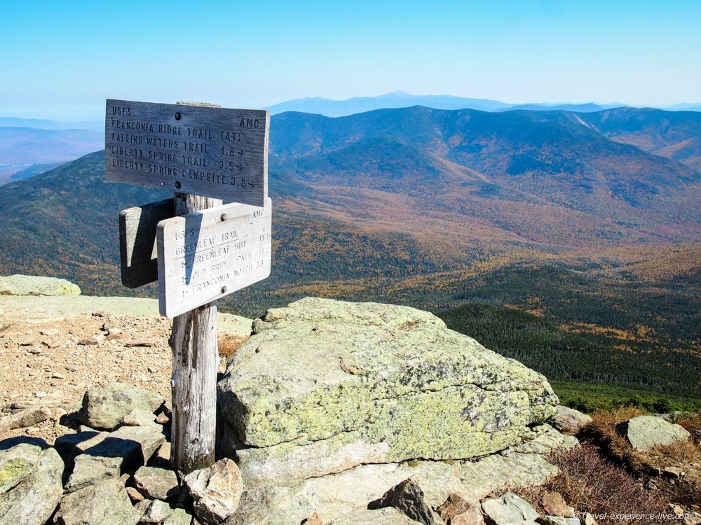
Trail signs at the summit of Mount Lafayette
Greenleaf Trail/Old Bridle Path
The Greenleaf Trail is 1.1 miles (1.8 km) long and runs from Mount Lafayette’s summit down to the Greenleaf Hut, a place that offers beds and meals to long-distance hikers. There are some great views of Mount Lafayette and Eagle Lake from the hut.
Green pines and orange deciduous trees in the White Mountains
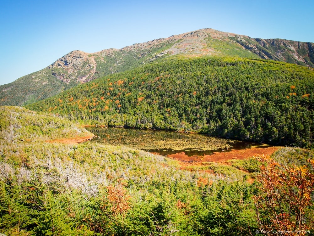
View of Eagle Lake and Mount Lafayette from the Greenleaf Hut
While the Greenleaf Trail continues to the right, we turned left onto the Old Bridle Path.
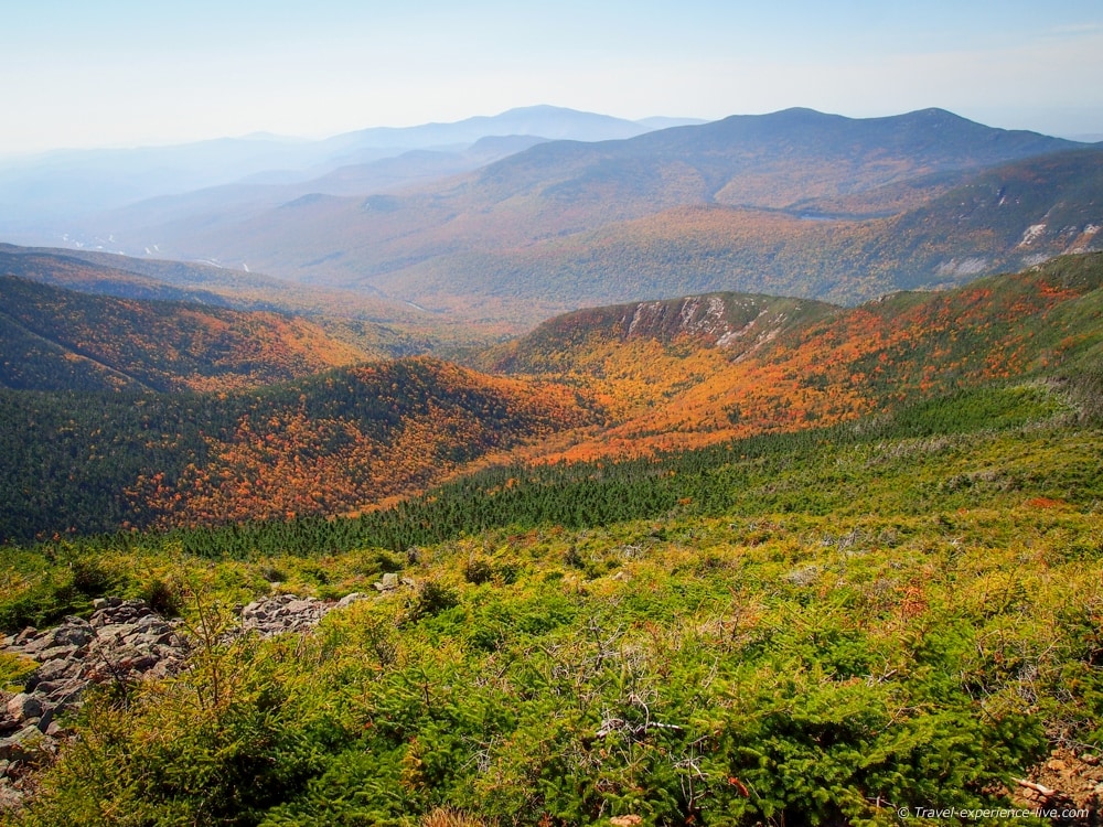
About a mile (1.6 km) down this trail, there are a couple of lookouts that offer fantastic views of the Franconia Ridge above and Walker Ravine below. We took a short break and some photos there.
Another scenic break
Stunning fall foliage in Walker Ravine
Some sections of the Old Bridle Path are quite steep and slippery. After 2.7 miles (4.3 km) the trail converges with the Falling Waters Trail again and a short 0.2-mile walk brought us back to the Lafayette Place parking lot.
The descent along the Greenleaf Trail and Old Bridle Path is 4 miles (6.4 km) and took us a little more than two hours.
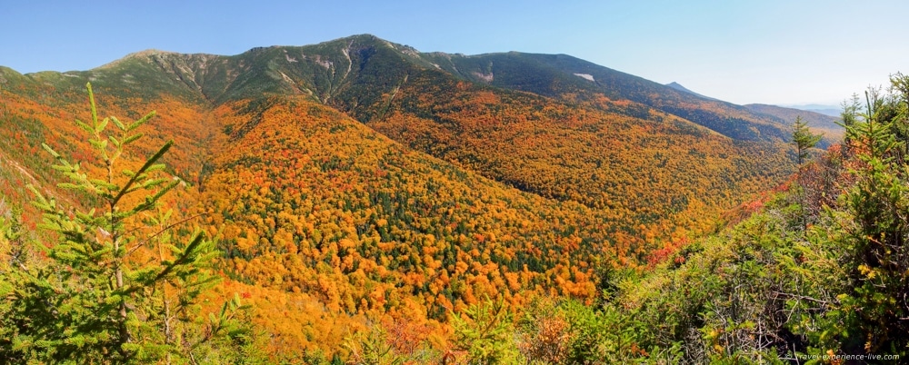
Panoramic view of Walker Ravine and the Franconia Ridge
The total distance of the Franconia Ridge Loop is 8.9 miles (14 km) and we completed it in five hours and twenty minutes. It was by far the longest hike we’ve done, but it was also the best one so far.
This Franconia Ridge Loop Trail to the summit of Mount Lafayette was better even than the Precipice Trail up Champlain Mountain and the loop to the summit of Mount Mansfield.
The weather was superb and the scenery absolutely beautiful.