After our hike to the summits of Mount Webster and Mount Jackson, we spent the night in a motel in North Conway. The next day, we’d planned to bag two more 4,000-footers, Mount Osceola and East Osceola. After arriving at the trailhead and getting our backpacks ready, we noticed that my rain jacket was missing. So, we were forced to retrace our route along the Kancamagus highway and to drive back to North Conway to check with the motel we stayed at if they’d found it. The answer we got was negative.
We had to rethink our plans for the day at that point, as by then it was already noon. We consulted our detailed waterproof White Mountains trail map and picked the nearest interesting-looking trail to North Conway. This was the Moat Mountain Trail, leading up and over South Moat Mountain and Middle Moat Mountain toward North Moat Mountain.
Caroline and I hiked to the summits of two of them, South Moat and Middle Moat.
Hiking the Moat Mountain Trail
The Moat Mountain Trail starts off Passaconaway Road, a side road of West Side Road that connects the town of Conway with Echo Lake in North Conway. Passaconaway Road parallels the Swift River for a while before joining the Kancamagus Highway just across the gorgeous Albany Covered Bridge. The trailhead can therefore also be reached directly from the Kancamagus Highway.
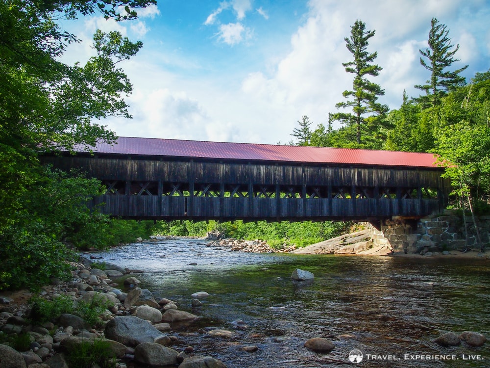
Covered bridge in Albany, New Hampshire
There’s a fairly large parking lot with information boards and plenty of space to park your car.
The Moat Mountain Trail runs across a logging site for a couple hundred yards (meters)—watch out for trucks when hiking on weekdays!—before entering a dense wood of deciduous trees. The first mile (1.6 kilometers), it winds gently through the trees with an easy grade.
It then begins to climb rather abruptly and the grade increases with every couple hundred yards or so. After about a mile and a half (2.4 kilometers), the first views start to appear through the trees.
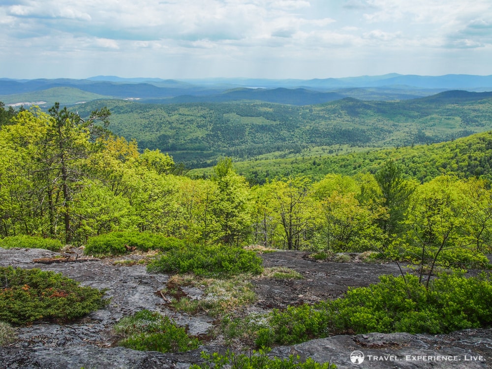
First view from South Moat Mountain
The trail keeps on going up and up and up, seemingly endlessly, until the trees open up completely and reveal what can only be described as a breathtaking southward view of the Swift River Valley and beyond. On this granite plateau, covered with spring flowers and dotted with small shrubs, this fabulous 180-degree panorama deserves to be enjoyed during a snack break. Which is exactly what we did.
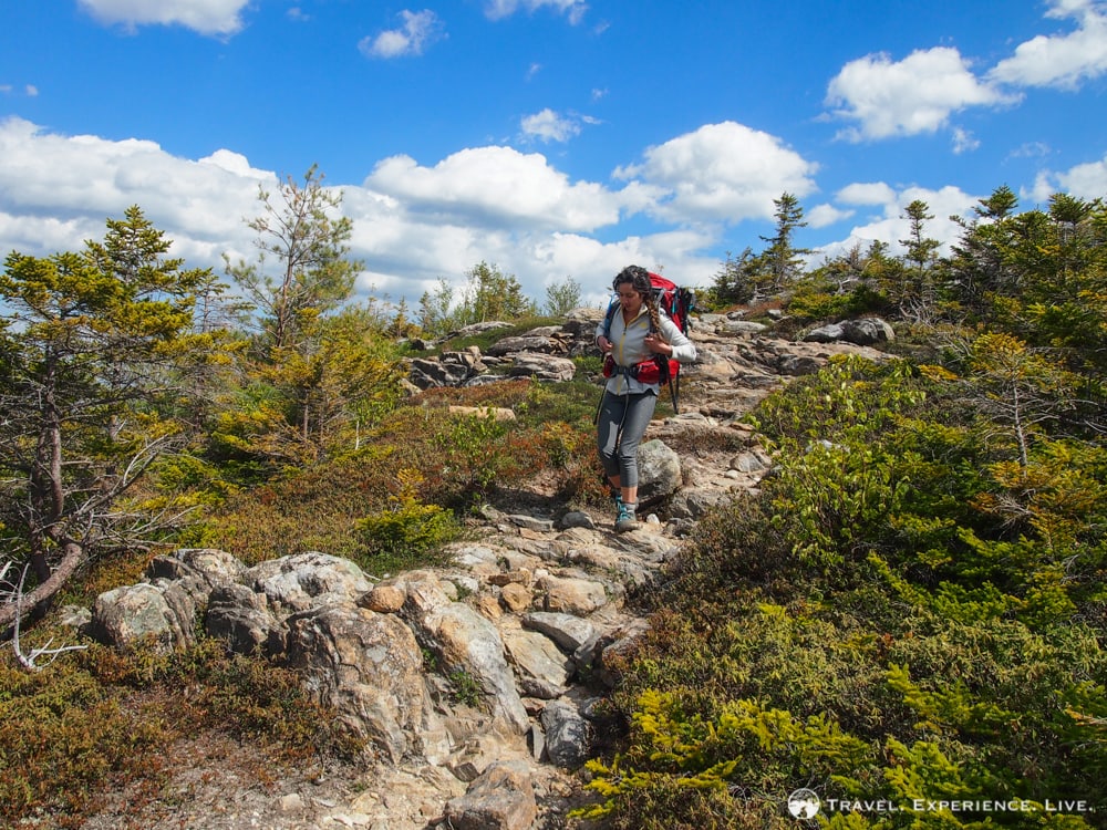
From there, the trail entered the woods again and continued on climbing. There are a couple of false summits on the way, which caused us to feel relieved to have completed this strenuous climb before we realized that the trail still hadn’t ended.
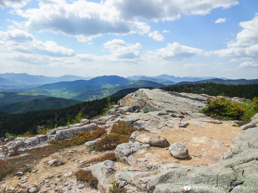
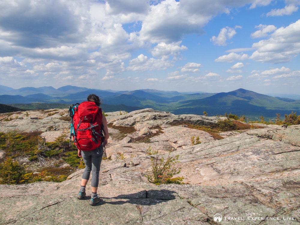
Once we got to the summit, however, after 2.7 miles (4.3 kilometers), all we experienced was awe. The summit is nothing but bare rock, while protruding ledges offer spectacular viewpoints—and great places to pose for a photo.
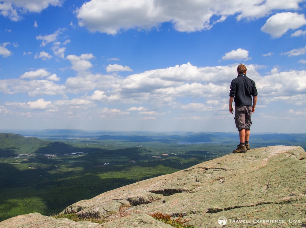
Bram standing on a ledge on South Moat Mountain
Incredible views from South Moat Mountain’s summit
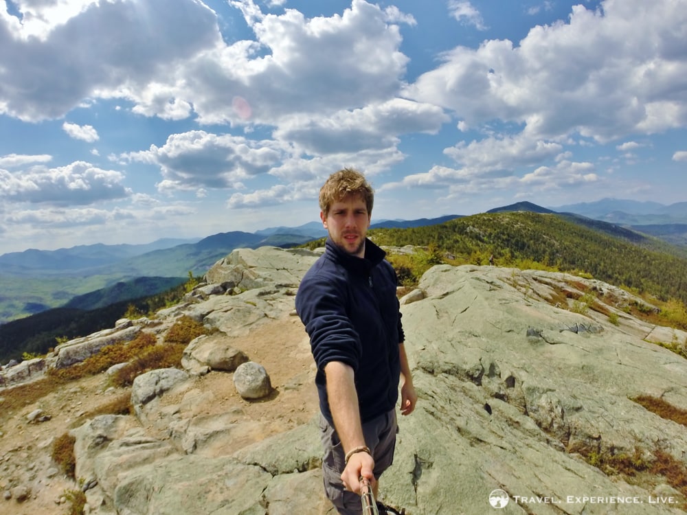
Selfie on South Moat Mountain
At 2,749 feet (838 meters), South Moat Mountain is not the highest of mountains. Yet, it does offer some of the most incredible views I’ve ever seen. 360-degree panoramic views took in everything from Mount Washington as a faraway landmark to the north, to the town of North Conway below in the valley to the east, and the rest of the White Mountains wilderness in all other directions. Due to the steep grade of most of the trail, this 2.7-mile hike took us more about two hours, including rest breaks.
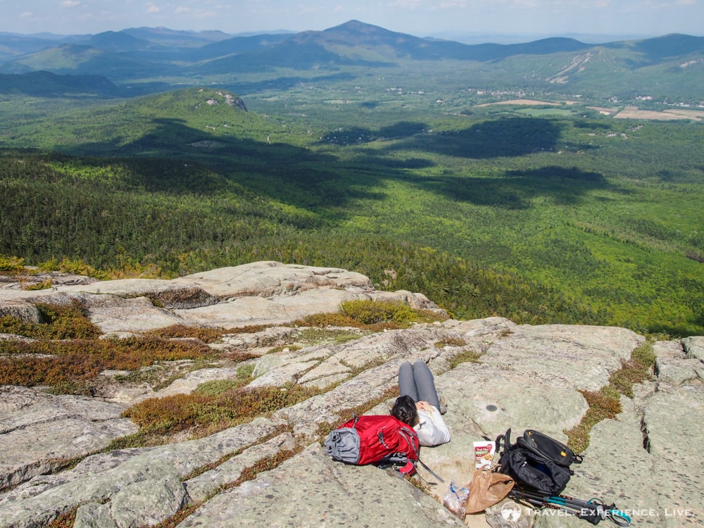
Caroline enjoying a well-earned rest on South Moat Mountain
Summit of South Moat Mountain
Exploring the summit of South Moat Mountain
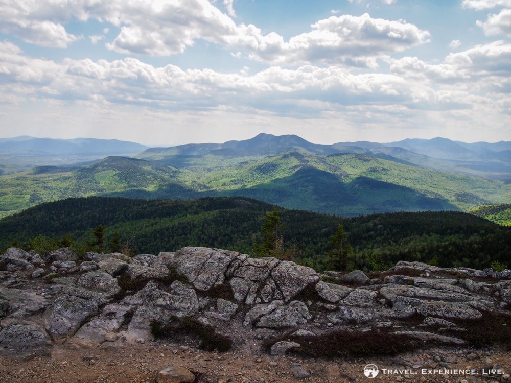
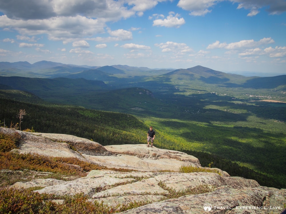
After a long rest at the summit of South Moat Mountain, we decided to continue on toward Middle Moat Mountain, located only 0.6 miles (1 kilometer) further north. This section ran down the saddle between the two summits, gently, and offered fine views of both mountains.
Middle Moat Mountain’s 2,805-foot (855-meter) summit was less impressive than South Moat’s, although the views weren’t bad in any case. We didn’t spend much time there, though, and turned around almost immediately.
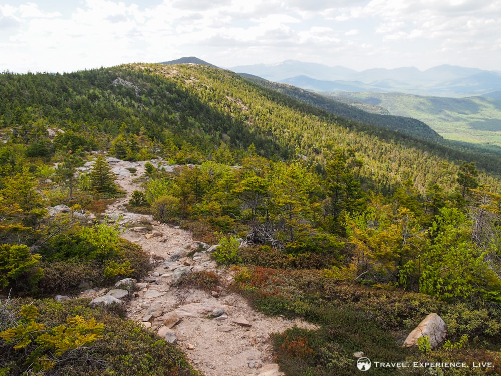
The Moat Mountain Trail toward Middle Moat Mountain
Caroline taking in the views from Middle Moat Mountain
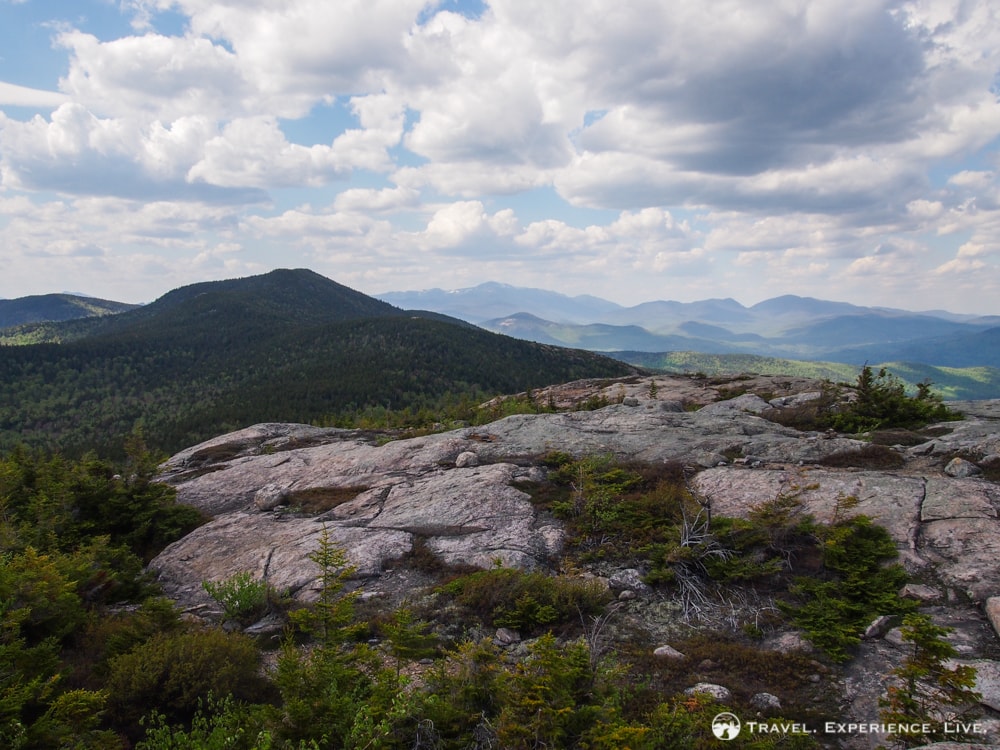
View from the summit of Middle Moat Mountain
On the way back toward South Moat Mountain, Caroline was walking just a few steps in front of me when a snake swirled its way across the trail between our respective feet. She didn’t see it at first, but my startled scream made her turn around quickly. Not expecting to almost step on a snake threw us off balance and we watched every step carefully on the way down—later, I learned that it had been an eastern milk snake, which is completely harmless.
This is where we almost stepped on a snake
The descent was steep and exhausting, and seemed much longer than the ascent had been. Drained and relieved, we arrived back at our car after a five-hour and 6.6-mile (10.6-kilometer) roundtrip.
It had been a surprisingly spectacular hike, but also a quite strenuous and challenging one. It’s that aspect of unexpected challenge that made the phenomenal views from the summit(s) even more rewarding.
Hiking to South Moat Mountain is absolutely and strongly recommended if you’re ever in the area. Taking in Middle Moat Mountain is a nice extension of that hike, but only really necessary if you want to add another mountain summit to your list (which, honestly, was my main motivation).
A Few Panoramas (Click to Enlarge)
-
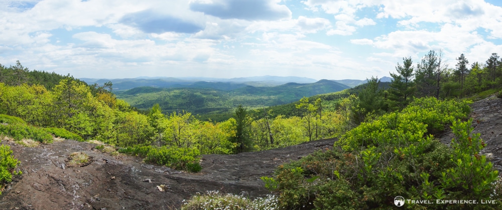
- Panorama of the Swift River Valley
-
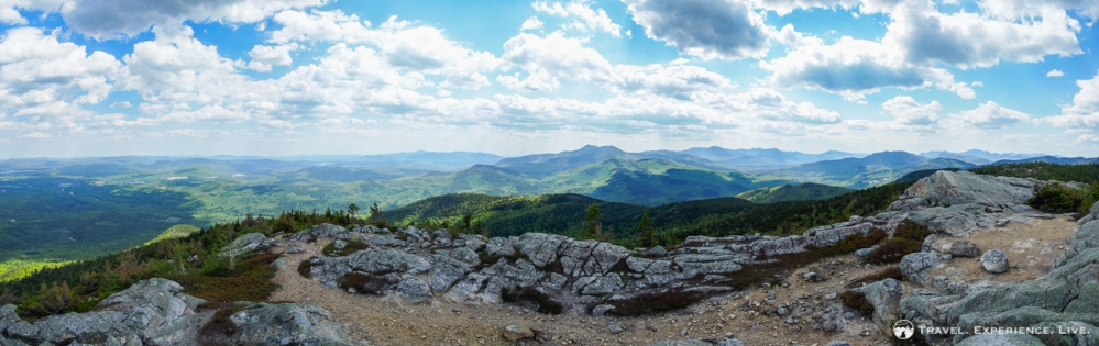
- Spectacular view from South Moat Mountain
-
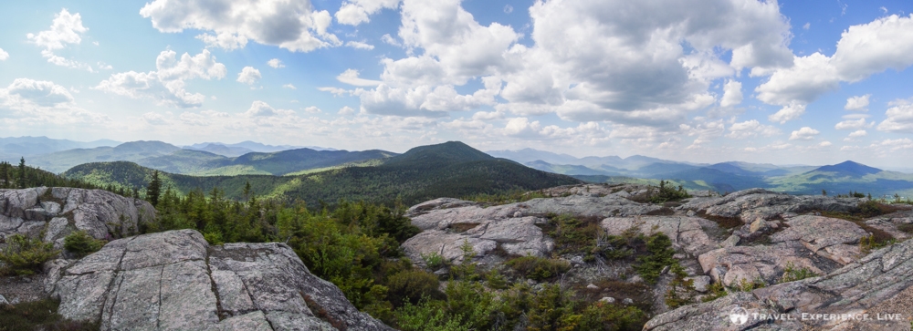
- Panoramic view of Middle Moat Mountain from South Moat Mountain
-
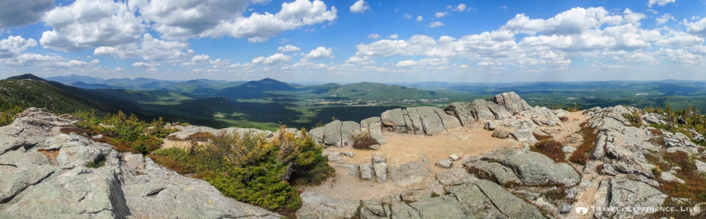
- 360-degree views from the summit of South Moat Mountain
A Video (If you’re reading this via email, click here to watch it)
https://www.youtube.com/watch?v=JJNLanlLBRA