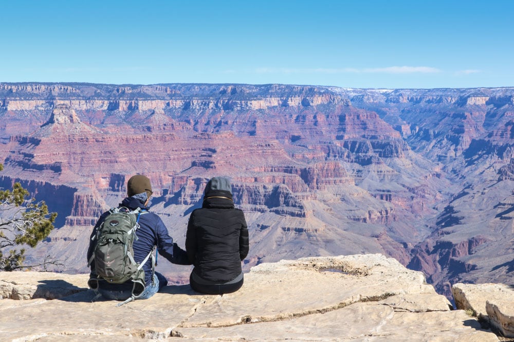
Nothing can prepare you for your first view of the Grand Canyon. No matter how many pictures you’ve seen or documentaries you’ve watched, the immense scale of this place needs to be seen in 3D, not on paper or a screen.
On our two-day visit, Caroline and I did two hikes in Grand Canyon National Park. It’s those two that, I think, you should focus on if you’re looking to do some serious hiking, but only have two days in the park.
This best Grand Canyon National Park hikes contains affiliate links. You can read more about our Terms of Use / Disclosure here.
Contents
Impressive Stats
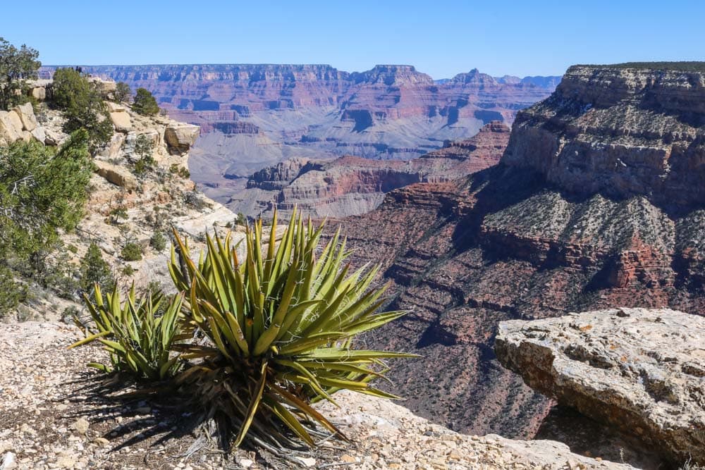
The Grand Canyon overwhelms everyone. I can’t imagine anyone not being impressed by it. It’s spectacular, its dimensions are mindboggling. Really, it’s almost impossible to grasp the sheer size of this thing.
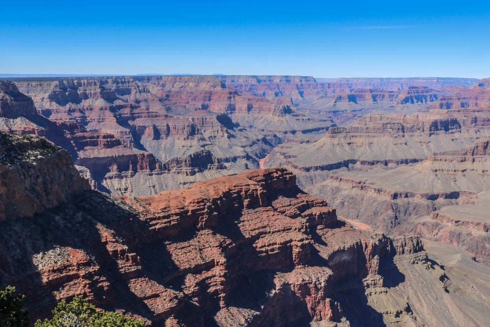
This is a canyon that’s 277 river miles (446 kilometers) long, 18 miles (29 kilometers) wide at its widest point, and a mile (1.6 kilometers) deep.
It’s the obvious centerpiece of Grand Canyon National Park, which encompasses a section of the Colorado River and both the North and South Rims. Often considered to be one of the Wonders of the World, Grand Canyon National Park is also a UNESCO World Heritage Site, which indicates its significance to the world and humankind.
Almost six million people visit the park each year, making it the second most-visited of all national parks in America. Only Great Smoky Mountains National Park in North Carolina and Tennessee receives more annual visitors.
Two Best Day Hikes in Grand Canyon National Park South Rim
The only way to really experience the Grand Canyon is hiking. There’s really no other way to fully grasp the scale of this place. You can only truly appreciate and respect this monument of nature if you’ve spent a few hours laboring your way back to the South Rim on a steep dirt trail.
If you have two days to spend on the South Rim, I recommend you do the following two day hikes in Grand Canyon National Park.
Both hikes, if done completely, are quite long. Starting early in the morning is always a good idea. Note, though, that you can make both hikes as long as you want.
Rim Trail
The first hike you should do, the Rim Trail, is the best introduction to the Grand Canyon you can imagine. This is basically the only one of all the long hikes in Grand Canyon National Park that everyone can do.
As its name implies, it runs along the South Rim from the South Kaibab Trailhead westward to Hermits Rest. Many people, however, begin this hike at Mather Point, which is probably the most popular viewpoint in the entire park.
Located in Grand Canyon Village, just behind the visitor center, this is where the vast majority of visitors see the canyon for the first time.
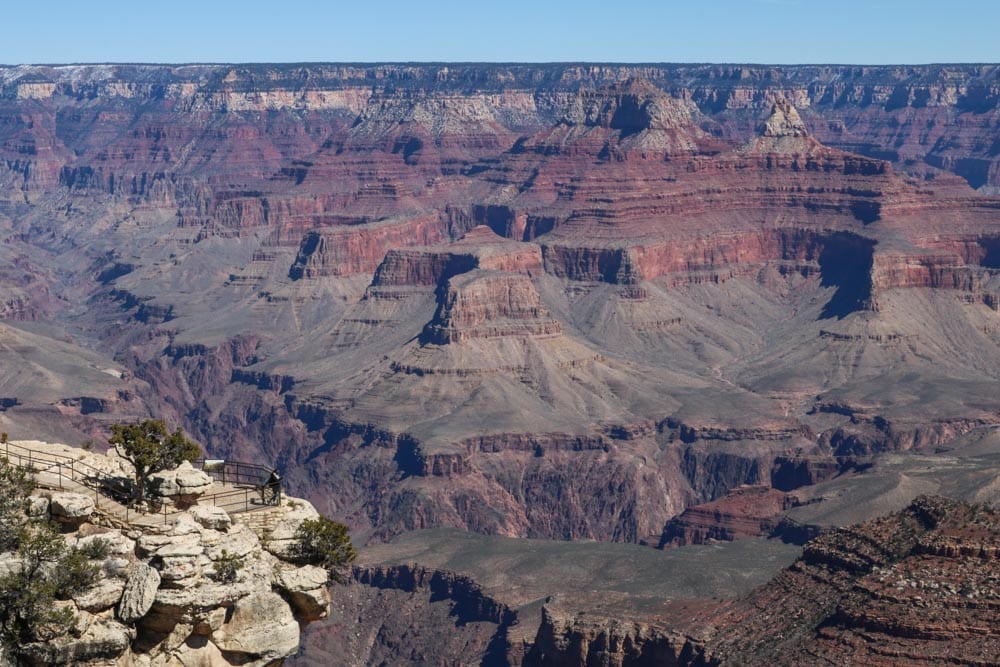
The full length of this trail is 13 miles (21 kilometers) and you’ll hike past several amazing Grand Canyon viewpoints. I personally liked Yavapai Point, Hopi Point, and Mohave Point best.
Of course you’re encouraged to hike the whole trail, but it’s also good to know that you can make your hike as long as you choose. A shuttle bus runs along Hermit Road, which parallels the trail, so you can catch a ride back whenever you want.
If you do hike the entire trail, you can hop on the bus at Hermits Rest, eliminating the need to retrace your steps all the way back.
Most of this trail is paved and shaded. It’s virtually flat, making it a super-easy scenic hike for all ages and abilities. There is no water or food available on the trail, though, so make sure to bring plenty of both.
- Difficulty: Easy
- Distance: 13 miles (21 kilometers) one way
- Duration: 1 to 6 hours, depending on how far you hike
- More Information: National Park Service – Rim Trail
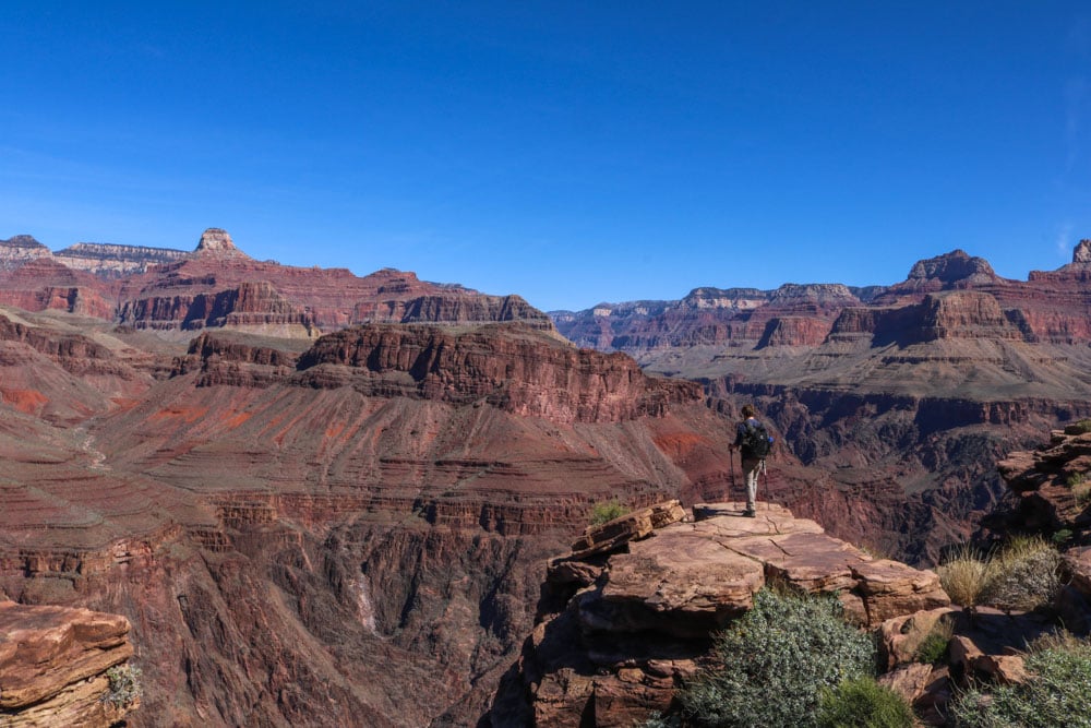
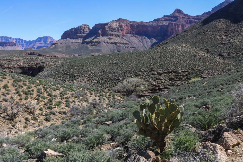
Bright Angel Trail to Plateau Point
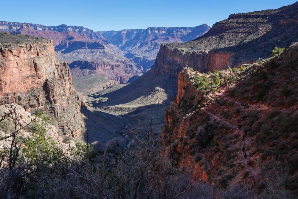
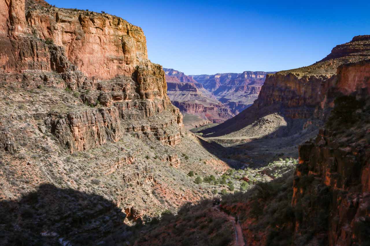
This is one of the most popular hikes in Grand Canyon National Park. In fact, it’s one of the best—if not the best—day hikes I’ve ever done, anywhere. It’s a phenomenal hike, both challenging and rewarding.
The Bright Angel Trail is the trail that puts the size of the Grand Canyon into perspective. It’s the hike that’ll show you what this place is really all about.
A well-maintained dirt trail, its trailhead lies just west of the Bright Angel Lodge. The Rim Trail passes it, too. Look for the mule corral, this is where the descent into the Grand Canyon starts.
The Bright Angel Trail’s countless switchbacks take you down the upper canyon cliffs. That first section is pretty steep—remember that for the way back up—but the trail does flatten out a bit once you’re on the lower plateau.
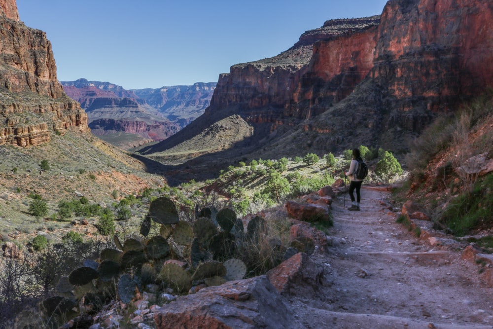
Many people hike this trail to Indian Garden, which has a campground, water and another mule corral. This is where mule excursions turn back.
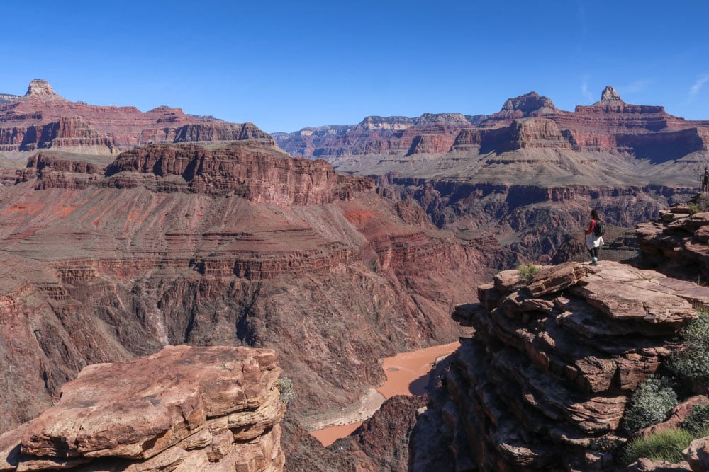
Plateau Point isn’t actually a part of the Bright Angel Trail. It’s accessed on a side trail that splits off to the left from the Bright Angel Trail in Indian Garden. The Bright Angel Trail continues down into the canyon all the way to the Colorado River.
Because it’s not recommended to hike down to the river and back up in one day, I suggest that you hike to Plateau Point instead. This is a doable day hike for in-shape hikers.
The one-way distance of this epic hike is 6 miles (9.7 kilometers). There are resthouses after every 1.5 miles (2.4 kilometers)—1.5 Mile Resthouse, 3 Mile Resthouse and Indian Garden. Note that Indian Garden has potable water year-round, but that water is available at the resthouses only seasonally. I advise you to bring plenty of water anyway.
Remember that the hardest part of this trail is the ascent back to the South Rim. Don’t misjudge the trail’s difficulty and your own ability on the relatively easy descent. It takes twice as long to hike back up than it does to get down.
Also be aware that the Bright Angel Trail is a popular trail for mule rides. You will most likely see mules while hiking down or up. Be careful, let them pass and don’t disturb or scare them.
- Difficulty: Strenuous
- Distance: 12 miles (19.3 kilometers)
- Duration: 5 to 8 hours, depending on your fitness level
- More Information: National Park Service – Bright Angel Trail
Watch the Weather, Remember the Elevation
The average altitude of the South Rim of the Grand Canyon is about 6,800 feet (more than 2,000 meters). Don’t forget that when you’re visiting and doing these hikes.
Drink plenty of water on both of these hikes in Grand Canyon National Park, even if you don’t feel thirsty. Thinner air causes you to lose more water through breathing. Your heart rate increases and you breathe faster and deeper in order to get more oxygen in your blood.
This is especially important to remember when hiking the Rim Trail. As an easy trail, you may assume you don’t need to drink a lot because you won’t sweat profusely. That would be a mistake. Bring plenty of water and drink a lot of it.
On the Bright Angel Trail, you’ll actually go down 2,968 feet (905 meters)—providing quite a challenge on the way back—so the air will get thicker and you’ll lose less fluids that way.
However, it will also get warmer as you descend into the canyon. You’ll definitely lose a bunch of water through respiration on the ascent, so top off your water bottle(s) in Indian Garden.
Please be conscious of the weather conditions and climate in the canyon, on the trail and on the rim. Obviously, you shouldn’t go for a hike if the weather forecast talks about approaching inclement weather. Thunderstorms, rainfall, snowfall and high winds are all signs you better stay inside.
In summer, it’s a really bad idea to hike too deep into the canyon. It’s scorching hot down there, even if it’s chilly on the South Rim. Don’t be fooled by that. Be smart and be informed.
Be aware that the Bright Angel Trail is one of the the most dangerous hiking trails in the entire United States. Of the more than 200 rescue operations they have to do in Grand Canyon National Park each, the majority is on this trail.
In fact, the best time of year to visit Grand Canyon National Park is spring. With a dusting of snow still on the rim, but very comfortable temperatures down in the canyon, it’s the ideal time of year for a long canyon hike.
Here’s a great book about the dangers of venturing into the Grand Canyon.
I hiked the Bright Angel Trail in early March, when there was still snow on the rim. When I started the hike just after sunrise, it was literally freezing.
Down at Indian Garden, however, the temperature was so high that I found myself hiking in shorts and t-shirt and still sweating. And that was March. I can’t imagine the heat in July or August.
It’s Big But Not the Biggest
You may be surprised that the Grand Canyon is neither the deepest nor the longest canyon in the world. It’s not even the deepest in the United States.
In fact, there are numerous canyons on Planet Earth that are deeper, longer or both than the Grand Canyon. Some of the canyons in the Himalayas, for example, dwarf the Grand Canyon in terms of depth.
When it comes to volume, however, the Grand Canyon is definitely among the world’s largest canyons. It’s mainly its accessibility that makes this arguably the most popular and well-known canyon on earth.
Getting to Grand Canyon National Park
Being one of the Colorado Plateau national parks, getting to Grand Canyon National Park is extremely easy.
Located in northwestern Arizona, near the Utah-Arizona and Nevada-Arizona borders, its nearest major cities are Flagstaff and Phoenix, Arizona and Las Vegas, Nevada, which happens to be a fantastic base for Southwest national parks road trips.
If you’re traveling independently, which you should, it’s a pretty easy drive from both cities. In fact, Grand Canyon National Park is a popular detour from Old Route 66, America’s most famous historic road.
Another great place to visit along Route 66 in Arizona, by the way, is Petrified Forest National Park, situated a relatively short drive east from Grand Canyon National Park.
As this post is about two hikes in Grand Canyon National Park on the South Rim, I won’t get into how to get to the North Rim. Getting to the South Rim is pretty straightforward. This park is one of the absolute highlights on an Arizona national parks road trip, after all.
Basically, you simply follow Interstate 40, a part of which now parallels Old Route 66, until the exit to Highway 64, which runs directly north to Grand Canyon Village. The drive from I-40 to Grand Canyon Village, the tourist hub on the South Rim, takes about an hour and a half.
Additionally, the South Rim also has its own airport with commercial flights to and from Flagstaff, Phoenix and Las Vegas. This is also where scenic plane and helicopter rides over the canyon depart.
The Grand Canyon is accessible by train as well, which I can imagine is an experience that’s quite memorable.
More National Park Trails to Explore
- Acadia National Park Hikes
- Bryce Canyon National Park Hikes
- Capitol Reef National Park Hikes
- Haleakala National Park Hikes
- Joshua Tree National Park Hikes
- Shenandoah National Park Hikes
- Zion National Park Hikes