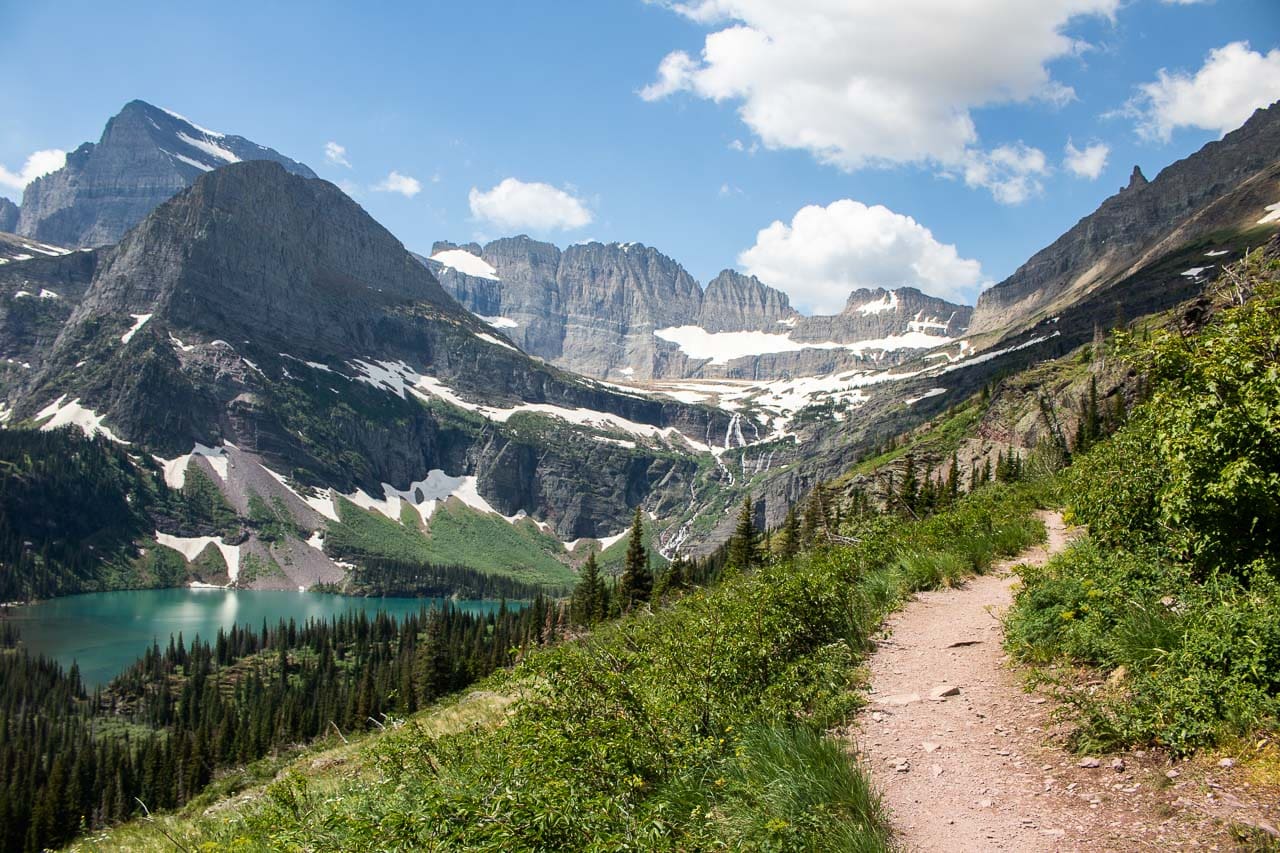
Known as the “Crown of the Continent”, Montana’s Glacier National Park is one of the most spectacular national parks in America. An elaborate network of day hiking trails in Glacier National Park allows you to explore these spectacular landscapes.
More than 700 miles of hiking trails run through Glacier National Park, taking hikers to glorious alpine lakes, stunning meadows, sharp ridges and steep mountain passes.
In this mountainous and lake-filled park in the northern Rocky Mountains, a variety of ecosystems meet, while its rivers flow to three different directions: the Pacific Ocean, Gulf of Mexico and Hudson Bay.
Blessed with an abundance of natural beauty and a wealth of cultural history, Glacier National Park is truly a hiker’s paradise.
In this post, you’ll find the best hikes in Glacier National Park. Whether you’re hiking in Glacier National Park’s west side (Lake McDonald), east side (Many Glacier, St. Mary and Two Medicine) or along the epic Going-to-the-Sun Road, you can enjoy beautiful scenery and wildlife viewing opportunities anywhere.
Contents
- 13 Best Day Hikes in Glacier National Park
- Johns Lake Loop Trail
- Trail of the Cedars
- Avalanche Lake Trail
- Highline Trail
- Hidden Lake Overlook Trail
- Siyeh Pass Trail
- St. Mary and Virginia Falls Trail
- Swiftcurrent Nature Trail
- Lake Josephine and Grinnell Lake Trail
- Grinnell Glacier Trail
- Fishercap Lake and Redrock Falls Trail
- Iceberg Lake Trail
- Cracker Lake Trail
- Staying Safe While Hiking in Glacier National Park
- More About Glacier National Park
- Glacier National Park Hiking Essentials
- Wildlife Safety in Glacier National Park
13 Best Day Hikes in Glacier National Park
This post about the best day hikes in Glacier National Park contains affiliate links. You can read more about our Terms of Use / Disclosure here.
I’ve listed these awesome Glacier National Park hikes from west to east, roughly from the Lake McDonald area, across Logan Pass, to St. Mary and Many Glacier.
Note: Since I haven’t personally done any hikes in Glacier’s Two Medicine area, I haven’t included those trails in this post. (I’ll add them once I’ve explored the area myself.)
Johns Lake Loop Trail
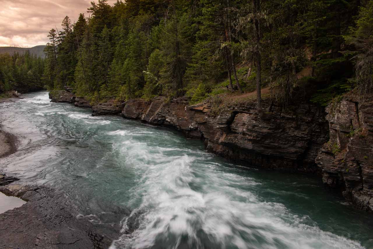
Starting just north of Lake McDonald, the Johns Lake Loop is a great introduction to the verdant forests of Glacier’s west side. The trailhead is just over a mile north of Lake McDonald Lodge on the Going-to-the-Sun Road.
You can either go for a quick 1.8-mile circuit around this tiny lake or, the option I personally recommend, opt for the longer loop around the area.
Explore a dense old-growth forest of hemlocks and red cedars, occasionally catching a glimpse of Johns Lake. Keep an eye out for moose as you walk along the lakeshore.
The loop continues on the other side of the Going-to-the-Sun Road, where you’ll cross scenic McDonald Creek and hike past beautifully photogenic spots like the Sacred Dancing Cascades and McDonald Falls.
- Area: Lake McDonald (Going-to-the-Sun Road, West Side)
- Trailhead: Johns Lake Trailhead, 1.3 miles north of Lake McDonald Lodge
- Distance: 1.8 – 3 miles (loop)
- Difficulty: easy
- Elevation gain: –
Trail of the Cedars
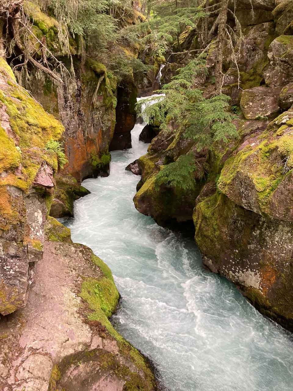
One of the most popular easy hikes in Glacier National Park, the Trail of the Cedars starts at the extremely busy Avalanche Picnic Area. Make sure to get here as early in the morning as you can to find a parking spot.
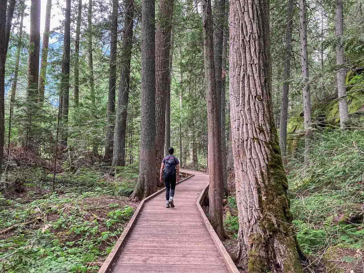
A wonderful loop, this trail is mainly a boardwalk, which is wheelchair-accessible, that runs through a beautiful rain forest reminiscent of the Pacific Northwest.
There’s no elevation gain to speak of, making this a fantastic option for people with different abilities or less desire to take on the challenging Glacier National Park hiking trails.
As you stroll through a forest of towering 500-year-old red cedars, black cottonwoods and hemlocks, listen to the song of birds and take in the wonderful woodland scents.
The Trail of the Cedars also crosses two bridges across Avalanche Creek, which is especially stunning at Avalanche Gorge.
Although very short and super-easy, this is one of the top hikes in Glacier National Park, giving you the chance to immerse yourself in Glacier’s lush west side forests.
You can also combine the Trail of the Cedars with the excellent Avalanche Lake Trail (see below) for a longer hike.
- Area: Lake McDonald (Going-to-the-Sun Road, West Side)
- Trailhead: Avalanche Picnic Area
- Distance: 0.7 miles (loop)
- Difficulty: easy
- Elevation gain: –
Avalanche Lake Trail
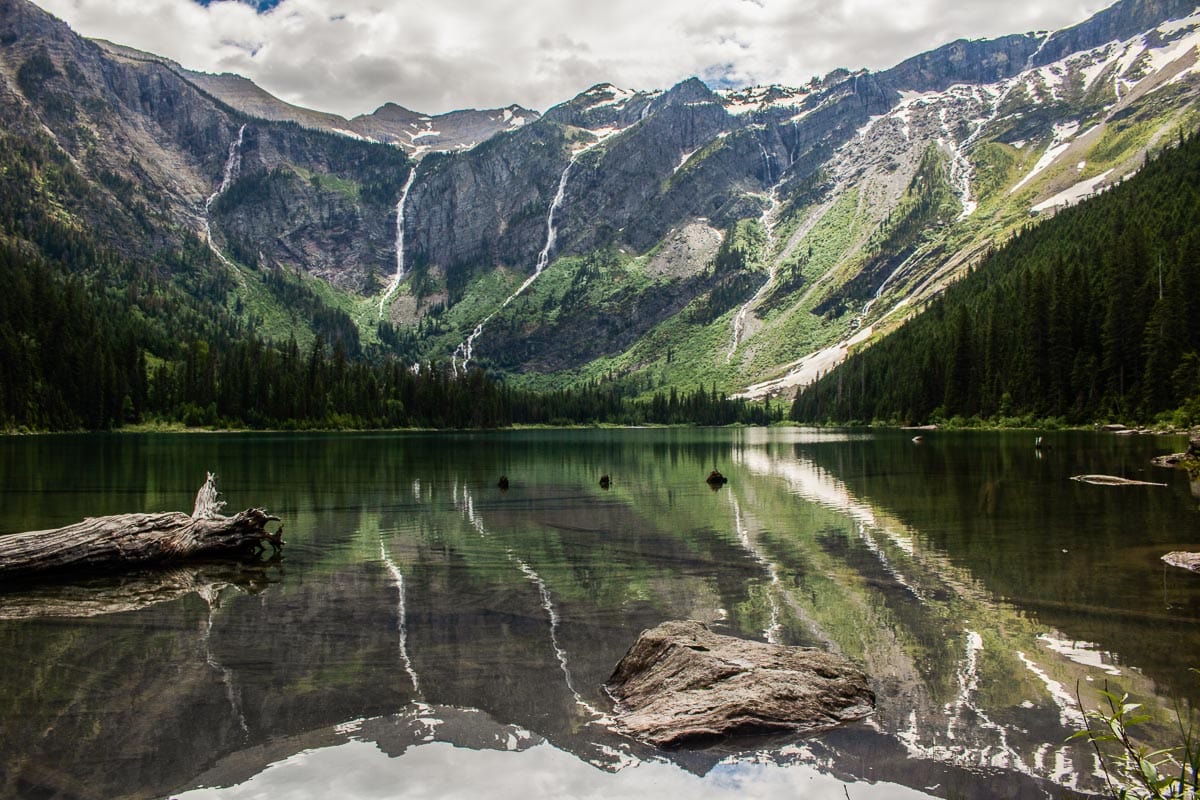
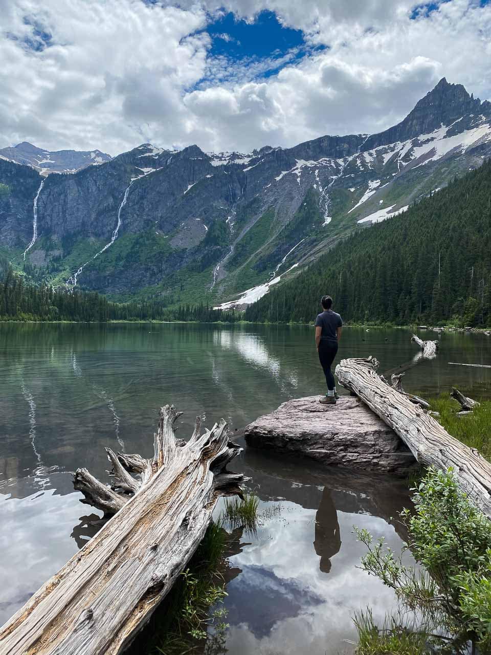
If you’re looking for a moderate hike in Glacier National Park’s west side, few trails are better—or busier—than the Avalanche Lake Trail.
This hike starts about halfway around the Trail of the Cedars, where the trail shortly but steeply climbs to the top of Avalanche Gorge.
Then, you’ll hike through thick woods, every now and then catching a glimpse of towering glacier-carved walls just to your left.
The trail ends at glorious Avalanche Lake, backed by a cirque with sheer cliffs and lined with waterfalls.
Several benches are set up along the lakeshore, ideal for enjoying a picnic lunch or just admiring this extraordinary landscape. Alternatively, you can also continue hiking to the far end of the lake, which is much less crowded.
- Area: Lake McDonald (Going-to-the-Sun Road, West Side)
- Trailhead: Avalanche Picnic Area
- Distance: 4.6 miles (out and back)
- Difficulty: Moderate
- Elevation gain: 500 feet
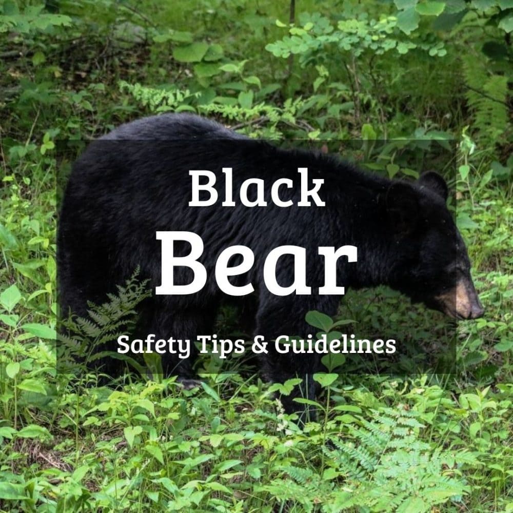
Note: The Avalanche Lake Trail in Glacier National Park is often posted for bears frequenting. We saw a black bear just off the trail near the lake. Remember to make noise while hiking, especially in areas with less visibility, such as woods and dense bushes, even if the trail is crowded with other hikers.
Highline Trail
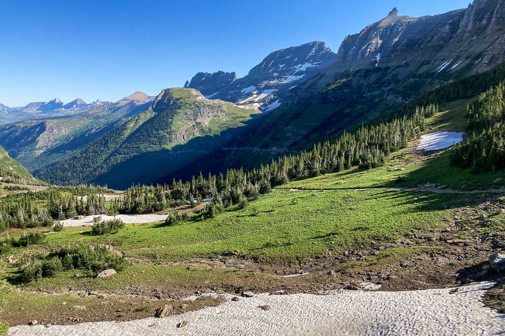
Considered by many to be the crown jewel of the park’s trail system, the Highline Trail in Glacier National Park is one of the greatest day hikes in America.
Completing the entire hike, however, requires a more-than-basic fitness level, no fear of heights and a full day. The hike from Logan Pass to Granite Park Chalet and back is more than 15 miles.
Alternatively, you can also hike from Logan Pass to The Loop and catch a shuttle bus back to your starting point, a 11.8-mile point-to-point hike.
Along the entire Highline Trail, from the famous Garden Wall to Haystack Saddle and Bear Valley, you get to enjoy spectacular mountain views.
Easily one of the best Glacier National Park hikes, this is a full-day adventure in the heart of the park, made even longer in duration by the endless photo opportunities. Just try not to stop every 100 yards to take a photo!
Because of its high elevation, the Highline Trail is often closed until early-July due to dangerous, steep snow-covered sections. Once it opens, though, it immediately becomes one of the busiest hiking trails in Glacier National Park.
Get to Logan Pass before 7.30 am, at the very latest, or you won’t find a parking spot.
- Area: Logan Pass (Going-to-the-Sun Road)
- Trailhead: Logan Pass, across the road from the Continental Divide sign
- Distance: 11.8 miles (point to point) or 15.2 miles (out and back to Granite Park Chalet)
- Difficulty: Strenuous
- Elevation gain: 800 feet
Hidden Lake Overlook Trail
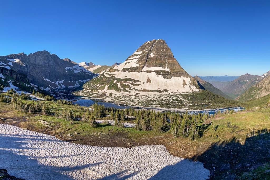
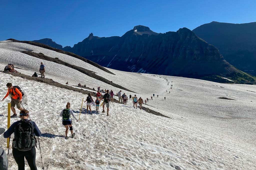
Often (partially) snow covered and marked by poles well into July, the Hidden Lake Overlook is an amazing hike. It is also very, very crowded, though, so it’s best done right after sunrise or just before sunset, which are also the best times for photography.
The trailhead is directly behind the Logan Pass Visitor Center. A boardwalk leads the way during the first half of the hike, protecting the fragile alpine meadows below. Stay on it!
As the trail climbs to the Hidden Lake Overlook, you can enjoy panoramic views of Logan Pass and see ancient rock layers in the cliffs of Clements Mountain to your right.
The upper section of the trail features small waterfalls and reflective moraines, as well as excellent opportunities to see mountain goats and bighorn sheep.
The Hidden Lake Overlook Trail also runs straight through prime grizzly bear habitat. It’s one of the top Glacier National Park wildlife watching locations.
From the platform at Hidden Lake Overlook, one of Glacier National Park’s most iconic views sprawls before you: Hidden Lake backed by striking Bearhat Mountain.
- Area: Logan Pass (Going-to-the-Sun Road)
- Trailhead: Logan Pass, behind the Visitor Center
- Distance: 2.8 miles (out and back)
- Difficulty: Moderate
- Elevation gain: 460 feet
Siyeh Pass Trail
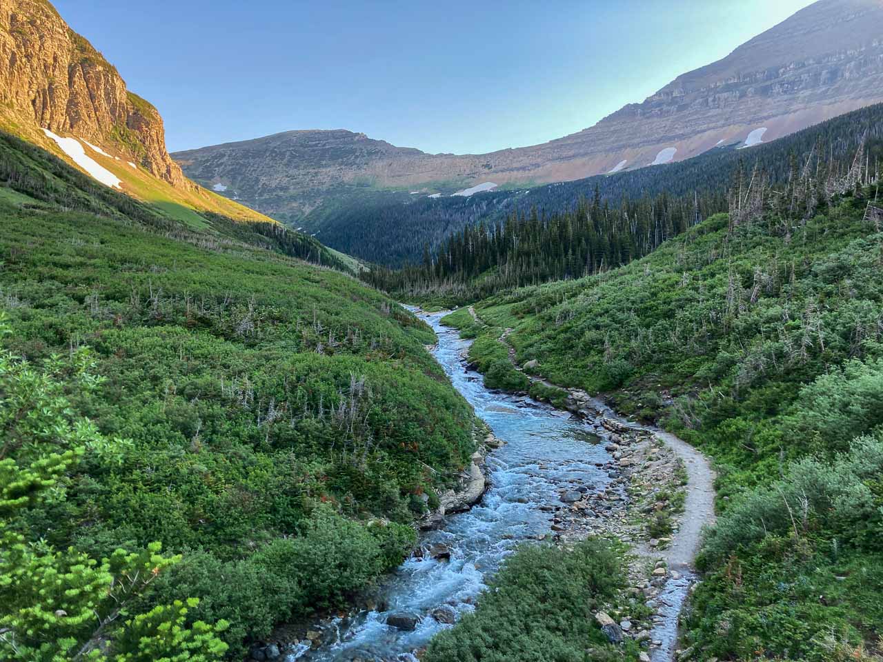
The Siyeh Pass Trail is one of Glacier’s most spectacular day hikes, climbing from the Going-to-the-Sun Road to a breathtaking mountain pass with views of some of the park’s shrinking glaciers.
From Siyeh Bend, the trail ascends through subalpine woods and pockets of meadows. After about 2 miles, you’ll arrive at an area filled with all kinds of wildflowers, flanked by peaks, known as Preston Park.
This is one of the most beautiful wildflower areas in Glacier National Park, but it’s also popular among bears. Be bear aware, make noise and carry bear spray.
Switchbacks then transport you above the tree line to a saddle, which is Siyeh Pass. Another series of bends continue above the pass, offering awesome views, before the trail descends to Sunrift Gorge on the Going-to-the-Sun Road.
You can either retrace your steps to Siyeh Bend for an out-and-back hike or head down to Sunrift Gorge for a point-to-point hike. If you choose the latter option, take the shuttle bus back to your original starting point.
- Area: between Logan Pass and St. Mary Lake (Going-to-the-Sun Road)
- Trailhead: Piegan/Siyeh Pass Trailhead at Siyeh Bend
- Distance: 9.2 miles (out and back) or 10.1 miles (point to point)
- Difficulty: Strenuous
- Elevation gain: 2,240 feet
St. Mary and Virginia Falls Trail
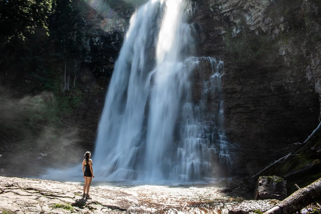
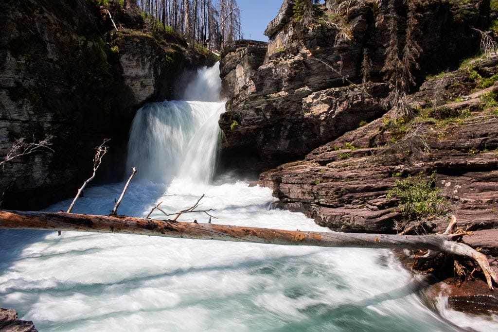
There are few day hikes in Glacier National Park that lead to waterfalls and none are as great as the St. Mary and Virginia Falls Trail.
Depending on where you start this hike near the head of St. Mary Lake, distances vary. I’ll describe the shortest option below.
The most direct routes to St. Mary Falls and Virginia Falls start at the St. Mary Falls Shuttle Stop or Trailhead on the Going-to-the-Sun Road.
The total distance from these starting points is respectively 3.2 and 3.6 miles. (Other places where you can start this hike are Sunrift Gorge and Sun Point, both of which add several miles to its total distance.)
From either the shuttle stop or trailhead, this extremely popular Glacier National Park trail first descends for about 1 mile toward St. Mary Falls, a picturesque multi-tiered waterfall in a small gorge. On a hot summer’s day, you’ll certainly relish the cooler temperatures at the falls.
Cross the wooden bridge across the stream and climb about 0.7 miles to beautiful Virginia Falls. This large and wide waterfall makes for a great picnic spot. Often windy, there’s a constant spray of droplets coming from the waterfall, a welcome way to cool off when it’s hot.
- Area: St. Mary Lake (Going-to-the-Sun Road, East Side)
- Trailhead: St. Mary Falls Trailhead or Shuttle Stop
- Distance: 3.2 – 3.6 miles (out and back)
- Difficulty: Moderate
- Elevation gain: 260 feet loss, then 285 feet gain
Swiftcurrent Nature Trail
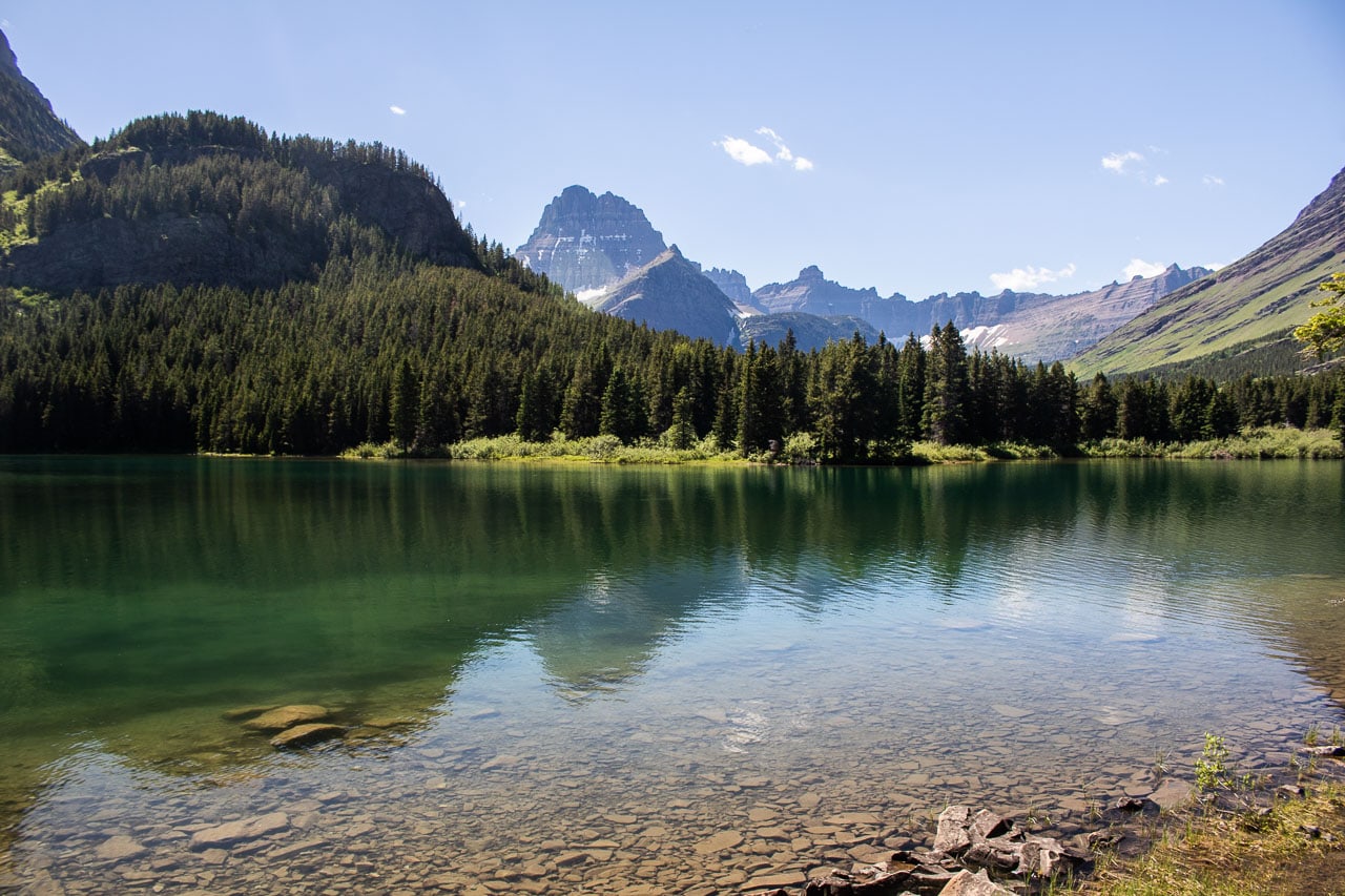
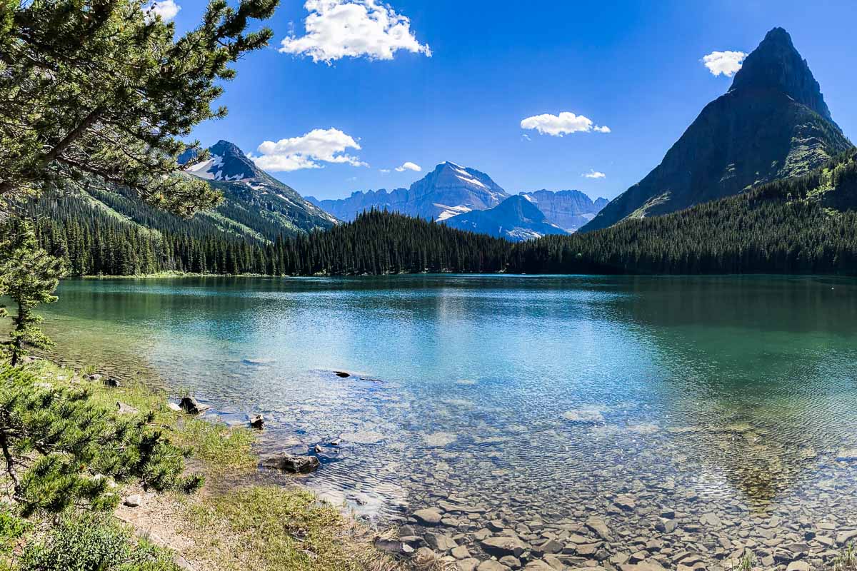
Partly wheelchair-accessible, the scenic Swiftcurrent Nature Trail is an easy 2.3-mile circuit around beautiful Swiftcurrent Lake in Many Glacier. It’s both among the easiest and most photogenic of Glacier National Park trails.
You can start this hike—it’s more of a stroll, really—at the Swiftcurrent Picnic Area or Many Glacier Hotel.
While walking along the lakeshore, watch people kayaking and canoeing, keep your eyes out for moose, and enjoy superb views of the iconic Many Glacier Hotel, striking Grinnell Point and other natural features.
- Area: Many Glacier (East Side)
- Trailhead: Swiftcurrent Picnic Area or Many Glacier Hotel
- Distance: 2.3 miles (loop)
- Difficulty: easy
- Elevation gain: –
Lake Josephine and Grinnell Lake Trail
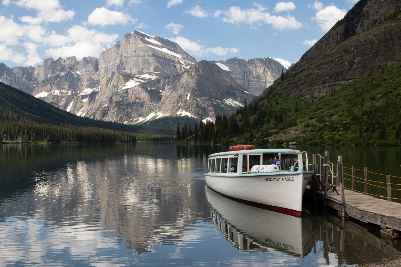
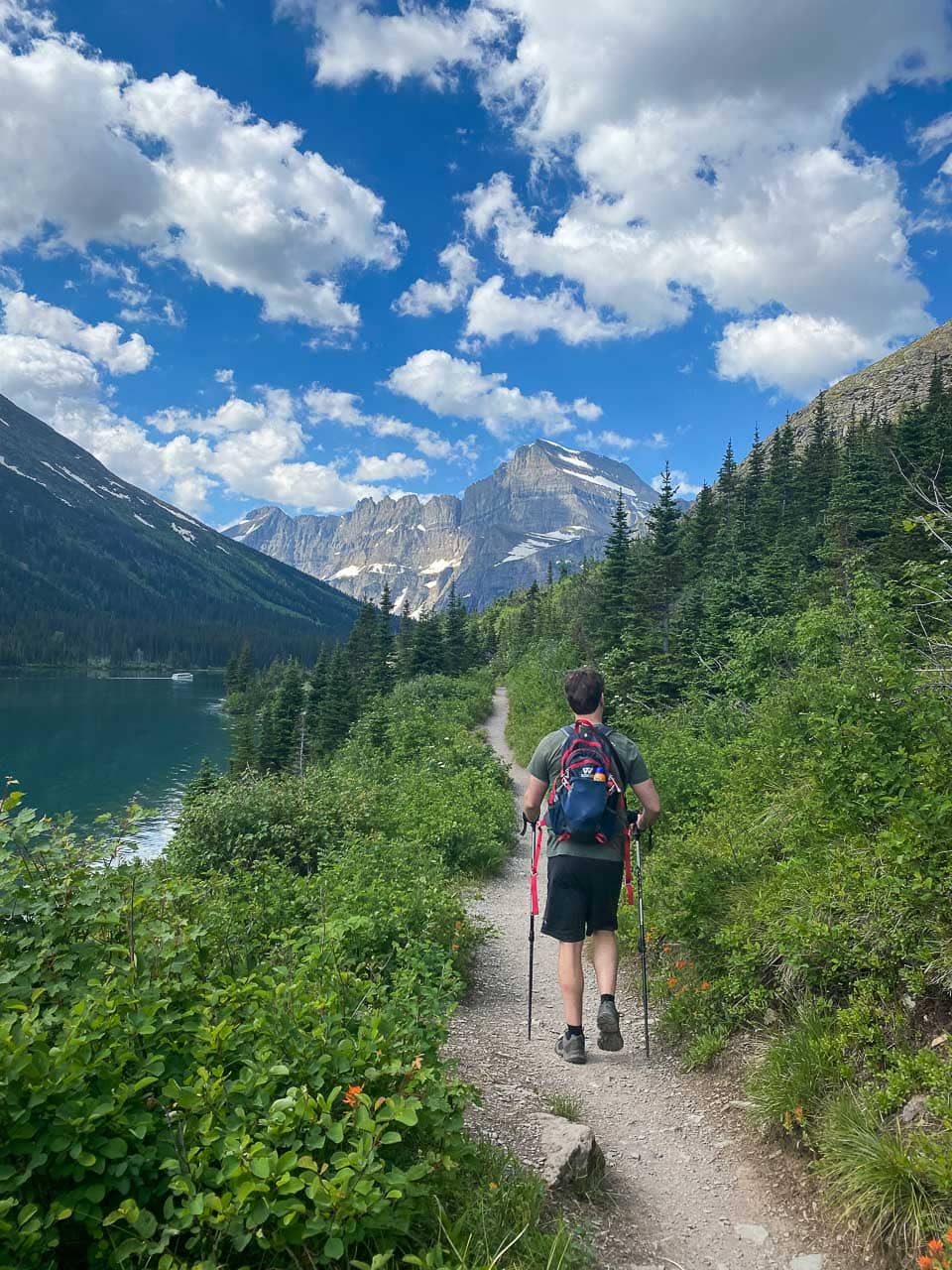
After hiking a part of the Swiftcurrent Nature Trail in Many Glacier, head deeper into the wildlife-rich wilderness of the Swiftcurrent Valley on the Lake Josephine Trail.
Cross the small hill behind Swiftcurrent Lake and follow the north shore of Josephine Lake to the boat dock at its far end.
At the trail junction, follow the Grinnell Lake Trail to this beautiful turquoise lake. Rest your legs and take in the glorious landscape before retracing your steps back to the boat dock.
To get back to your car, you have two options. You can either hike back the same way you came or catch the tour boat back.
It’s important to know, however, that people with boat reservations have priority.
When it’s busy, you may have to wait a while to find a seat on a tour boat, or you may not find a seat at all. It’s best to plan this hike in advance if you’d like to combine it with a tour boat trip.
- Area: Many Glacier (East Side)
- Trailhead: Swiftcurrent Picnic Area or Many Glacier Hotel
- Distance: 6.8 miles (out and back)
- Difficulty: easy to moderate
- Elevation gain: 60 feet
Note: Because of an abundance of food sources, the Swiftcurrent and Grinnell Valleys are home to one of the densest concentrations of grizzly bears in Glacier National Park. The trails to Lake Josephine, Grinnell Lake and Grinnell Glacier (see below) are often posted for bears frequenting. Once again, carrying bear spray and being loud while hiking are essential for your safety.
Grinnell Glacier Trail
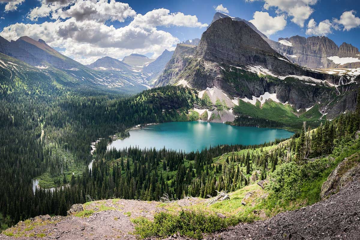
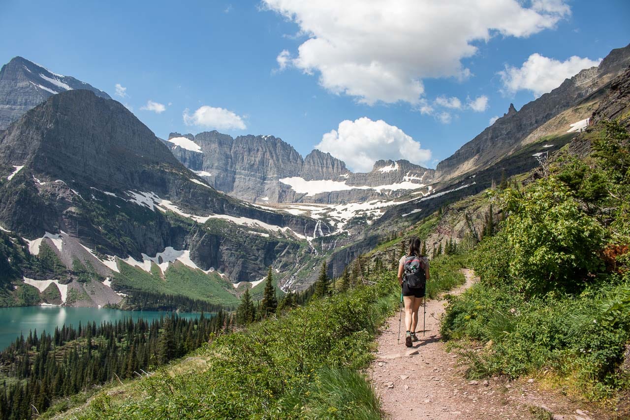
The Grinnell Glacier Trail, one of my absolute favorite Glacier National Park hikes, follows much of the same route as the hike above.
From the Swiftcurrent Picnic Area or Many Glacier Hotel, hike along Swiftcurrent Lake and the north shore of Lake Josephine until the junction at Lake Josephine’s west end.
There, the Grinnell Glacier Trail splits off and runs directly uphill. After a short distance, views of Grinnell Lake below begin opening up. Once you’re well above the tree line, the vista gets nothing less than awe-inspiring.
Following a cliffside above Grinnell Lake, you’ll continue toward Grinnell Glacier itself, accompanied by views of Gem Glacier and Salamander Glacier.
The last section of the Grinnell Glacier hike is usually closed until early-July, but when it’s open, this is how you can get to the park’s only accessible glacier.
From the moraine and Upper Grinnell Lake, the views are absolutely sensational. Be careful, though, to not step onto the glacier itself—it has numerous hidden crevasses, falling can be deadly.
- Area: Many Glacier (East Side)
- Trailhead: Swiftcurrent Picnic Area or Many Glacier Hotel
- Distance: 10.6 miles (out and back)
- Difficulty: Strenuous
- Elevation gain: 1,600 feet
Fishercap Lake and Redrock Falls Trail
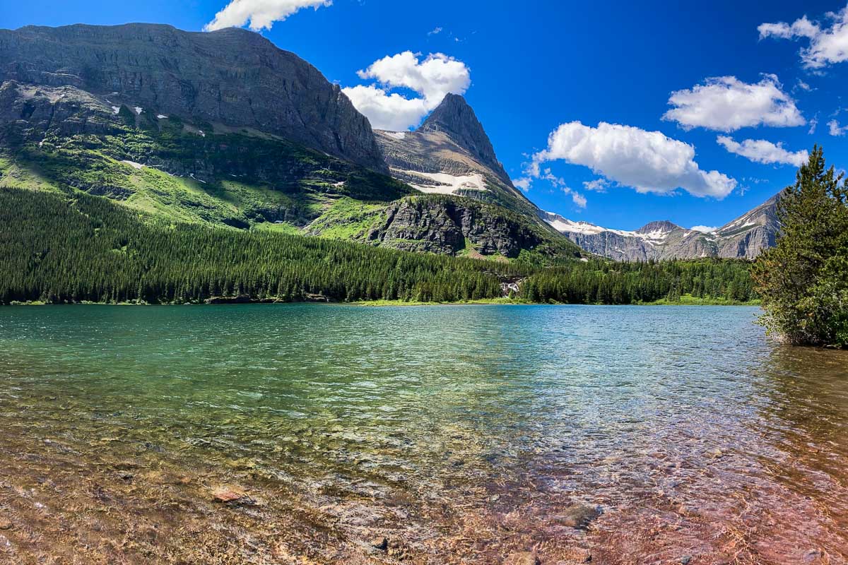
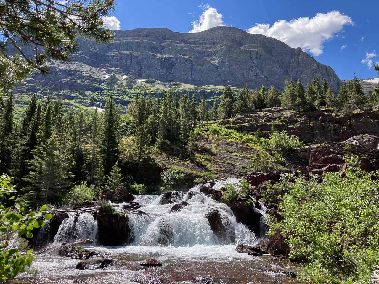
An easy journey into the Swiftcurrent Valley, Redrock Falls is a fun outing to two shimmering lakes and a beautiful waterfall.
Start at the Swiftcurrent Motor Inn and follow the trail into the forest. You’ll quickly get to a spur trail to the shore of Fishercap Lake, where you might spot a moose.
The trail continues parallel to a bubbling creek toward Redrock Lake, at the end of which you’ll arrive at photogenic Redrock Falls, a nice picnic spot and popular among children.
Bring your binoculars and scan the surrounding hillsides for bears from the top of the falls, before returning the same way you came.
- Area: Many Glacier (East Side)
- Trailhead: Swiftcurrent Motor Inn
- Distance: 3.6 miles (out and back)
- Difficulty: Easy
- Elevation gain: 100 feet
I haven’t done the following two hikes in Glacier National Park myself yet, but pretty much every Glacier National Park blog and guidebook I’ve read highly recommends them.
If you’re looking for a Glacier National Park guidebook, I strongly recommend Moon’s Glacier National Park: Hiking, Camping, Lakes & Peaks (Travel Guide). It’s probably the best guidebook for this particular park you can find.
Even though I can’t speak from personal experience quite yet, for the sake of completeness, I decided to still include them in this list of the best day hikes in Glacier National Park. I’ll expand the descriptions and update the photos once I hit those trails myself.
Iceberg Lake Trail
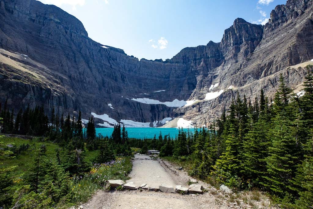
When, in summer, the lake is accessible and icebergs float in its turquoise water, the Iceberg Lake Trail is one of the those must-do hikes in Glacier National Park.
Starting behind the Swiftcurrent Motor Inn in Many Glacier, the trail climbs steadily through woods and areas of beautiful wildflowers. Ptarmigan Falls is a great spot to take a break before continuing to the exceptionally photogenic Iceberg Lake.
- Area: Many Glacier (East Side)
- Trailhead: Swiftcurrent Motor Inn
- Distance: 9.6 miles (out and back)
- Difficulty: Strenuous
- Elevation gain: 1,200 feet
Note: Yep, here’s another bear warning! Running between Mount Wilbur and Mount Henkel, the Iceberg Lake Trail is in prime grizzly bear habitat. The trail is known for its frequent bear sightings—both black and grizzly—so make sure to make noise while hiking, even if there are lots of other hikers around. On all hikes in Glacier National Park, always carry bear spray and know how to use it!
Cracker Lake Trail
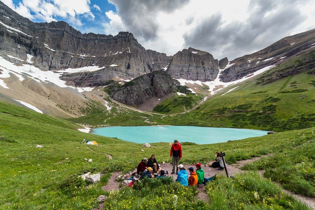
Much less crowded than most other trails in Many Glacier, Cracker Lake Trail offers hikers beautiful alpine scenery, complete with lupines, bluebells and other wildflowers. The first 1.5 miles or so are shared with a horse trail, so pay attention.
Cracker Lake itself is one of the most stunning lakes in the park, featuring milky blue glacial water and backed by massive Siyeh Peak. Home to a backcountry campsite, it’s also a popular backpacking destination.
- Area: Many Glacier (East Side)
- Trailhead: Many Glacier Hotel parking lot, south end
- Distance: 12.8 miles (out and back)
- Difficulty: Strenuous
- Elevation gain: 1,400 feet
Staying Safe While Hiking in Glacier National Park
Even though it’s one of the busiest national parks in America, Glacier National Park is a very wild place.
There are over 700 miles of trails to explore, from easy boardwalks and lakeshore strolls to Glacier National Park day hikes and epic backpacking trips. There’s a trail for everyone.
The park’s landscapes and natural resources are, however, vulnerable and fragile. It’s crucial that all visitors act responsibly, plan their trips and hikes properly, and reduce the impact they have on the park.
Specifically for hiking Glacier National Park, the National Park Service provides the following safety advice:
- Always let someone know exactly where you’re going, the trail you’re hiking, when you think you’ll be back, what clothing you’re wearing and where your car is. In case there’s an emergency or you don’t return, this significantly reduces rescue response time.
- Cell service is extremely limited in Glacier National Park. Don’t count on it to ask for help.
- Depending on which of the trails in Glacier National Park you’re hiking, help could be hours or even days away. Prepare and know how to take care of yourself out there.
- Hike in a group to lower the chance of negative encounters with wildlife.
- Always stay with your group. Don’t let anyone behind or get ahead. Over 75% of search-and-rescue incidents in Glacier National Park are because of parties that got separated. Stay together!
- Before you start hiking in Glacier National Park, stop by a visitor center or ranger station for current trail information, weather forecasts and wildlife reports.
More About Glacier National Park
- Park Website
- Travel Guide
- Topographic Map
- Top Attractions on Going-to-the-Sun Road
- Best Things to Do at Many Glacier
- Best Things to Do at Lake McDonald
- Where to See Wildlife in Glacier National Park
- Accommodation
Glacier National Park Hiking Essentials
Proper gear and equipment are essential for a safe and successful hike in Glacier National Park. Don’t be an idiot and try a hike in flip-flops or heels. Many trails at Glacier National Park are slippery, steep and/or rocky.
Make sure you bring and use the following essential items to enjoy the Glacier National Park hiking trails:
- Sturdy footwear, whether it’s hiking shoes or hiking boots.
- Lots of water. The mountains and valleys of Glacier get very hot during summer. In summer, carry at least 1 liter (or about 34 fluid ounces) of water for every hour you expect to hike.
- Mosquito and bug repellent. These winged annoyances are prevalent in many places in the park in (early-)summer.
- Hat and sunscreen. Protect your head and skin against overheating and burning.
- Hiking snacks or lunch. Every trail has at least one perfect picnic spot, scenic overlook or beautiful natural feature worth taking a break at.
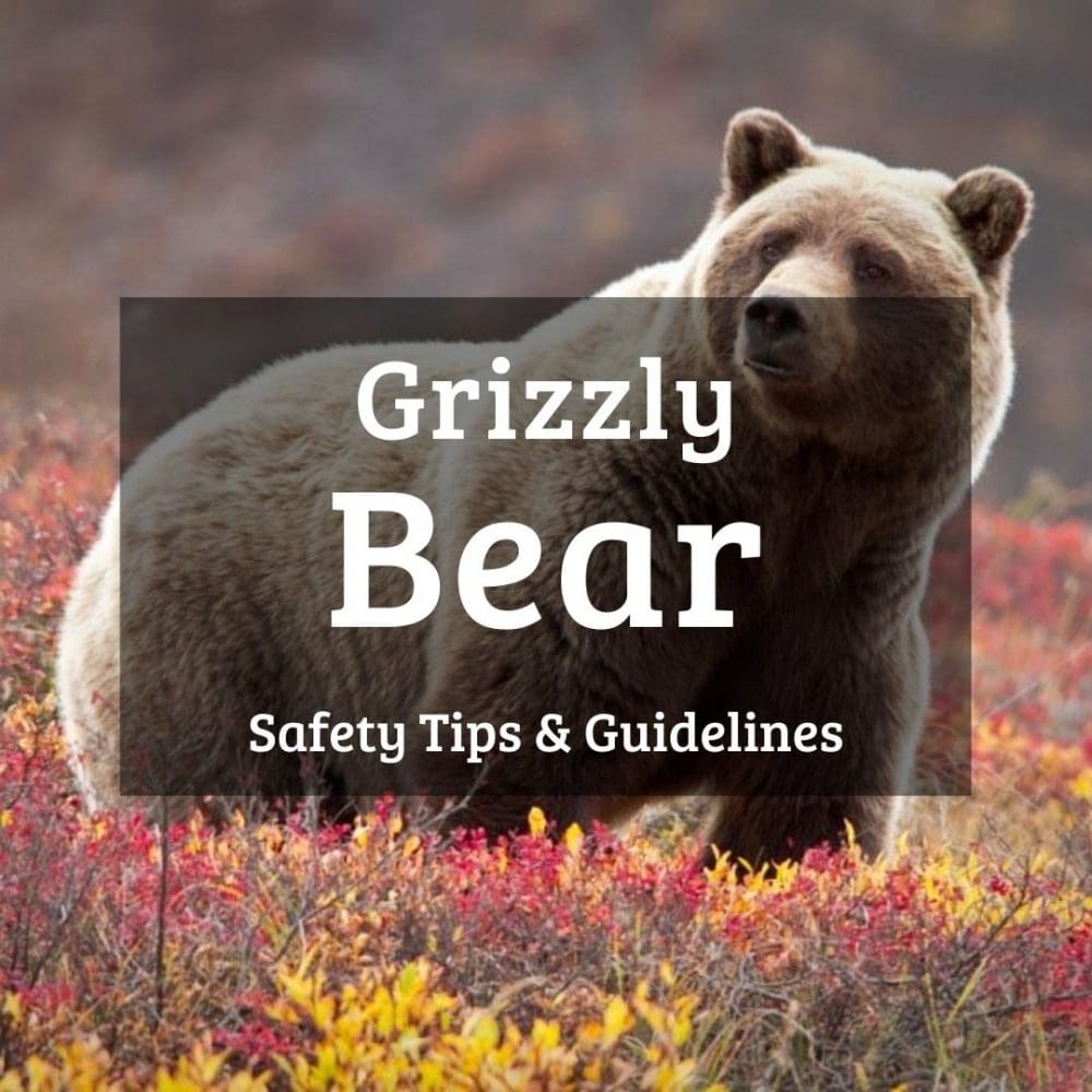
- BEAR SPRAY. Yes, in all caps! Glacier National Park is grizzly bear country. Always carry bear spray while hiking in Glacier National Park. Learn how to use bear spray properly here.
Wildlife Safety in Glacier National Park
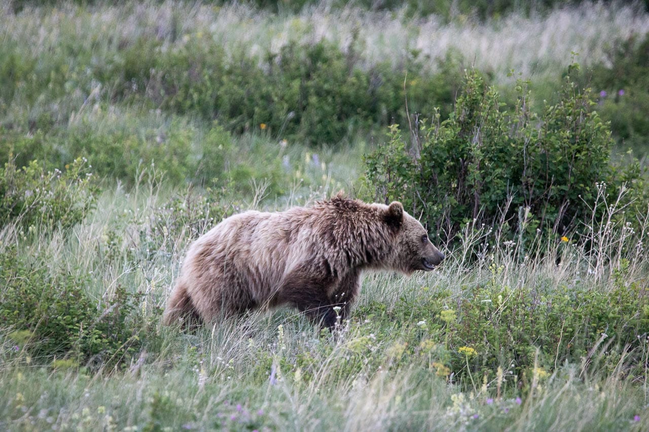
I’ve mentioned it numerous times in this blog post featuring the best hikes in Glacier National Park, but let me repeat it once again. Bears live here! Be bear aware on every trail, however short or busy it may be.
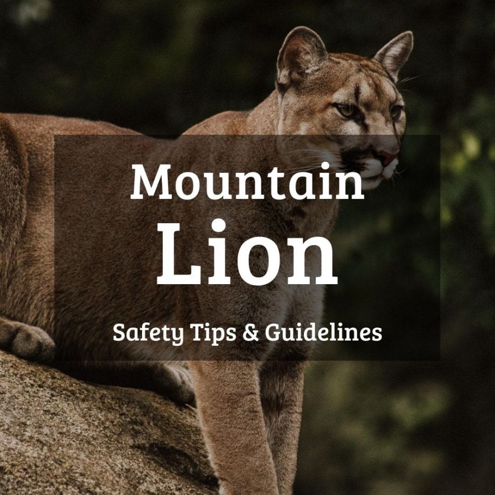
Additionally, Glacier National Park is home to many other wild animals, too. Wolves and mountain lions call the park home, both of which can be dangerous.
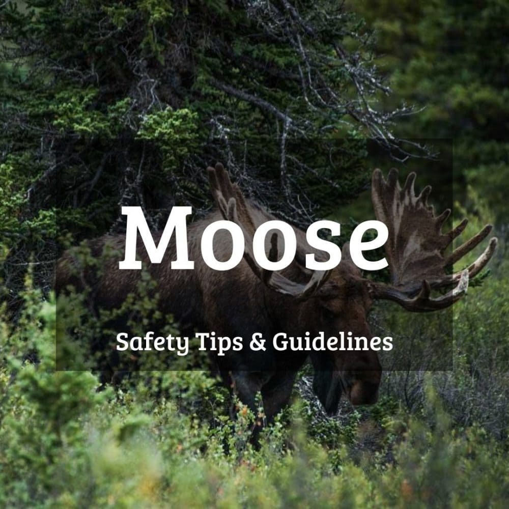
Other wildlife such as mountain goats, bighorn sheep, elk and even deer can potentially hurt a human as well. Especially moose, one of the largest land mammals in North America, are worth watching out for.
All people—which includes everyone from hikers and bikers to roadside sightseers and photographers—must stay at least 100 yards from wolves, black bears and grizzly bears, and minimum 25 yards from all other animals.
Use binoculars, a spotting scope or telephoto lens to observe and photograph wildlife from a safe distance.
You can read more about specific wildlife safety guidelines and tips in the articles below.

