Some of the world’s most extraordinary landscapes are found on the Big Island of Hawaii. You can explore them on a number of awesome day hikes in Hawai‘i Volcanoes National Park.
The only Hawaiian island that’s still volcanically active, the Big Island is home to two of the most active volcanoes on Earth: Mauna Loa and Kīlauea, both of which are protected by Hawai‘i Volcanoes National Park.
In fact, Kīlauea Volcano has been continuously erupting since 1983, almost constantly transforming the park’s landscape.
Lava lakes intermittently appear and dry up, devastating lava flows run down the mountain toward the Pacific Ocean, and plumes of steam and volcanic gases billow upward.
Mauna Loa, on the other hand, while also an active volcano, is best known as the biggest volcano on the planet. Rising 13,680 feet above the ocean, this gigantic mountain is actually higher than Mount Everest when measured from its base on the ocean floor.
Both sprawling lava deserts and lush meadows cover the slopes of mighty Mauna Loa, while the spectacular Kīlauea Caldera is home to dense rain forests.
The best way to explore this exceptionally diverse environment is by hiking the many trails in Hawai‘i Volcanoes National Park.
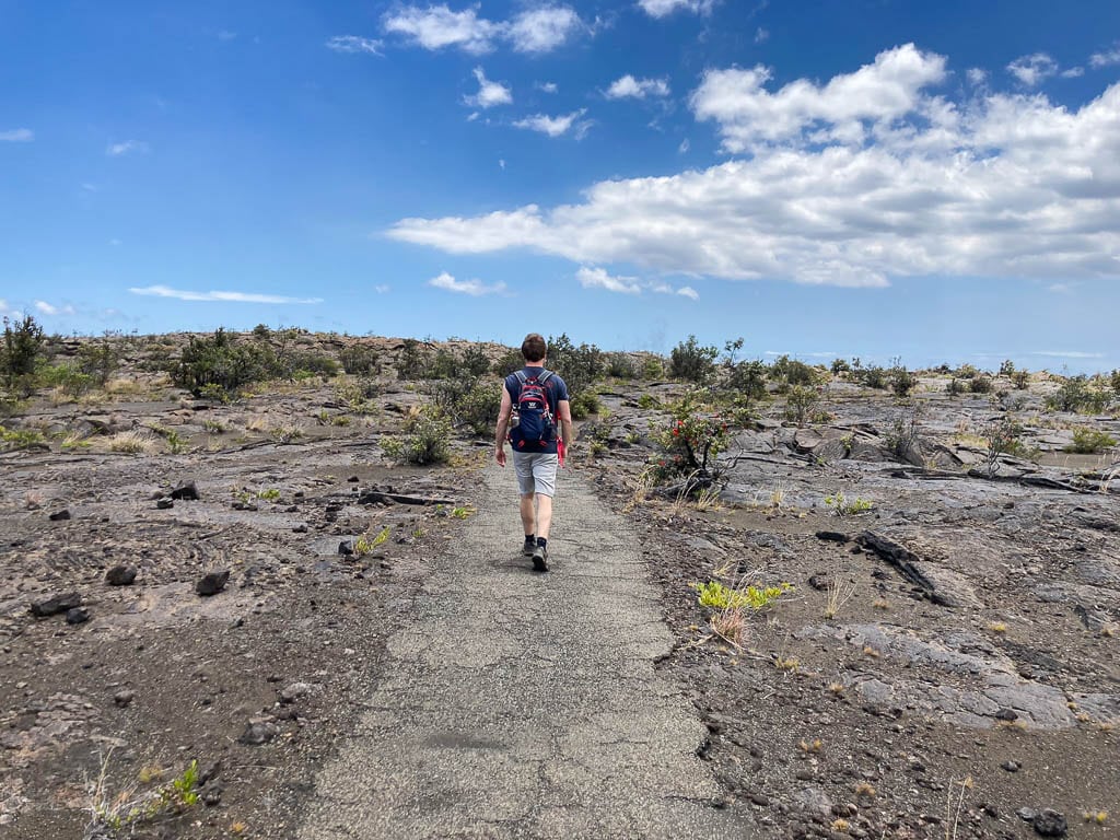
Contents
- 10 Amazing Day Hikes in Hawai‘i Volcanoes National Park
- Best Day Hikes at Hawai‘i Volcanoes Kīlauea Caldera
- Best Day Hikes in Other Hawai‘i Volcanoes National Park Areas
- More Day Hikes in Hawai‘i Volcanoes National Park
- Accommodation Near Hawai‘i Volcanoes National Park
- Amazing Day Hikes in Other Volcanic Parks
10 Amazing Day Hikes in Hawai‘i Volcanoes National Park
Whether you’re looking for quick scenic strolls or a longer day hike, perhaps in a volcanic crater, there are plenty of Hawai‘i Volcanoes hikes to choose from.
I’ve listed the best day hikes in Hawai‘i Volcanoes National Park below.
They’re divided into two sections:
- The Kīlauea Caldera, which is the most popular part of the park and has the most Hawai‘i Volcanoes hiking trails.
- Other areas that make up the national park, such as the Chain of Craters Road, Mauna Loa and the Kahuku Unit.
This blog post about the best hikes in Hawai‘i Volcanoes National Park contains affiliate links. You can read more about our Terms of Use / Disclosure here.
Best Day Hikes at Hawai‘i Volcanoes Kīlauea Caldera
Crater Rim Trail
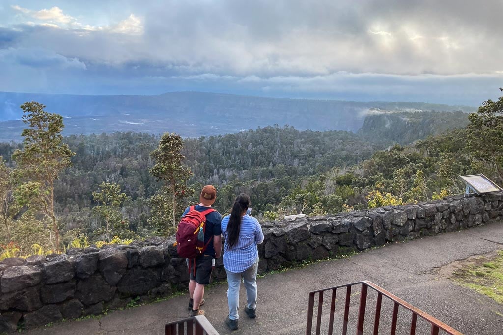
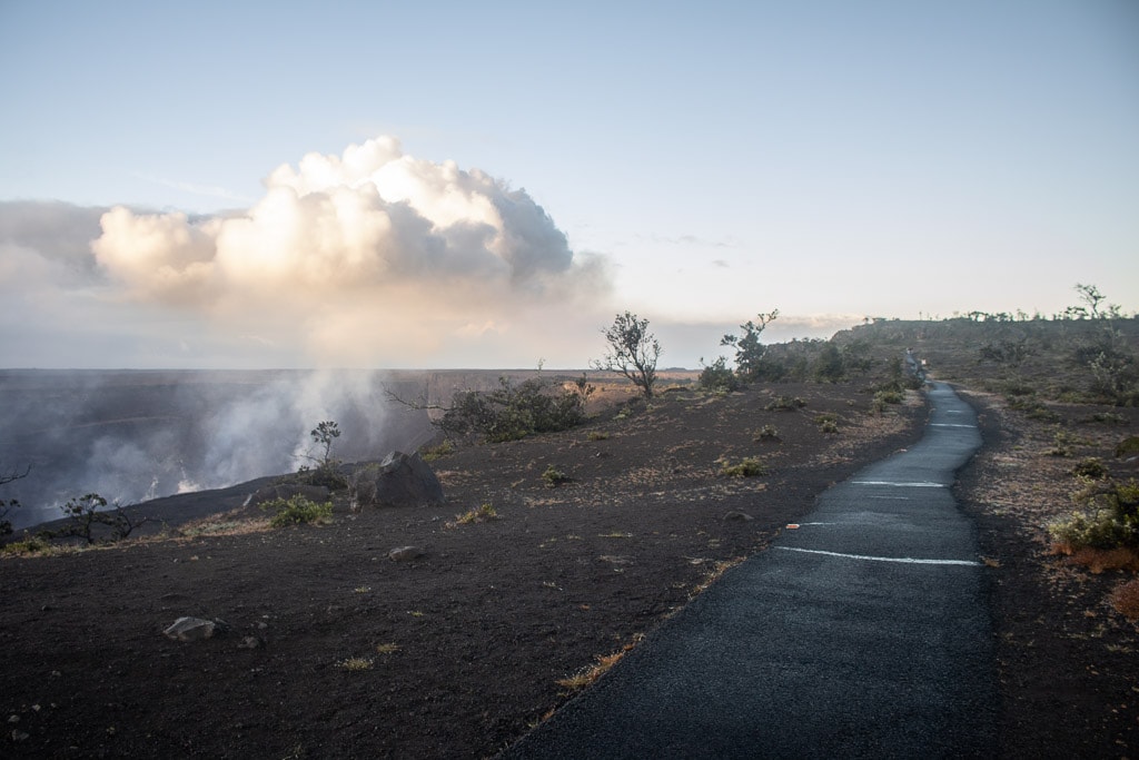
As the longest trail in Hawai‘i Volcanoes National Park’s Kīlauea Caldera, the Crater Rim Trail runs past and sometimes even overlaps most other trails in the area.
Originally encircling the entire Halema‘uma‘u Crater, the length of this scenic trail was essentially cut in half by the devastating 2018 eruption of Kīlauea.
The eruption caused a massive collapse of the summit, along with tens of thousands of earthquakes, which destroyed the Crater Rim Drive and Crater Rim Trail along the south and west rim of the crater.
Nowadays, the remainder of the Crater Rim Trail is still 11 miles long. It stretches from Uēkahuna on the northwest rim of the caldera to the Keanakākoʻi Crater on the southeast rim.
On the way, the trail passes by numerous awe-inspiring views, such as at the Kīlauea Overlook and along Waldron Ledge. It also overlaps a part of the magnificent Kīlauea Iki Crater Loop and provides access to the popular Nāhuku (Thurston Lava Tube).
Because of its relatively long one-way distance, most visitors hike only a section of the Crater Rim Trail, which is what I’d recommend, too.
Consider exploring the sections between Uēkahuna and the Kīlauea Overlook; the Steam Vents and Sulphur Banks area; and the Crater Rim Trail from Volcano House to Waldron Ledge.
- Distance: up to 11 miles (one way), but numerous shorter options
- Duration: 10 minutes to multiple hours, depending on the distance hiked
- Difficulty: easy
- Trailheads: Uēkahuna, Kīlauea Overlook, Steam Vents, Volcano House or Kīlauea Iki Overlook
Ha‘akulamanu (Sulphur Banks) Trail
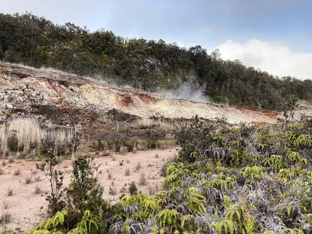
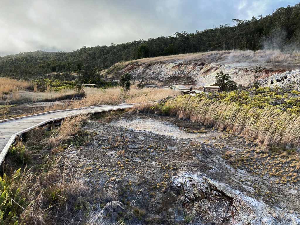
One of the main highlights and most interesting trails at the Kīlauea Caldera is the Ha‘akulamanu (Sulphur Banks) Trail. As its name suggests, hiking this trail comes with some serious smells.
The Sulphur Banks, known as Ha‘akulamanu by Native Hawaiians, release volcanic gases from deep within the Earth.
These gases contain lots of carbon dioxide, sulfur dioxide and hydrogen sulfide, the latter of which is most recognizable because it smells like rotten eggs.
This remarkable hydrothermal area is also known for its colorful rocks, which are deposited as pure crystals by some sulfur gases. Additionally, sulfuric acid also breaks down lava into clay, which in its turn is colored red by iron dioxide.
An easy boardwalk runs through the Sulphur Banks, offering hikers close-up views—and smells—of this fascinating area, the easiest place to experience volcanic activity at Hawai‘i Volcanoes National Park.
- Distance: 1.2 miles (loop)
- Duration: 30 minutes
- Difficulty: easy
- Trailhead: west end of the Kīlauea Visitor Center parking lot
Note: Because these volcanic gases can be toxic, this hike is not recommended for pregnant women, infants, and people with heart conditions or respiratory conditions like asthma.
Halema‘uma‘u Trail
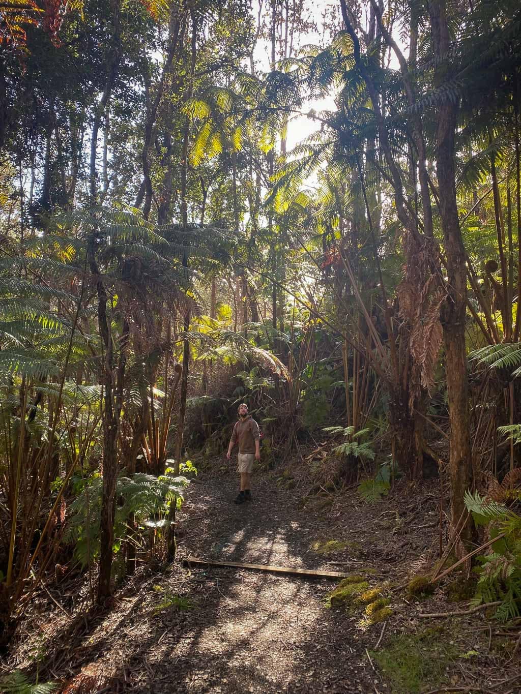
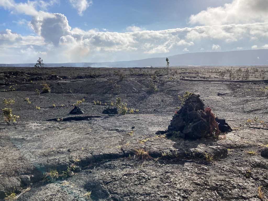
One of the oldest tourist hiking trails at Hawai‘i Volcanoes National Park, the Halema‘uma‘u Trail has taken visitors, particularly guests of Volcano House, into the Kīlauea Caldera since 1846.
The trail used to lead all the way across the caldera floor to the rim of the Halema‘uma‘u Crater, but due to high levels of sulfur dioxide and the ongoing volatility of Halema‘uma‘u, it now ends at the Kīlauea Caldera floor.
It’s still one of the coolest crater hikes you can do at Hawai‘i Volcanoes, though.
The trail splits off from the Crater Rim Trail just west of Volcano House. It drops down 425 feet through a beautiful rain forest to the floor of Kaluapele, the edge of the massive Kīlauea Caldera.
Hiking through this section of Hawaiian rain forest is absolutely amazing, but standing in the caldera of the world’s most active volcano is arguably even more so.
The shortest hiking option is retracing your steps back up to Volcano House.
Alternatively, it’s possible to create a longer loop hike by combining the Halema‘uma‘u Trail with the Kīlauea Iki Crater Loop and/or the Crater Rim Trail along Waldron Ledge.
- Distance: 1.6 miles (out and back), but longer loop hikes are also possible
- Duration: 1 hour
- Difficulty: moderate
- Trailhead: Crater Rim Trail behind Volcano House
Kīlauea Iki Crater Loop
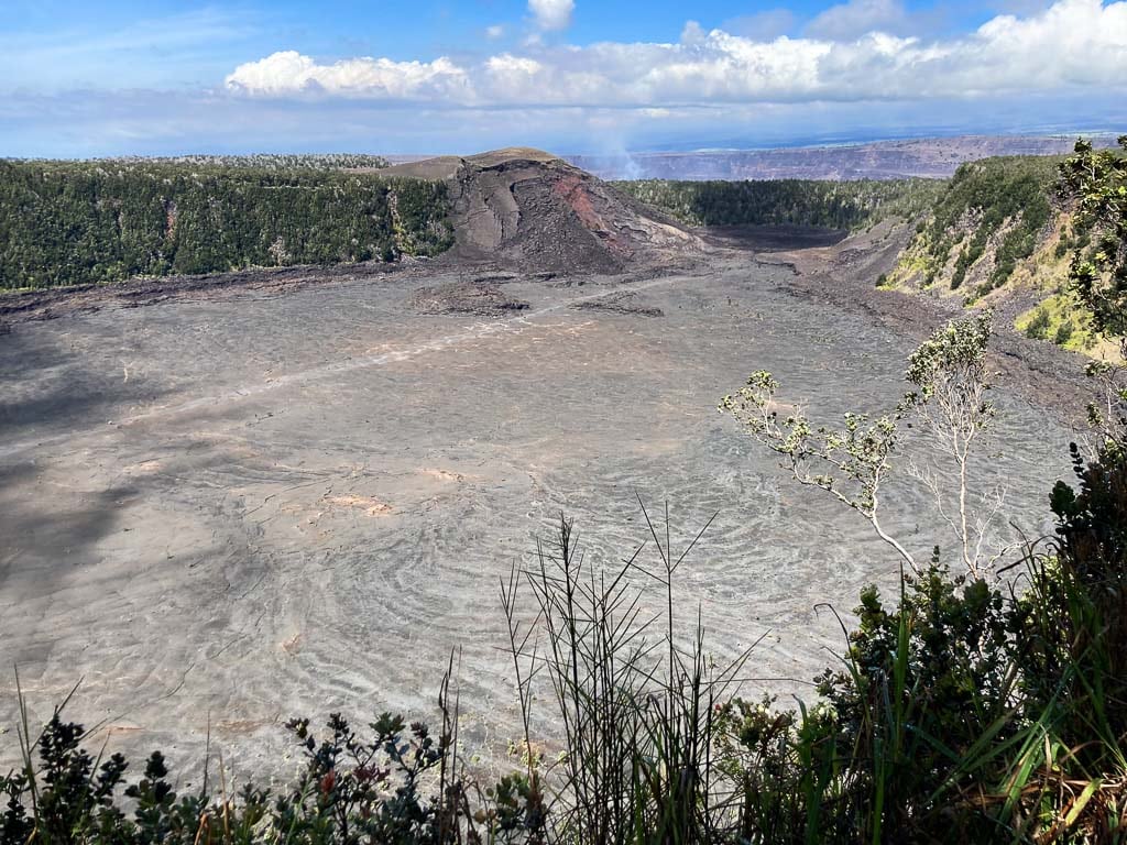
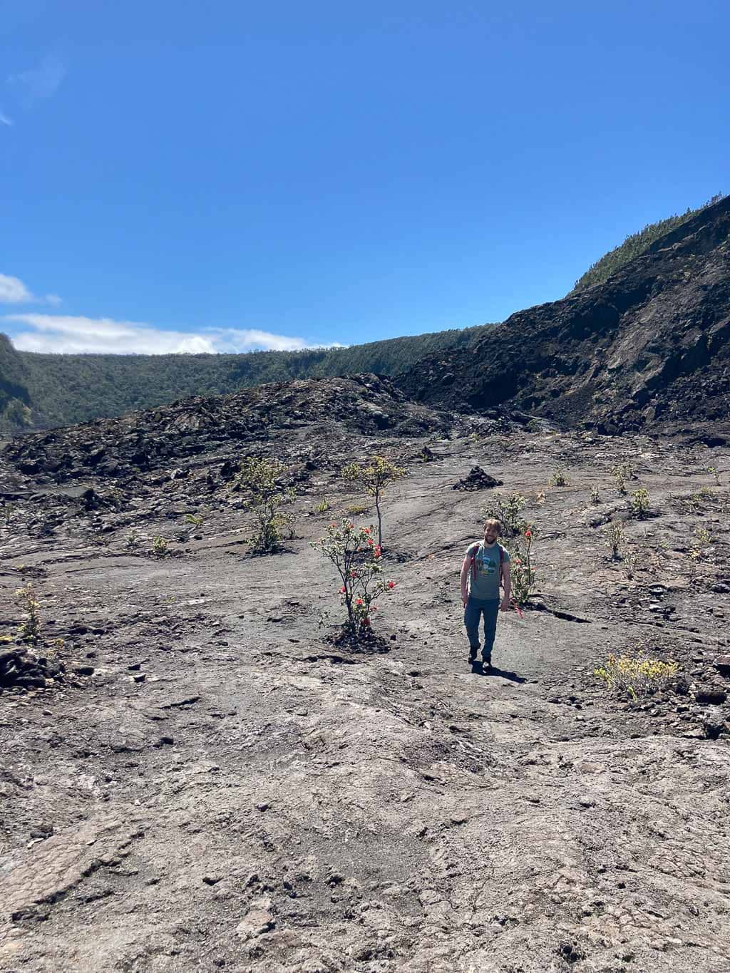
Without question one of the best day hikes in Hawai‘i Volcanoes National Park, if not the best day hike, is the Kīlauea Iki Crater Loop.
This popular hike includes everything that makes Hawai‘i Volcanoes National Park so special. There are sections of stunning rain forest, spectacular overlooks and a stretch that runs—literally—across a solidified lava lake.
The Kīlauea Iki Crater filled with seething lava after a vent erupted below the Pu‘upua‘i Cinder Cone in 1959.
The vent spewed lava thousands of feet into the air, “considered by some to be the most spectacular eruption event of the 20th century”, according to the National Park Service.
Nowadays, the lava is solid at the top, but still lingers in its red-hot molten state not all that deep below the trail.
You can hike the 3.3-mile Kīlauea Iki Crater Loop from either the Kīlauea Iki Overlook or Nāhuku (Thurston Lava Tube) parking lot, which are the shortest hiking options.
I would, however, suggest combining the Kīlauea Iki Crater Loop with Nāhuku (Thurston Lava Tube) and the Devastation and Uēaloha (Byron Ledge) Trails. See below for descriptions of those additional trails.
Together, these four individual trails make for a phenomenal 7-mile roundtrip hike. The trailhead for this longer day hike is at the Pu‘upua‘i Overlook parking lot.
In my opinion, this second route is easily one of the greatest day hikes in the entire National Park System.
- Distance: 3.3 miles (loop) to 7 miles (lollipop)
- Duration: 2 to 4 hours
- Difficulty: moderate to strenuous
- Trailheads: Kīlauea Iki Overlook, Nāhuku (Thurston Lava Tube) parking lot, Devastation Trailhead parking lot or Pu‘upua‘i Overlook parking lot
Nāhuku (Thurston Lava Tube)
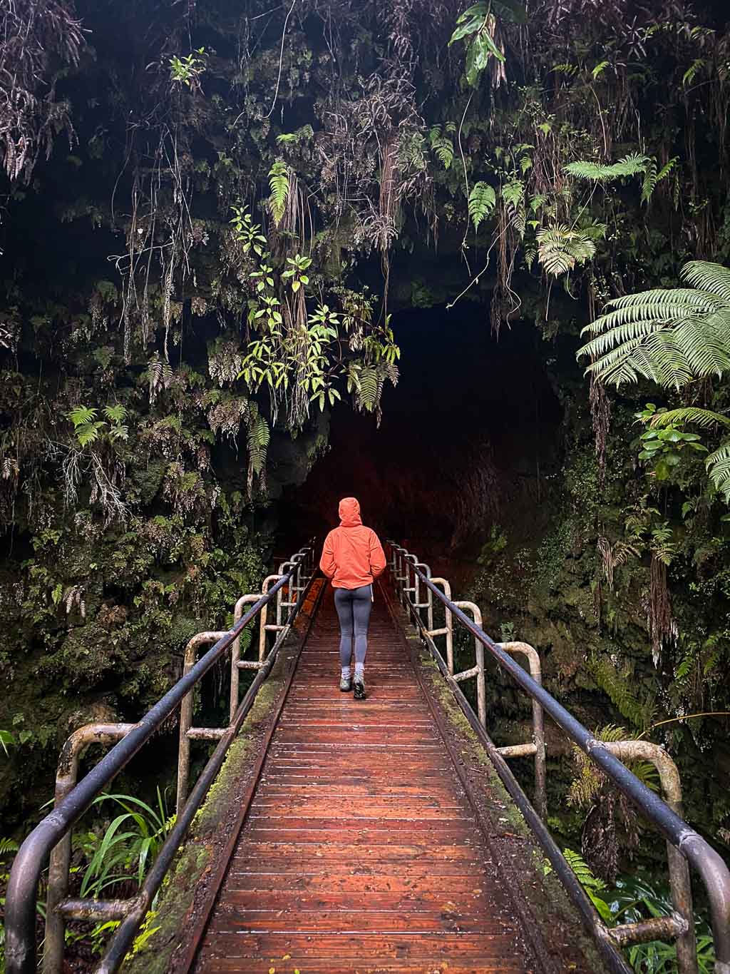
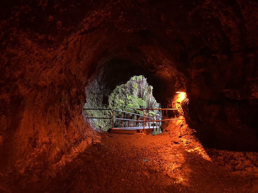
One of the most popular short hikes in Hawai‘i Volcanoes National Park, the Nāhuku (Thurston Lava Tube) Trail is a beautiful loop through rain forest and a remarkable lava tube.
Before entering Nāhuku—the name means “the protuberances” in Hawaiian—the trail winds its way through a lush rain forest home to numerous native birds.
The lava tube itself is one of the star attractions at Hawai‘i Volcanoes. A cylinder-shaped cave created 500 years ago by a 2,000-degree-Fahrenheit river of lava, the Thurston Lava Tube is open 24/7.
During the day, it’s ridiculously crowded and the nearest parking lot almost always full, but early mornings, evenings and even in the dark of night, the lava tube is quiet and even more spectacular.
While walking through Nāhuku—even though it’s lit during the day, it’s a good idea to bring a flashlight—enjoy the uniqueness of the lava tube, but don’t touch any hanging roots or the walls.
This isolated environment is home to its own ecosystem, which is fragile and easily destroyed, so be respectful and keep your hands to yourself.
From the Nāhuku (Thurston Lava Tube) parking area, which is quite small and usually full, it’s only a 0.5-mile loop hike.
Another excellent parking option is the nearby Kīlauea Iki Overlook parking lot, which makes for a 1.5-mile roundtrip hike.
- Distance: 0.5 miles (loop) or 1.5 miles (lollipop)
- Duration: 20 minutes to 1 hour
- Difficulty: easy
- Trailheads: Nāhuku (Thurston Lava Tube) parking lot or Kīlauea Iki Overlook parking lot
Note: As mentioned above, you can easily combine the Thurston Lava Tube with the Kīlauea Iki Crater Loop.
Devastation and Uēaloha (Byron Ledge) Trails
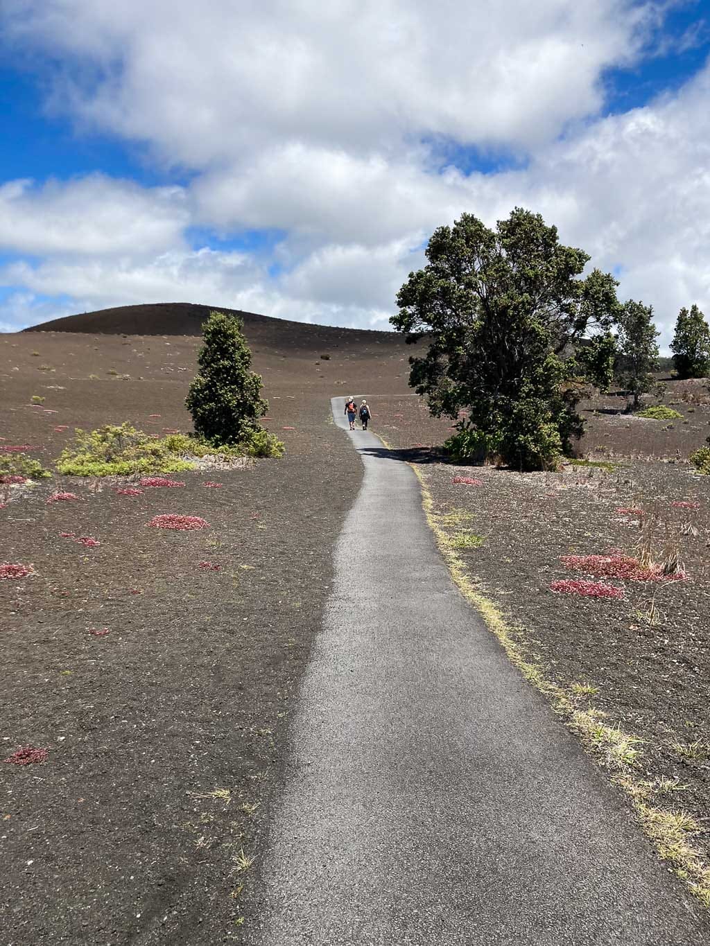
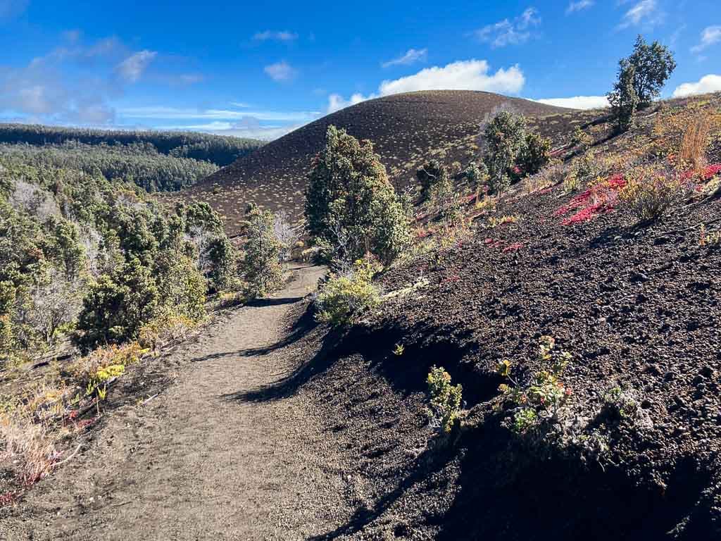
Although you can hike these two trails in Hawai‘i Volcanoes National Park separately, I do recommend combining them.
Park your car at the Pu‘upua‘i Overlook parking area and explore a landscape that’s recovering from the Kīlauea Iki eruption of 1959, whose lava fountains covered the area in a thick layer of cinders.
Combined, the two trails run along the south side of the imposing Pu‘upua‘i Cinder Cone.
From the Pu‘upua‘i Overlook parking lot, the Devastation Trail is an easy, paved and wheelchair-accessible path that runs through a remarkable cinder landscape dotted with new vegetation.
The moderately difficult Uēaloha (Byron Ledge) Trail is basically an extension of the Devastation Trail. It offers awesome views of Pu‘upua‘i Cinder Cone and sporadic views of the Kīlauea Caldera toward the end.
From Byron Ledge, you can retrace your steps back to your car for a moderate out-and-back hike centered on the Pu‘upua‘i Cinder Cone.
Alternatively, as I mentioned above, you can also continue on the Kīlauea Iki Crater Loop for a (much) longer day hike that takes in several of the best trails in Hawai‘i Volcanoes National Park.
- Distance: 2.1 miles total (out and back)—Devastation Trail is 1 mile out and back, Uēaloha (Byron Ledge) Trail is 1.1 miles out and back
- Duration: 1.5 hours for both trails
- Difficulty: Devastation Trail easy, Uēaloha (Byron Ledge) Trail moderate
- Trailheads: Pu‘upua‘i Overlook parking lot or Devastation Trail parking lot
Best Day Hikes in Other Hawai‘i Volcanoes National Park Areas
Puʻuloa Petroglyphs Trail (Chain of Craters Road)
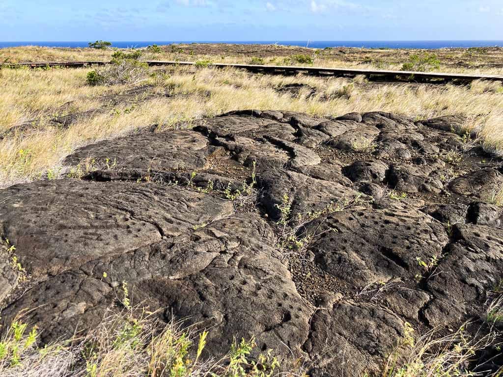
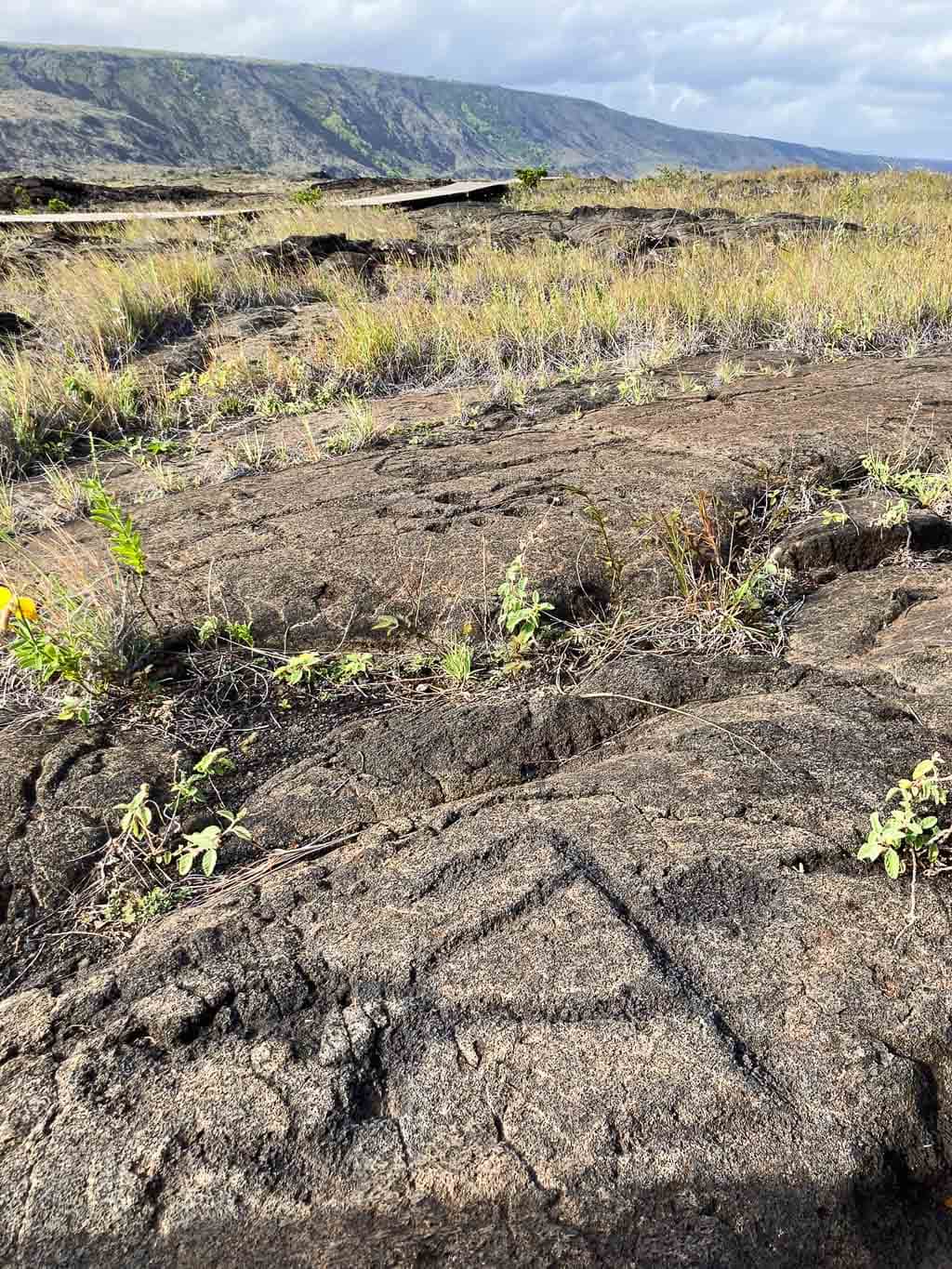
Near the end of the Chain of Craters Road, you can “walk in the footsteps of the kūpuna (elders) to Puʻuloa (hill of long life), a sacred and awe-inspiring gallery of kiʻi pōhaku (images carved in stone).”
The Puʻuloa Petroglyphs Trail is one of the top hikes in Hawai‘i Volcanoes National Park for Native Hawaiian heritage. It takes you to the largest field of petroglyphs in Hawaii and one of the greatest rock art sites in the national parks.
Sprawling across a large area of 500-to-550-year-old lava, this site contains no fewer than 23,000 petroglyphs. Dozens of those are visible from a boardwalk at the end of the trail.
This is a great place to get a better understanding of the life, beliefs and customs of the Native Hawaiian people.
Most of the petroglyphs you can see here are cup-like carvings, known as poho, which cradled the umbilical cord, or piko, of newborn babies. This practice was done in the hopes the child would enjoy a long and prosperous life.
Other petroglyphs at Puʻuloa are circles, canoe sails, cryptic motifs, straight lines and human-looking figures called anthropomorphs.
- Distance: 1.4 miles (out and back)
- Duration: 1 hour
- Difficulty: moderate
- Trailhead: Puʻuloa parking area on the Chain of Craters Road
Kīpukapuaulu Loop (Mauna Loa Road)
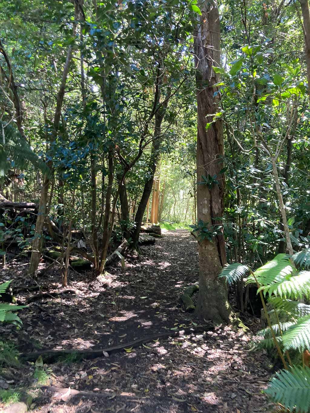
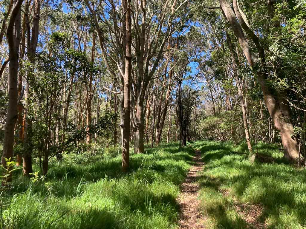
An enjoyable stroll through a regenerating Hawaiian forest, the Kīpukapuaulu Loop offers an insight into the struggle for survival of many native Hawaiian plants and animals.
This easy 1.2-mile loop takes you through a kīpuka, an area of ancient vegetation that escaped more recent lava flows. They’re effectively an “island” in a “sea” of lava, as the National Park Service explains here.
In the case of Kīpukapuaulu, the lava flowed down from the summit of mighty Mauna Loa above. On this scenic forest hike, you can learn about Hawaii’s native trees, plants, birds and insects, and the enormous threats posed by invasive species.
Besides the word kīpuka, the name of this area consists of two other Hawaiian words. Pua means flower, while ulu means growing. So essentially, Kīpukapuaulu can be translated as “island of growing flowers in a sea of lava.”
It’s a fascinating hike and a wonderful stop along the less-explored Mauna Loa Road.
Consider hiking this short Hawai‘i Volcanoes trail in the morning for the best chances to see unique Hawaiian fauna like honeycreepers and butterflies.
- Distance: 1.2 miles (loop)
- Duration: 40 minutes
- Difficulty: easy
- Trailhead: Kīpukapuaulu parking area on Mauna Loa Road
Kaʻū Desert Trail to Maunaiki (Highway 11)
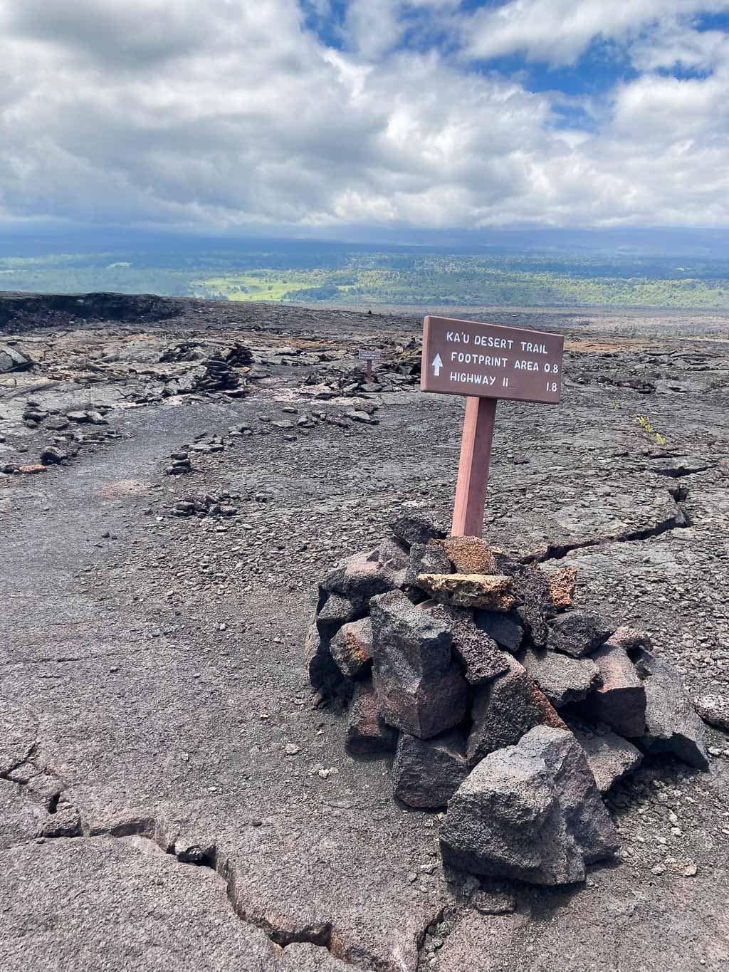
One of my personal favorite hikes in Hawai‘i Volcanoes National Park starts along Highway 11, about 15 minutes west of Volcano Village.
The Kaʻū Desert Trail begins at a small parking area on the south side of Highway 11, taking hikers across an extraordinary volcanic desert landscape.
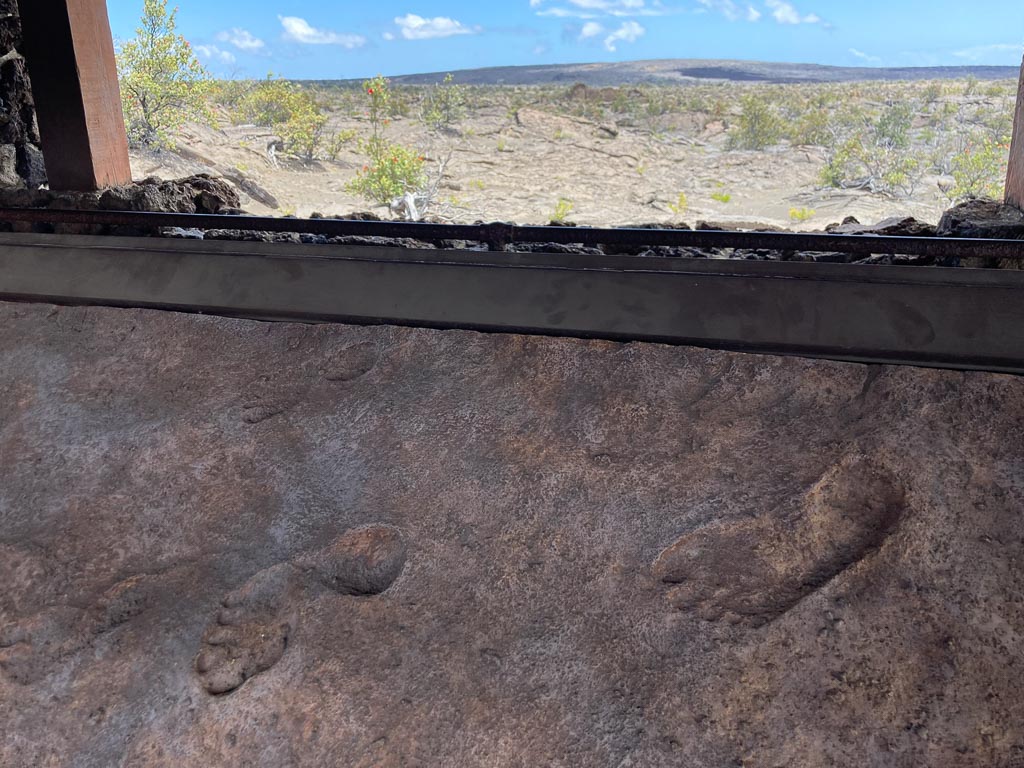
A major highlight along the way is the Footprints Shelter, which is 0.8 miles from the trailhead. This is where you can see the preserved footprints of Native Hawaiians who were surprised by a sudden eruption at the summit of Kīlauea in 1790.
Traveling on ancient trails, they were bombarded by ash, sand and gas from above. Their footprints are “a reminder that Hawaiians have beared witness to the geological drama of this island for centuries”, the National Park Service says.
Beyond the Footprints Shelter, the Kaʻū Desert Trail enters the sprawling and barren Maunaiki area.
You’ll walk across vast lava fields void of any vegetation whatsoever, a desolate and extremely exposed volcanic landscape on the southwest slope of Kīlauea.
This particular day hike at Hawai‘i Volcanoes is 1.8 miles one way (3.6 miles out and back) from the Kaʻū Desert Trailhead on Highway 11 to Maunaiki.
At Maunaiki, however, you do have the option to extend your hike—the Kaʻū Desert Trail continues to the west, while the Maunaiki Trail winds its way southeast.
- Distance: 3.6 miles (out and back)
- Duration: 2 hours
- Difficulty: moderate
- Trailhead: Kaʻū Desert Trailhead on Highway 11
Note: The National Park Service warns that, after the 2018 summit collapse of Kīlauea, large amounts of dust and ash remain in the Kaʻū Desert. During high winds, these particles can become airborne and wearing a mask and eye protection is recommended. Additionally, much of this hike is exposed with very little to no shade or shelter at all. Wear a hat, bring both rain gear and extra sunscreen, and drink plenty of water.
Pu‘u o Lokuana Cinder Cone (Kahuku Unit)

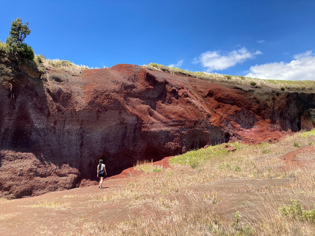
A 116,000-acre landscape of rolling hills, green meadows, groves of trees and cinder cones, the Kahuku Unit was added to Hawai‘i Volcanoes National Park in 2003. This addition effectively doubled the park’s size.
Despite the area’s fascinating history—it was once home to the Kahuku Ranch, one of Hawaii’s biggest cattle ranches—and scenic beauty, many visitors skip it. Don’t be one of them!
Even if you just pop into the Kahuku Unit for a quick visit on your way to Kona, it’s worth the stop. And I strongly recommend doing a short hike to experience this entirely different part of Hawai‘i Volcanoes National Park.
There are various trails to choose from, but the Pu‘u o Lokuana Cinder Cone Loop is arguably the nicest. This wonderful loop trail begins at the Visitor Contact Station near the start of the Kahuku Road.
It quickly climbs the grassy slopes of the Pu‘u o Lokuana Cinder Cone, its summit treating you to a stunning panorama of verdant scenery. You can clearly see the Pacific Ocean from here, too.
Additionally, the Pu‘u o Lokuana Cinder Cone is special for its unusual red rocks. You can walk into the crater and see where Native Hawaiians used to mine chunks and pieces of rock.
It’s a very short hike in Hawai‘i Volcanoes National Park’s less-crowded part, but the beautiful views, historic significance and sheer natural beauty make it well worth visiting.
- Distance: 0.5 miles (loop)
- Duration: 30 minutes
- Difficulty: easy
- Trailhead: Pu‘u o Lokuana Trailhead near the Kahuku Unit’s Visitor Contact Station
More Day Hikes in Hawai‘i Volcanoes National Park
If all those Hawai‘i Volcanoes National Park day hikes above aren’t enough, there are a handful of other trails you can hike, too.
- Keanakāko‘i Overlook Trail (Kīlauea Caldera)
- Waldron Ledge (Kīlauea Caldera)
- Pu‘uhuluhulu Trail (Chain of Craters Road)
- Palm Trail (Kahuku Unit)
- Pit Crater Trail (Kahuku Unit)
