From old-growth forests to towering mountains, from rocky coasts to shimmering lakes, America’s national parks preserve all kinds of landscapes. One of the landscapes least suitable to humans, however, are the American deserts. And this is exactly why the following desert hikes in the national parks are so unforgettable.
Hiking across shadeless desert flats, navigating boulder-strewn slopes, traversing sun-scorched canyons, exploring badlands wildernesses… There are many opportunities to experience—to the fullest extent—how unforgiving America’s national park deserts can be.
Below, I’ve collected several of the most epic national park desert hikes, all of which I’ve done myself.
From southern California, Utah and Arizona to even Hawaii, you’ll find magnificent, and surprisingly diverse, desert scenery all over the western United States.
Contents
- 10 Must-Do Desert Hikes in the National Parks
- 1. Golden Canyon, Gower Gulch and Badlands Loop, Death Valley National Park
- 2. Devils Garden Primitive Trail Loop, Arches National Park
- 3. Bright Angel Trail to Plateau Point, Grand Canyon National Park
- 4. Kaʻū Desert Trail to Maunaiki, Hawai‘i Volcanoes National Park
- 5. Lost Palms Oasis Trail, Joshua Tree National Park
- 6. King Canyon Trail to Wasson Peak, Saguaro National Park
- 7. Sliding Sands Trail (Keonehe‘ehe‘e), Haleakalā National Park
- 8. Chimney Rock Loop, Capitol Reef National Park
- 9. Painted Desert Wilderness Hike, Petrified Forest National Park
- 10. High Dune on First Ridge, Great Sand Dunes National Park
- Other “Themed” Hikes in the National Parks
10 Must-Do Desert Hikes in the National Parks
This article featuring amazing desert hikes in the national parks contains affiliate links. You can read more about our Terms of Use / Disclosure here.
1. Golden Canyon, Gower Gulch and Badlands Loop, Death Valley National Park
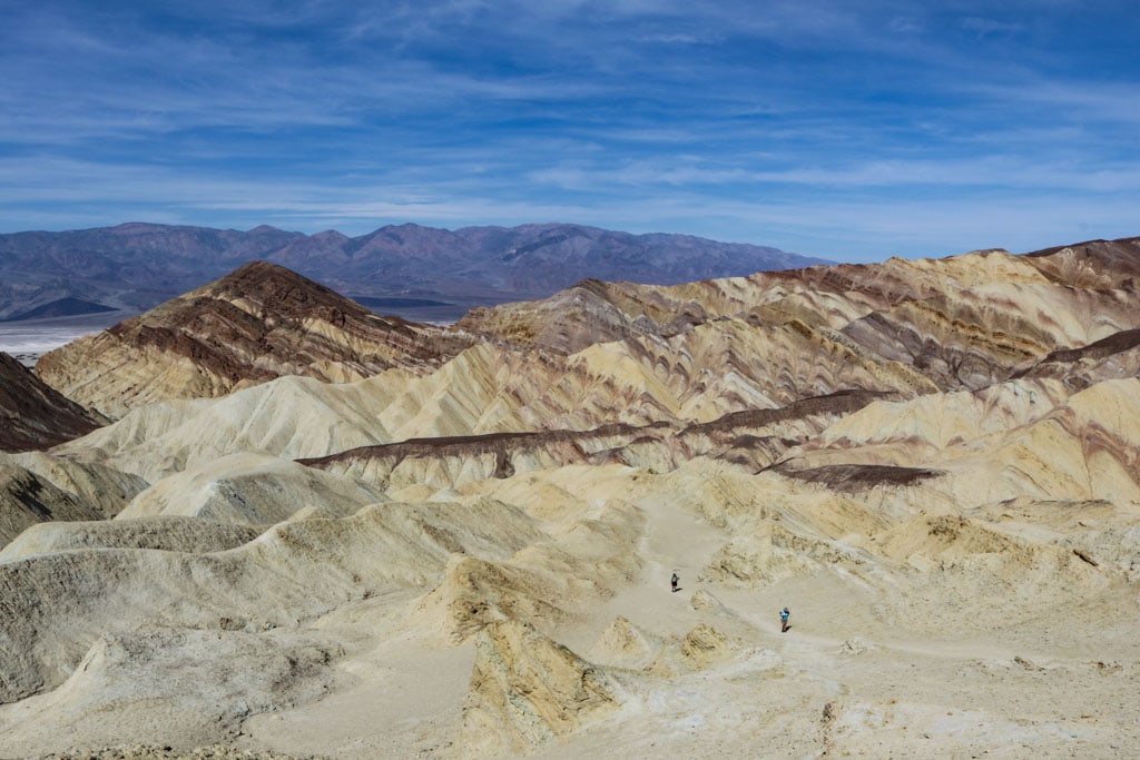
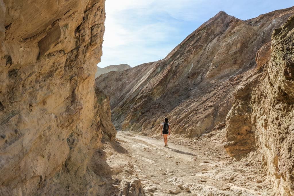
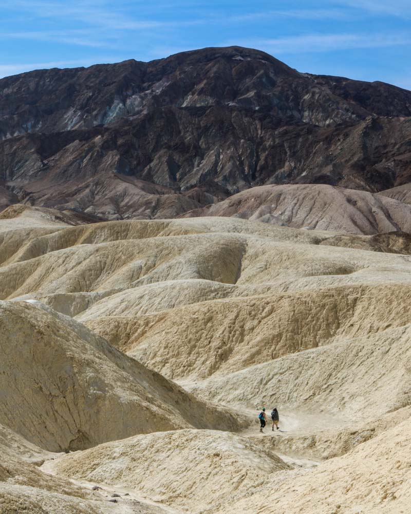
One of my favorite Death Valley activities, this three-trail loop hike takes you through the heart of the golden badlands of Death Valley National Park.
It runs through barren canyons and gullies, and to places like Red Cathedral and spectacular Zabriskie Point.
The entire circuit is about 8 miles long and takes at least four hours.
You can start the hike at either Zabriskie Point or at the parking lot off Badwater Road. I suggest starting at the Badwater Road parking lot. This way, you’ll save the (more or less) downhill part of the hike for the way back.
It’s a challenging hike in a sun-soaked, shadeless and scorching hot desert landscape. Saving the most strenuous section—back up to Zabriskie Point—for last isn’t an option I would recommend.
This strenuous hike is one of the best day hikes I’ve ever done in a national park. In fact, if you do any hiking in Death Valley National Park, let it be this hike.
I also recommend starting the Golden Canyon, Gower Gulch and Badlands Loop as early in the morning as you can. Bring lots and lots of water, put on a hat and wear sunscreen.
- Total distance: 8 miles, loop
- Duration: 4-5 hours
- Difficulty: strenuous
- Trailhead: Golden Canyon Trailhead on Badwater Road (or at Zabriskie Point)
2. Devils Garden Primitive Trail Loop, Arches National Park
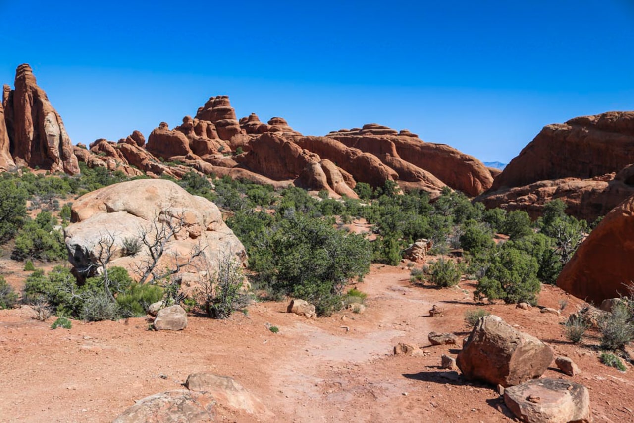
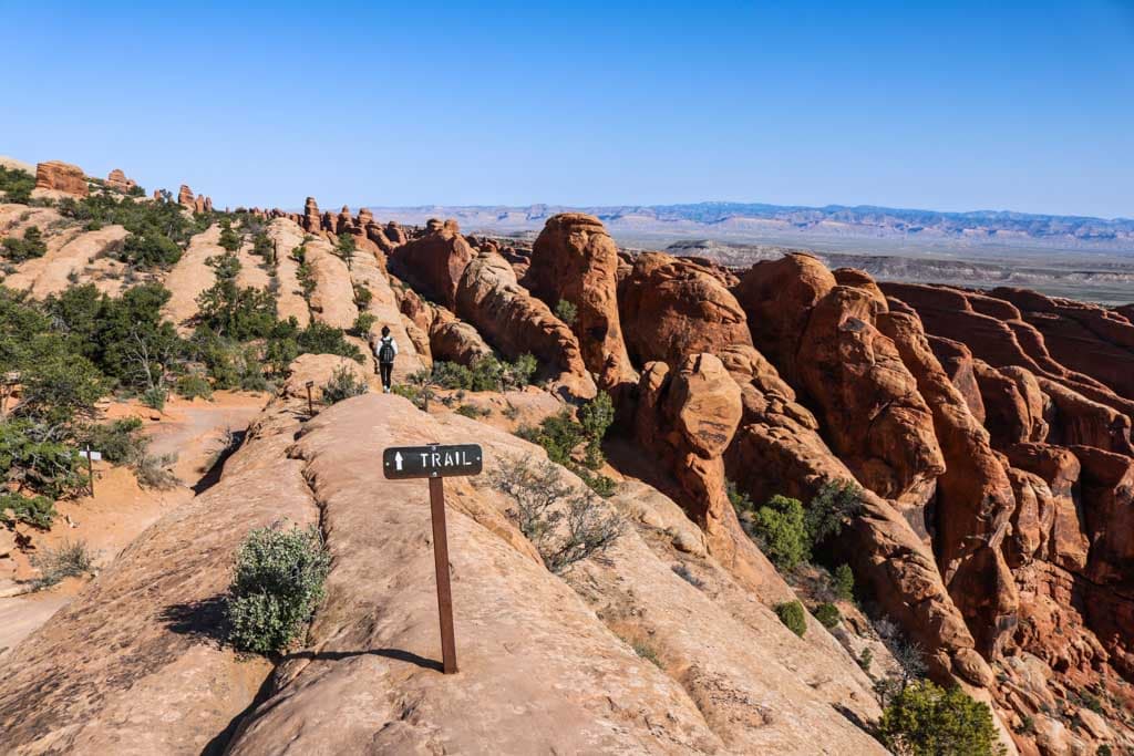
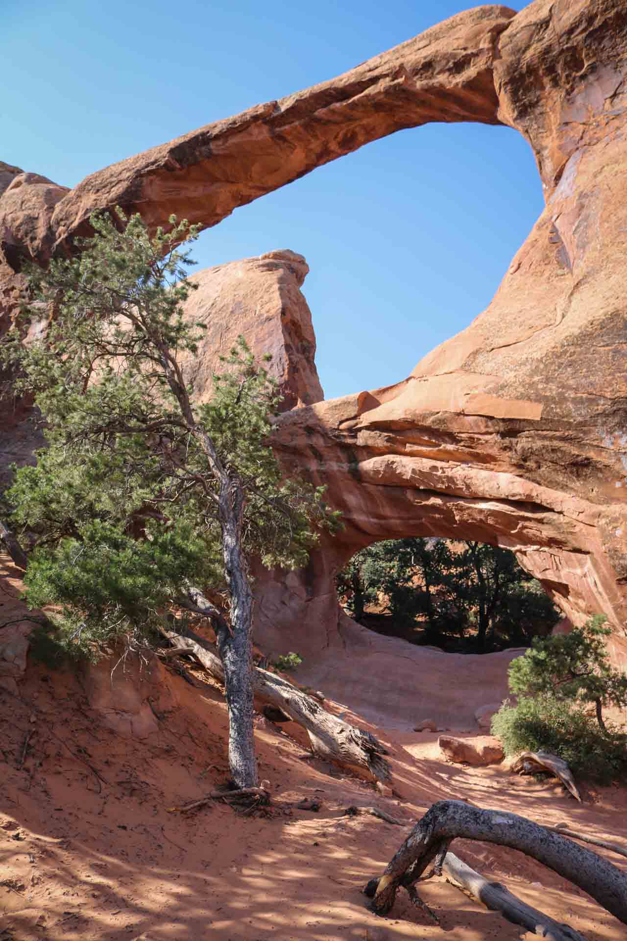
The Primitive Trail at Devils Garden is arguably the best day hike in Arches National Park. The first section of this epic hike is the Landscape Arch Trail, but the real excitement lies beyond that famous arch.
The Primitive Trail is just what its name suggests—there are few markers to rely on, some rock scrambling, steep slopes and a couple of drop-offs.
The remoteness of this particular desert hike is what appealed to me most. You’ll feel like you’re alone in the desert, which is a pretty awesome feeling and one that’s hard to come by in today’s jam-packed national parks.
The full loop consists of both the Primitive Trail and the Double O Arch Trail. Both trails split up just beyond Landscape Arch, forming a loop.
If that sounds a bit complicated, a quick glance at the Devils Garden trails map here will offer some clarity.
On the Devils Garden Primitive Trail Loop, you get to see no fewer than seven awesome rock arches, including iconic Landscape Arch, but also picturesque others like Double O Arch, Partition Arch and Private Arch.
The furthest point on this magnificent day hike in Arches National Park is the impressive Dark Angel rock formation.
This is the longest of all Arches National Park hiking trails, a journey into the park’s remotest still-accessible area.
Allow at least 4 hours to complete this superb national park desert hike and bring plenty of snacks and water.
You might find some welcome shade underneath the arches, but the trails are exposed. Wear a hat and sunscreen.
- Total distance: 9 miles, lollipop including all spur trails
- Duration: 4-5 hours
- Difficulty: strenuous
- Trailhead: Devils Garden Parking Area, end of the Park Road (beyond Landscape Arch)
3. Bright Angel Trail to Plateau Point, Grand Canyon National Park
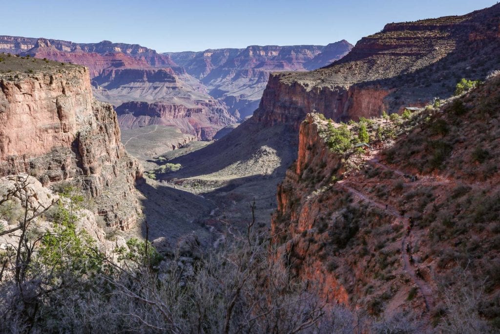
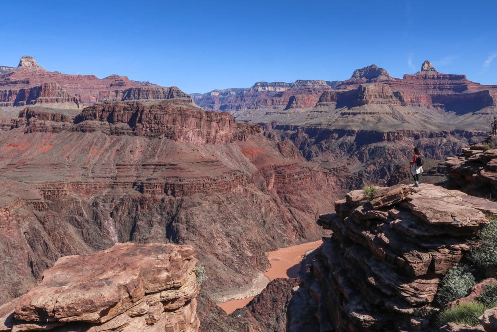
The popular Bright Angel Trail is a trail that really allows you to experience the grandeur of the Grand Canyon. It’s both challenging and rewarding, immersive and unforgettable. It shows hikers what the Grand Canyon is really all about.
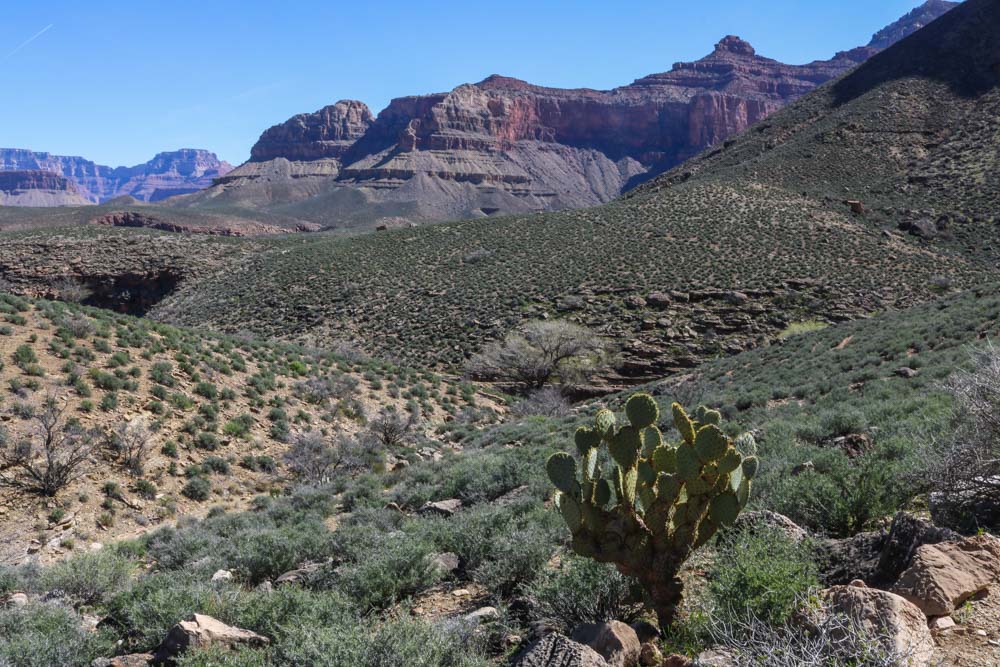
You might not associate Grand Canyon National Park with a desert environment, yet much of the inner canyon is scorching hot and arid.
Water is scarce to absent, while cacti dot the canyon floor. Unprepared hikers get into trouble due to the extreme heat and dryness every summer here.
A well-maintained dirt trail, the Bright Angel Trail starts just west of the Bright Angel Lodge. Look for the mule corral on the rim, which is where this descent into the Grand Canyon begins.
The Bright Angel Trail’s countless switchbacks take you down the upper canyon cliffs.
That first section is pretty steep—remember that for the way back up—but the trail does flatten out a bit once you’re on the lower plateau.
Many people hike this trail to Indian Garden, which has a campground, water and another mule corral. This is where mule excursions turn back.
A scenic viewpoint, Plateau Point is accessed via a spur trail that splits off from the Bright Angel Trail in Indian Garden. The Bright Angel Trail continues down into the canyon all the way to the Colorado River.
Because it’s not recommended to hike down to the river and back up in one day, I suggest that you hike to Plateau Point instead. This is a doable day hike for fit and experienced hikers.
The one-way distance of this epic hike is 6 miles. There are resthouses after every 1.5 miles: 1.5 Mile Resthouse, 3 Mile Resthouse and Indian Garden.
Note that Indian Garden has potable water year-round, but that water is only seasonally available at the resthouses. I strongly recommend to bring plenty of water either way.
Remember that the hardest part of this trail is the ascent back to the South Rim. Don’t misjudge the trail’s difficulty and your own ability on the relatively easy descent.
It takes twice as long to hike back up than it does to get down.
Also be aware that the Bright Angel Trail is a popular trail for mule rides. You will most likely see mules while hiking down or up. Be careful, let them pass and don’t disturb or scare them.
- Total distance: 12 miles, out and back
- Duration: 6-8 hours
- Difficulty: very strenuous
- Trailhead: Bright Angel Trailhead just west of the Bright Angel Lodge on the South Rim
4. Kaʻū Desert Trail to Maunaiki, Hawai‘i Volcanoes National Park
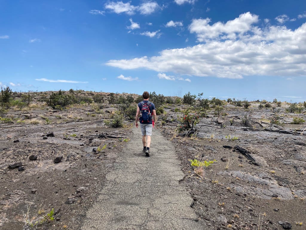
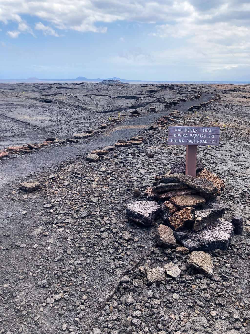
Yes, even in Hawaii’s national parks you can find desert hikes. On the Big Island, you can explore the barren lava desert in Hawai‘i Volcanoes National Park on the extraordinary The Kaʻū Desert Trail.
One of my personal favorite hikes in Hawai‘i Volcanoes National Park, this trail starts at a small parking area on the south side of Highway 11, about 15 minutes west of Volcano Village.
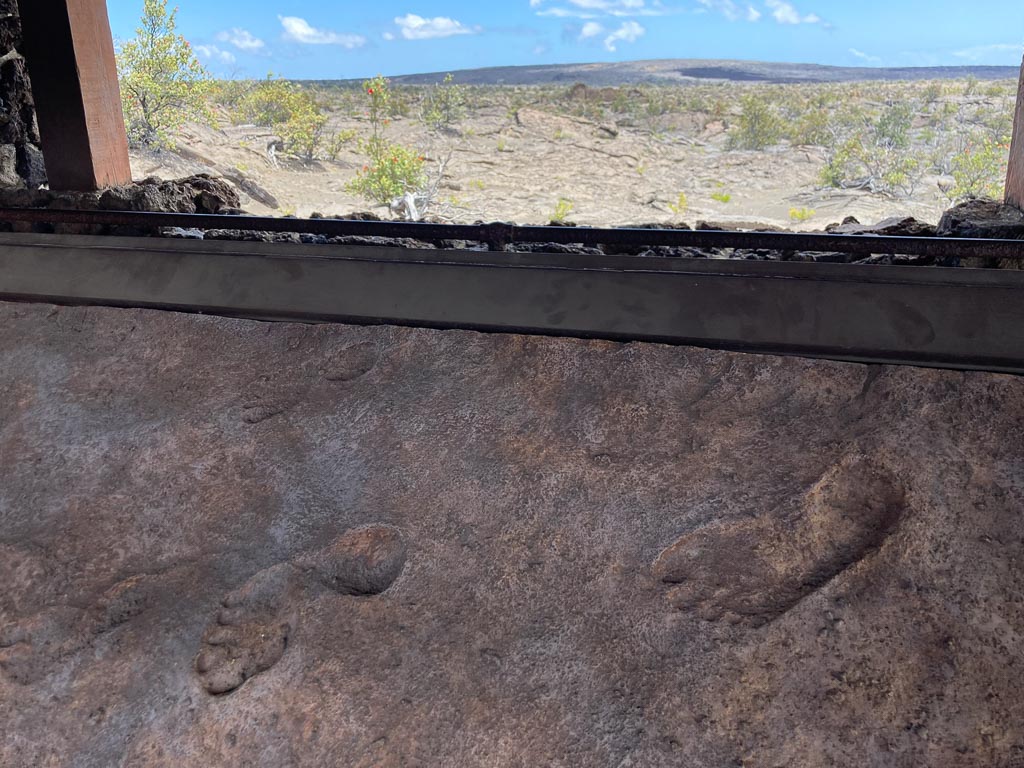
A major highlight along the way is the Footprints Shelter, which is 0.8 miles from the trailhead. This is where you can see the preserved footprints of Native Hawaiians who were surprised by a sudden eruption at the summit of Kīlauea in 1790.
Traveling on ancient trails, they were bombarded by ash, sand and gas from above.
Their footprints are “a reminder that Hawaiians have beared witness to the geological drama of this island for centuries,” the National Park Service says.
Beyond the Footprints Shelter, the Kaʻū Desert Trail enters the sprawling and barren Maunaiki area.
You’ll walk across vast lava fields void of any vegetation whatsoever, a desolate and extremely exposed volcanic landscape on the southwest slope of Kīlauea, the world’s most active volcano.
This particular day hike at Hawai‘i Volcanoes is 1.8 miles one way (3.6 miles out and back) from the Kaʻū Desert Trailhead on Highway 11 to Maunaiki.
At Maunaiki, however, you do have the option to extend your hike—the Kaʻū Desert Trail continues to the west, while the Maunaiki Trail winds its way southeast.
- Total distance: 3.6 miles, out and back
- Duration: 2 hours
- Difficulty: moderate
- Trailhead: Kaʻū Desert Trailhead on Highway 11
5. Lost Palms Oasis Trail, Joshua Tree National Park
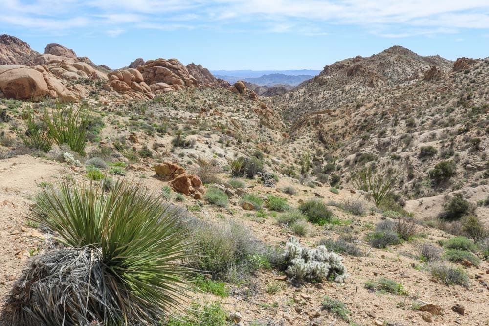
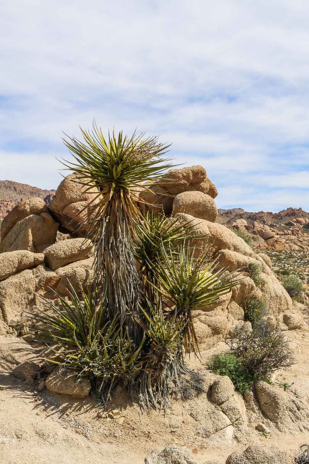
There are numerous Joshua Tree National Park desert hikes to choose from, but my personal favorite is the Lost Palms Oasis Trail. This is easily one of the greatest desert hikes in the national parks.
Although you won’t find (m)any of the park’s iconic Joshua trees along this trail, it does take you deep into the arid wilderness of the Colorado Desert.
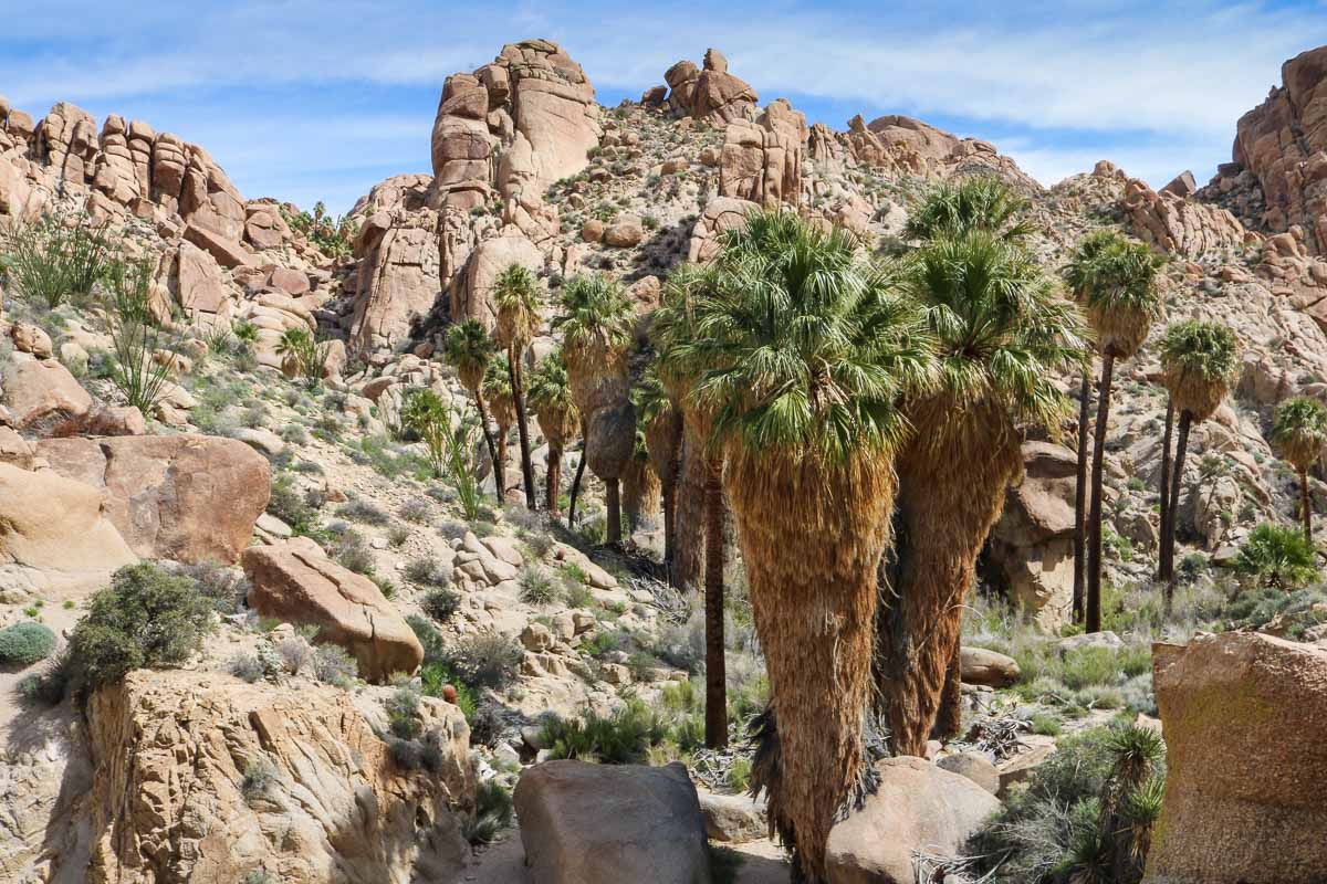
Additionally, the ultimate destination on this trail is an oasis of California fan palms—a welcome sight for any desert hiker.
With a roundtrip distance of 7.5 miles, the Lost Palms Oasis Trail is one of the longest day hikes in Joshua Tree National Park.
Remote and hot, it runs through the sand-bottomed washes and rock-strewn hills of the Colorado Desert.
There’s no shade whatsoever anywhere on the trail until you get to your destination—the Lost Palms Oasis. Situated at the bottom of a steep canyon, this is the largest group of California fan palms in Joshua Tree, the perfect spot for a break.
The trail starts at Cottonwood Spring, which is near the Cottonwood Campground in the far south of the park.
On the way, if you feel up for it, you can choose to make the hike a bit longer by taking a 1.5-mile detour to the summit of Mastodon Mountain for some amazing panoramic views in Joshua Tree National Park.
- Total distance: 7.5 miles, out and back
- Duration: 3-4 hours
- Difficulty: strenuous
- Trailhead: Cottonwood Spring near the Cottonwood Campground
6. King Canyon Trail to Wasson Peak, Saguaro National Park
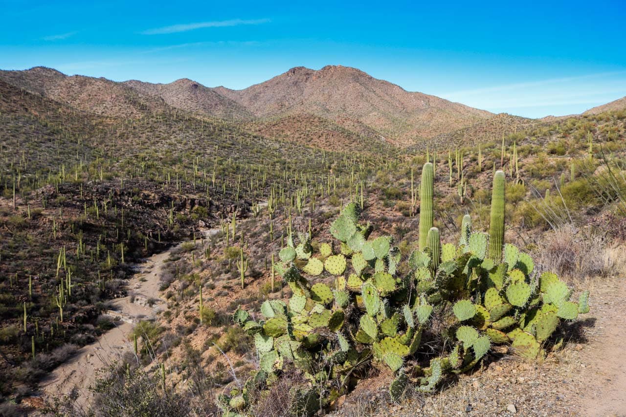
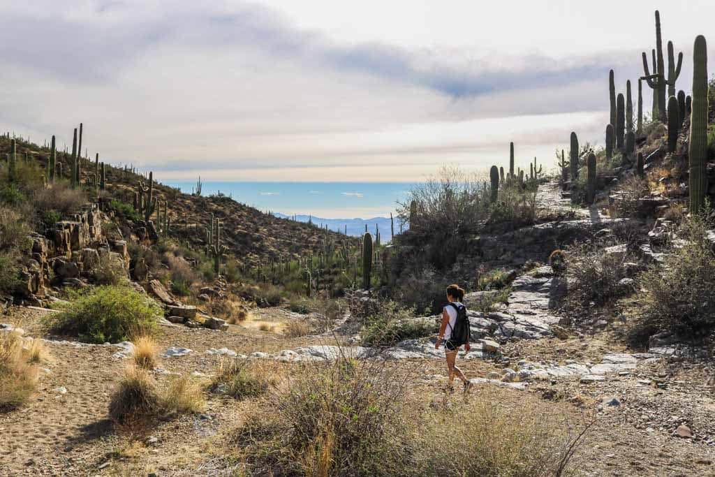
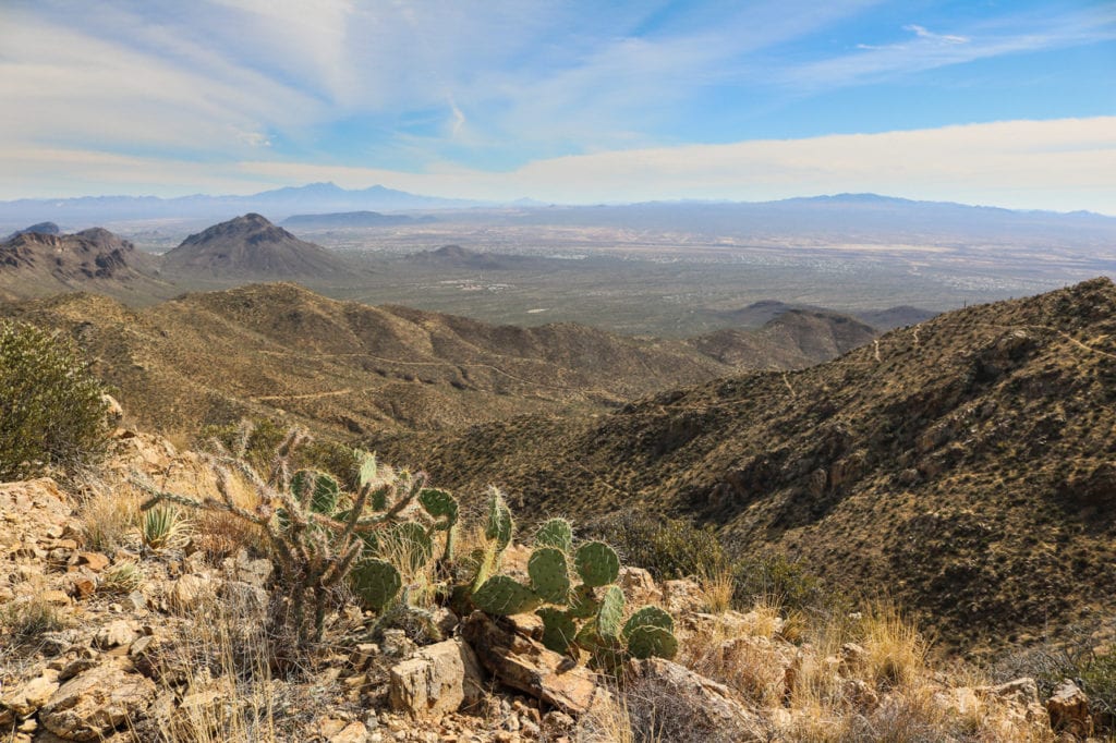
The 7-mile roundtrip to Wasson Peak via the King Canyon Trail is a magnificent hike to a commanding mountain summit in Saguaro National Park near Tucson, Arizona.
With its height of 4,687 feet, Wasson Peak is the highest mountain in the Tucson Mountains. The views from the top are spectacular—you might even say they’re the best in the entire park.
The parking area and trailhead are directly across the road from the excellent Arizona-Sonora Desert Museum, which is also worth visiting if you have some spare time.
The King Canyon section of this hike overlaps with the King Canyon-Gould Mine Loop, another great day hike in Saguaro National Park.
You could take the Gould Mine Trail back on the way down to combine both of those Saguaro National Park hikes.
I particularly love this hike because it offers a well-rounded desert experience. On the way, you can see and often even hike in desert washes and canyons dotted with iconic saguaro cacti, and on old mining roads.
As you climb higher, the views start opening up, up to the point where you’re literally above the entire desert landscape in southern Arizona.
- Total distance: 7 miles, out and back
- Duration: 3-4 hours
- Difficulty: strenuous
- Trailhead: King Canyon Parking Area, across the road from the Arizona-Sonora Desert Museum
7. Sliding Sands Trail (Keonehe‘ehe‘e), Haleakalā National Park
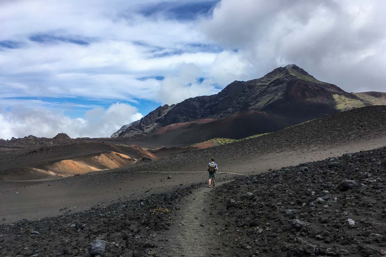
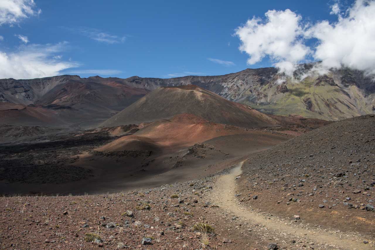
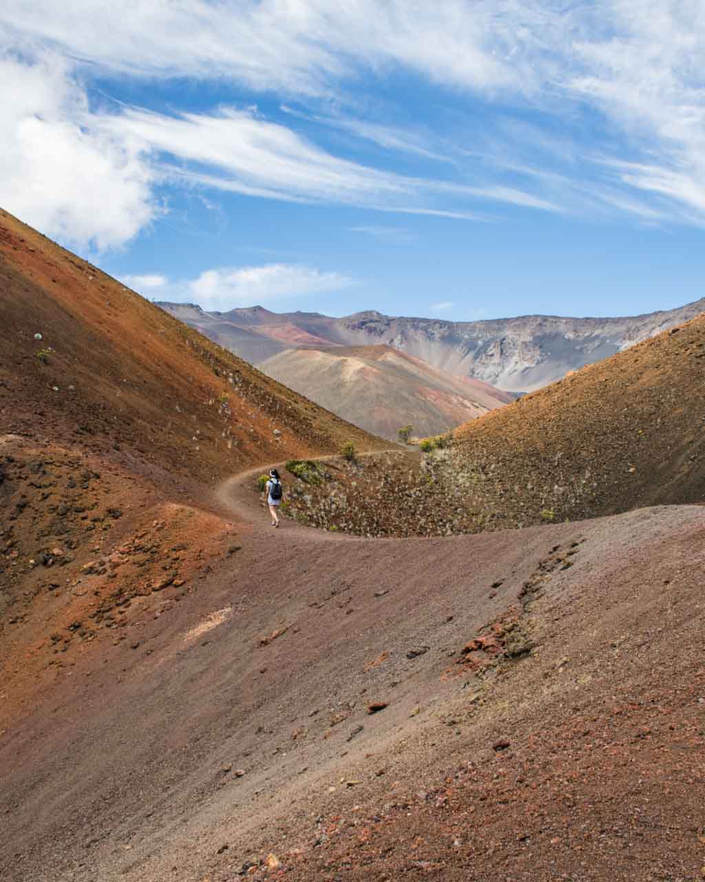
Also known as the Keonehe‘ehe‘e Trail, the Sliding Sands Trail is one of the best hikes in Haleakalā National Park on the Hawaiian island of Maui.
In fact, I wouldn’t hesitate calling it one of the greatest national park day hikes in general!
Starting at the Haleakalā Visitor Center parking lot, the trail descends into the spectacular Haleakalā Crater.
It’s 3.9 miles to the crater floor, while the elevation change is almost 2,500 feet. On the way, you’ll pass various specimens of the remarkable native Haleakalā silversword.
The ultimate destination of this hike is an area unofficially called Pele’s Paint Pot. Situated near the north slope of the Halali‘i cinder cone, it’s famous for its amazingly bright colors.
Pele’s Paint Pot is roughly 5.7 miles from the trailhead, in the very heart of the Haleakala Crater.
After looping around Halali‘i and Pele’s Paint Pot, retrace your steps back up to the crater rim.
The total distance of this phenomenal volcanic desert day hike is about 11.5 miles. Note, however, that the hard part is the return trip.
It’s a long climb back and you should count on at least twice as much time for the way up as for the way down.
So in practical terms: if it takes you 2 hours to get to Pele’s Paint Pot, it’ll be at least 4 hours back. Start this Haleakalā Crater hike early! Right after sunrise is the perfect time.
Please take my advice and put on a lot of sunscreen. This is a long day hike in the alpine high-elevation desert wilderness of Haleakalā National Park. It’s important to bring some day hike snacks and plenty of water. There are no facilities along the way.
- Total distance: 11.5 miles, out and back
- Duration: 6-7 hours
- Difficulty: strenuous
- Trailhead: Keonehe‘ehe‘e Trailhead, near the road at the Haleakala Visitor Center parking lot
8. Chimney Rock Loop, Capitol Reef National Park
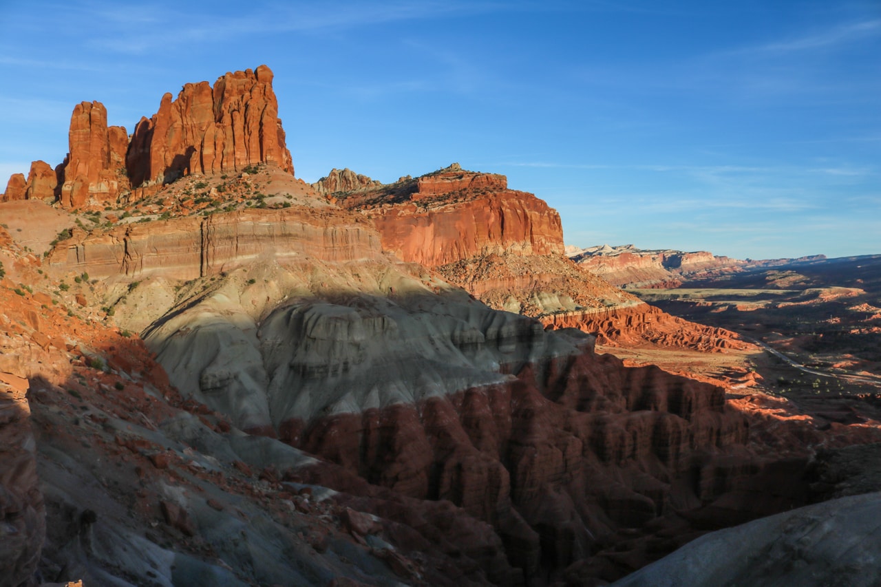
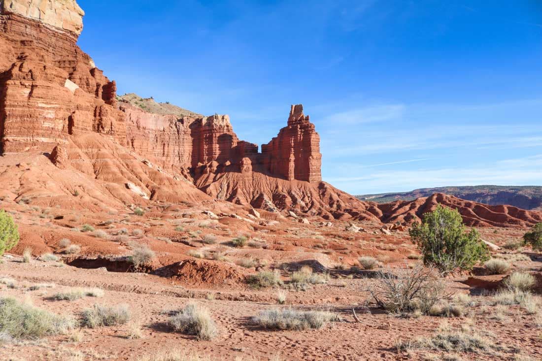
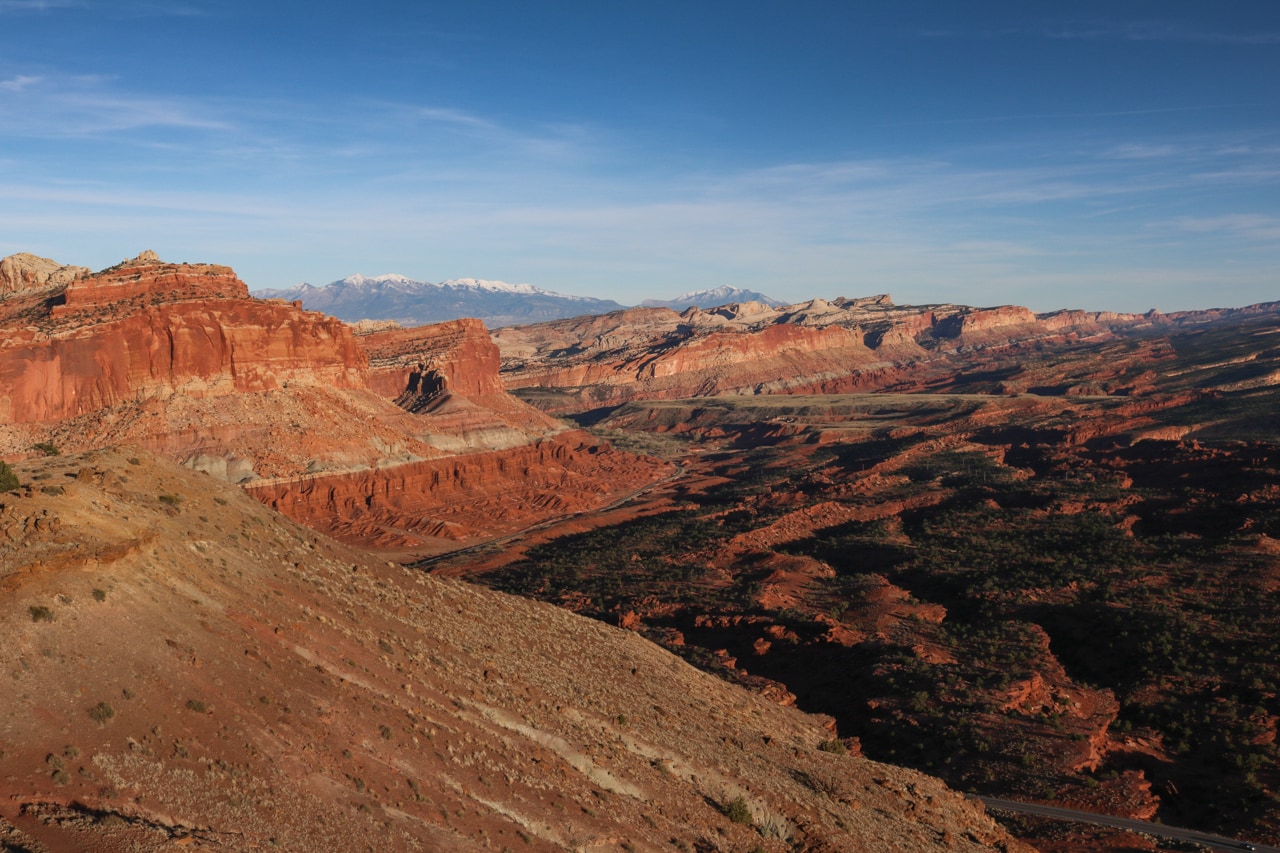
The Chimney Rock Loop is without question one of the best short day hikes in Capitol Reef National Park.
Chimney Rock is one of the first prominent natural features you’ll see after entering the park from the west. The parking lot is on the left side of the scenic Utah State Route 24.
The trail ascends and loops around the red-rock plateau behind Chimney Rock. On the way, you’ll have fantastic views of this imposing rock formation, as well as the gorgeous desert scenery of southern Utah.
Besides the initial climb, this amazing Capitol Reef National Park desert hike is actually fairly easy.
It’s classified as moderate to strenuous, though, but that’s mainly because of that first steep section, responsible for most of the total elevation gain of 590 feet.
Once atop the plateau, the panoramic views of the Waterpocket Fold, a 100-mile-long “geological wrinkle”, are breathtaking. These are some of the absolute best views in Capitol Reef National Park.
Additionally, the Chimney Rock Loop is also one of the best places in this underrated national park to watch the sunset.
- Total distance: 3.6 miles, loop
- Duration: 2 hours
- Difficulty: moderate
- Trailhead: Chimney Rock Trailhead, north side of Utah State Route 24 in the west of the park
9. Painted Desert Wilderness Hike, Petrified Forest National Park
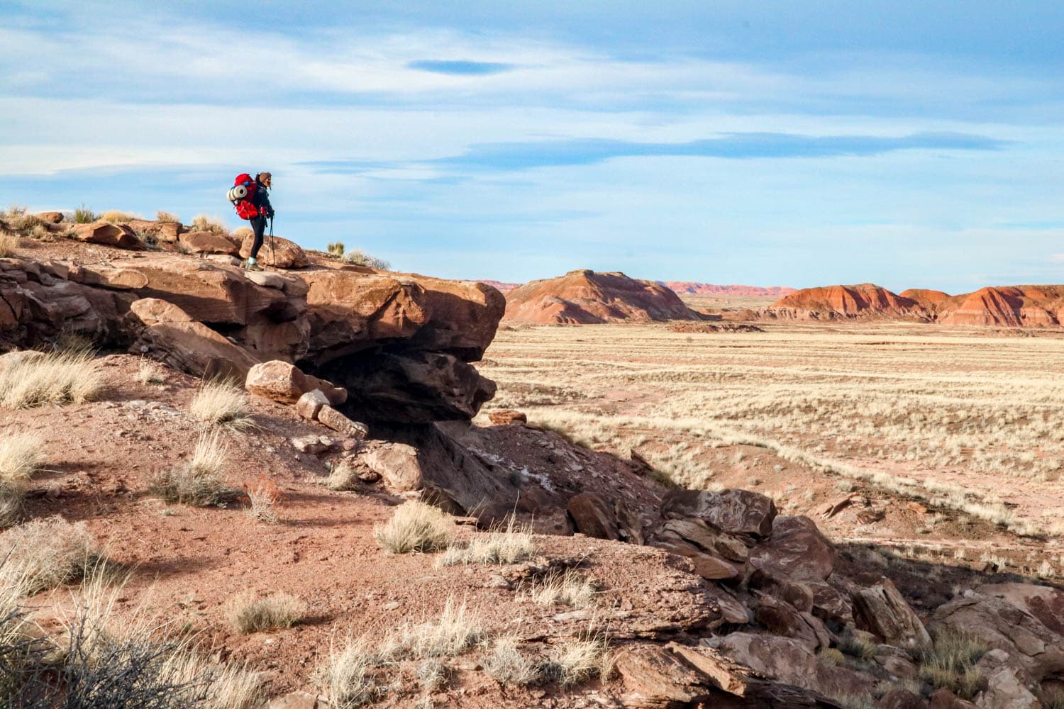
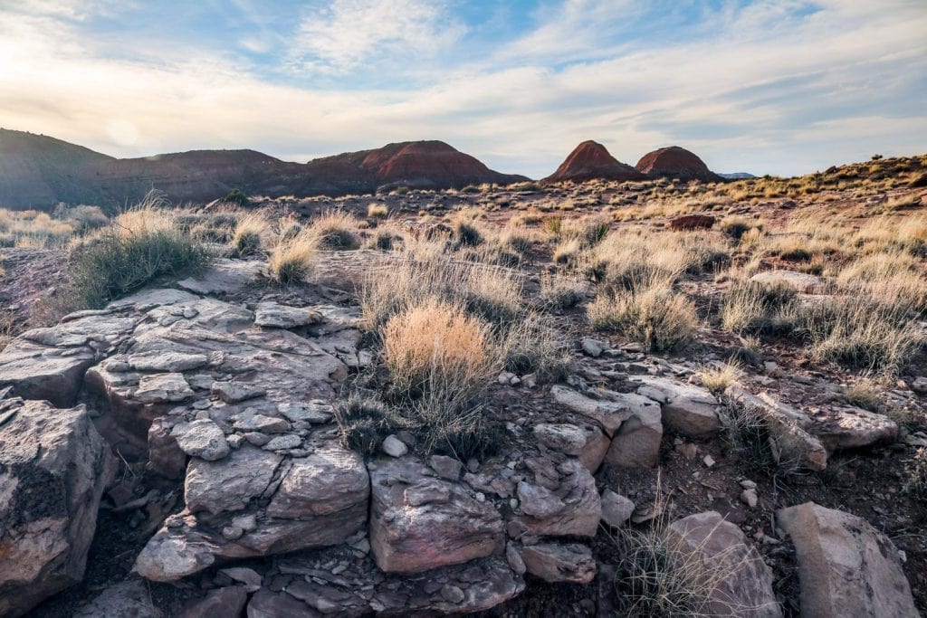
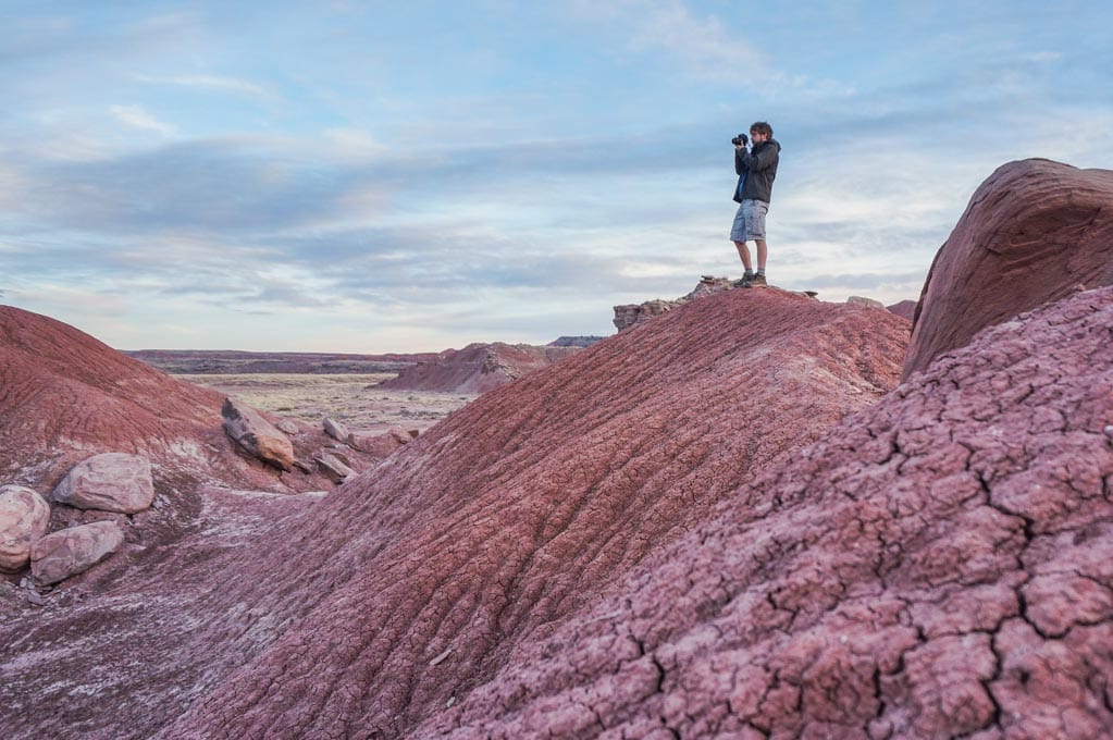
The Petrified Forest National Wilderness Area comprises two separate units, the largest of which is the northern Painted Desert unit.
This vast pristine wilderness in Arizona’s Petrified Forest National Park is open to backcountry exploration. There are no trails, but that’s what makes this such a fun Petrified Forest hiking experience.
The trail starts next to the beautiful and historic Petrified Desert Inn, which once offered accommodation to visitors and now serves as a museum.
Once you’re about a mile below the Painted Desert rim, you can walk around as you please, as far as you want, anywhere you want. You’re free to wander across the desert flats and explore stunning, colorful badlands.
Day hikers, however, must be back at their vehicles by the posted closing time of the park. (Petrified Forest National Park closes every night and there are no campgrounds or other accommodations.)
You do have the option to spend the night in the Painted Desert, though. This requires a free wilderness permit, which can be picked up at either of the park’s two visitor centers.
I personally highly recommend camping out in the Painted Desert. It’s still one of my own favorite national park experiences.
- Total distance: 2+ miles, out and back
- Duration: 1 hour to multi-day backpacking trips
- Difficulty: moderate
- Trailhead: Painted Desert Inn
10. High Dune on First Ridge, Great Sand Dunes National Park
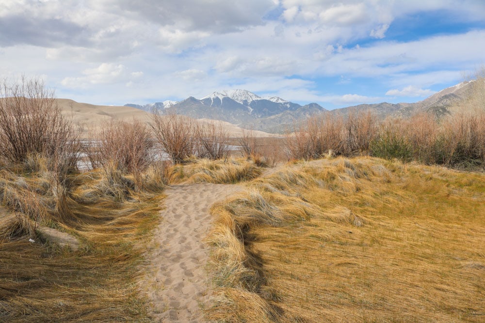
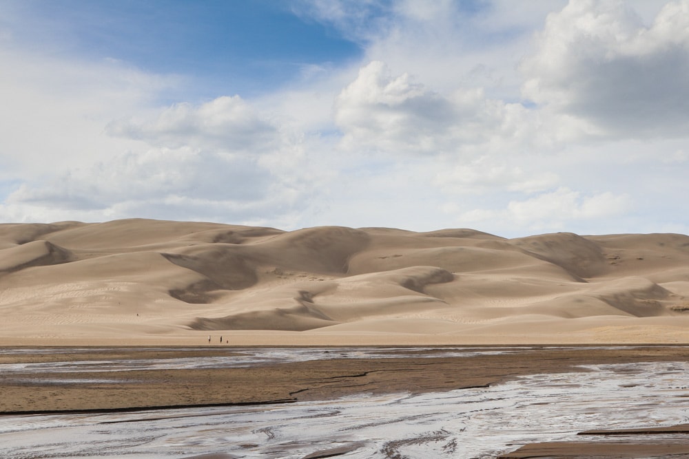
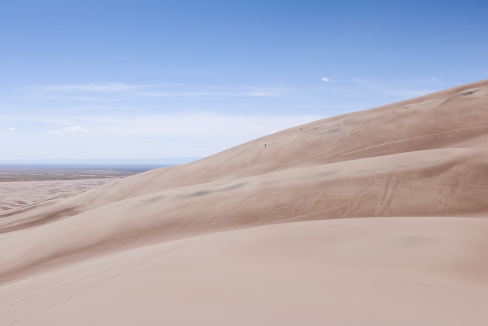
The namesake of Great Sand Dunes National Park in southern Colorado, the Great Sand Dunes are designated wilderness. You can explore these imposing sand dunes, the tallest in North America, on day (or night) hikes.
Since no official trails cross this sprawling 30-square-mile dunefield, you can wander around as you wish, as far and as long as you want.
There are a couple of popular destinations in the Great Sand Dunes, though, one of which is High Dune on First Ridge.
Looking like it’s the tallest dune in the field from the main parking lot, High Dune isn’t actually the tallest in the park.
“The High Dune on the First Ridge is neither the highest in elevation nor the tallest in the park, but it looks that way from the main parking lot,” the National Park Service says, adding that it’s the most common hiking destination in the Great Sand Dunes.
From the top of this huge mountain of sand, you can enjoy a panoramic view of entire dunefield behind it. The climb is approximately 693 feet from the dune’s base to the top.
From the parking lot, it’s a half-mile walk across the Medano Creek bed, followed by a zigzag hike up the dune along the ridgelines.
Note that the park’s high altitude, lack of shade and high afternoon sand temperature have surprised hikers in the past. Please prepare and allow for plenty of time for your return hike, pack plenty of water.
Additionally, hiking on soft sand is much different from and more difficult than walking on gravel. You’ll need significantly more time to cover a certain distance while climbing sand.
- Total distance: 2.5 miles, out and back
- Duration: 3-4 hours
- Difficulty: strenuous
- Trailhead: Dunes Parking Lot, Visitor Center or the Piñon Flats Campground.
